Glendale, Ohio facts for kids
Quick facts for kids
Glendale, Ohio
|
|||
|---|---|---|---|
|
Village
|
|||

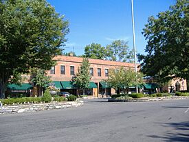
Shops downtown
|
|||
|
|||

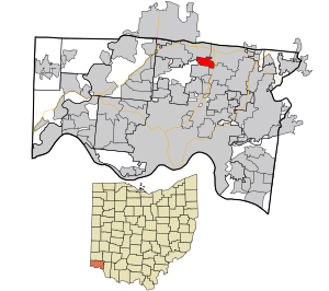
Location in Hamilton County and the state of Ohio.
|
|||
| Country | United States | ||
| State | Ohio | ||
| County | Hamilton | ||
| Area | |||
| • Total | 1.64 sq mi (4.25 km2) | ||
| • Land | 1.64 sq mi (4.25 km2) | ||
| • Water | 0.00 sq mi (0.00 km2) | ||
| Elevation | 627 ft (191 m) | ||
| Population
(2020)
|
|||
| • Total | 2,298 | ||
| • Estimate
(2023)
|
2,263 | ||
| • Density | 1,399.51/sq mi (540.49/km2) | ||
| Time zone | UTC-5 (Eastern (EST)) | ||
| • Summer (DST) | UTC-4 (EDT) | ||
| ZIP code |
45246
|
||
| Area code(s) | 513 | ||
| FIPS code | 39-30380 | ||
| GNIS feature ID | 1086210 | ||
Glendale is a small village located in Hamilton County, Ohio, United States. In 2020, about 2,298 people lived there. It is a northern suburb of Cincinnati. Glendale is also home to the Glendale Historic District, which means it has many old and important buildings.
Contents
Geography of Glendale
Glendale is a village that covers about 1.69 square miles (4.25 square kilometers) of land. The United States Census Bureau says that all of this area is land, with no water.
People of Glendale
Glendale has seen its population change over the years. Here's a quick look at how many people have lived there:
| Historical population | |||
|---|---|---|---|
| Census | Pop. | %± | |
| 1860 | 690 | — | |
| 1870 | 1,780 | 158.0% | |
| 1880 | 1,400 | −21.3% | |
| 1890 | 1,444 | 3.1% | |
| 1900 | 1,545 | 7.0% | |
| 1910 | 1,741 | 12.7% | |
| 1920 | 1,759 | 1.0% | |
| 1930 | 2,300 | 30.8% | |
| 1940 | 2,359 | 2.6% | |
| 1950 | 2,402 | 1.8% | |
| 1960 | 2,823 | 17.5% | |
| 1970 | 2,690 | −4.7% | |
| 1980 | 2,368 | −12.0% | |
| 1990 | 2,445 | 3.3% | |
| 2000 | 2,188 | −10.5% | |
| 2010 | 2,155 | −1.5% | |
| 2020 | 2,298 | 6.6% | |
| 2023 (est.) | 2,263 | 5.0% | |
| U.S. Decennial Census | |||
What the 2020 Census Showed
In 2020, there were 2,298 people living in Glendale. This means there were about 1,399 people per square mile. Most people (79.7%) were White. About 12.3% were Black or African American. Other groups included Asian (1.6%) and Native American (0.1%). About 4.7% of people were from two or more races. Around 3.4% of the population was Hispanic or Latino.
There were 838 households in the village. About 21.5% of these households had children under 18 living there. The average household had 2.26 people. The average family had 2.83 people.
The median age in Glendale was 49.7 years. About 19.8% of the people were under 18 years old. About 26.7% were 65 years or older.
The average yearly income for a household was estimated to be $97,917. For families, it was $146,250. About 12.0% of the people lived below the poverty line. This included 18.5% of those under 18.
What the 2010 Census Showed
In 2010, Glendale had 2,155 people. There were 969 households and 628 families. The population density was about 1,275 people per square mile.
The racial makeup was mostly White (81.4%). About 15.4% were African American. Asian people made up 1.5% of the population. About 1.3% of the population was Hispanic or Latino.
About 23.9% of households had children under 18. The average household size was 2.20 people. The average family size was 2.75 people.
The median age was 49.6 years. About 19.6% of residents were under 18. About 20.1% were 65 or older.
Culture and Symbols
Glendale has a special symbol: the black squirrel. You can find 25 statues of squirrels around the village. Each statue is dressed differently. This is similar to the "Big Pig Gig" art project in downtown Cincinnati.
Education in Glendale
Students in Glendale go to schools in the Princeton City Schools. This school district also serves nearby communities like Evendale and Sharonville.
Public school students attend Glendale Elementary, Princeton Middle School, and Princeton High School. There are also private schools in Glendale. These include Bethany School, which is for grades K-8. St. Gabriel is another private school, connected to the Roman Catholic Archdiocese of Cincinnati.
Famous People from Glendale
Many interesting people have lived in or are connected to Glendale:
- Sparky Anderson – He was a famous baseball manager. He lived in Glendale when he managed the Cincinnati Reds in the 1970s.
- Megan McCormick – She is a TV host, known for the travel series Globe Trekker.
- Alfred B. Mullett – He was a well-known architect.
- John Weld Peck II – He was a Federal Judge for the United States Court of Appeals for the Sixth Circuit.
- William Cooper Procter – He was born and lived in Glendale. He was a leader of the Procter & Gamble company.
- Charles W. Sawyer – He served as the United States Secretary of Commerce from 1948 to 1953.
- Bob Trumpy – He was a player for the Cincinnati Bengals. Later, he became a sports broadcaster for NBC and CBS.
- Albert Tyler – He was an athlete.
See also
 In Spanish: Glendale (Ohio) para niños
 | Audre Lorde |
 | John Berry Meachum |
 | Ferdinand Lee Barnett |


