Goleigh Hill facts for kids
Quick facts for kids Goleigh Hill |
|
|---|---|
|
Trig point on the hill above Goleigh Farm
|
|
| Highest point | |
| Elevation | 220 m (720 ft) |
| Prominence | 53 m (174 ft) |
| Parent peak | Butser Hill |
| Geography | |
| Location | Hampshire, England |
| Parent range | Hampshire Downs |
| OS grid | SU726308 |
| Topo map | OS Landranger |
Goleigh Hill is a cool place in Hampshire, England. It's one of the highest spots in the county! This hill is part of the Hampshire Downs, a range of hills. It stands tall at about 220 meters (that's about 722 feet) above the sea.
Where is Goleigh Hill?
Goleigh Hill is located in the beautiful countryside of Hampshire. It's about 2.5 kilometers (or 1.5 miles) west of a small village called Empshott. This hill is also part of a special area known as the East Hampshire Hangers. These "Hangers" are steep, wooded slopes that are unique to this part of England.
What You Can See on the Hill
The very top of Goleigh Hill is an open space. This means you can often get great views from the summit. Around the sides of the hill, you'll find different wooded areas. To the west, there are Goleigh Wood and Lye Wood. On the eastern side, you'll find Abbot's Copse.
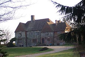
On the northwestern slope of the hill, there's a place called Goleigh Farm. Down in the valley below the hill, you can see Goleigh Manor.
The Trig Point
At the very top of Goleigh Hill, you'll find a trig point. A trig point is a special pillar made of concrete. These pillars were used by mapmakers to help them create accurate maps of the land. They are often found on the highest points of hills and mountains. Finding a trig point can be a fun goal if you're exploring the countryside!
 | Valerie Thomas |
 | Frederick McKinley Jones |
 | George Edward Alcorn Jr. |
 | Thomas Mensah |


