Goloe Pass facts for kids
Goloe Pass is an icy, low area between two peaks in Antarctica. It's like a natural pathway through mountains. This pass is 2,100 meters (about 6,890 feet) high. It sits between Enitsa Peak and Bruguière Peak.
Goloe Pass is part of a long ridge that stretches about 9.15 kilometers (5.69 miles) northeast. This ridge starts from Mount Giovinetto. The pass is located in the north-central part of the Sentinel Range. This range is found within the Ellsworth Mountains in Antarctica.
Goloe Pass also acts as a "glacial divide." This means it separates two glaciers: Rumyana Glacier to the southeast and Delyo Glacier to the northwest. Think of it like a roof's ridge, where water flows down different sides. Here, ice flows in different directions.
Where is Goloe Pass Located?
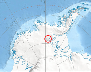
Goloe Pass is found in a very cold and remote part of the world. Its exact location is 78°15′42″S, 85°52′48″W.
It is about 5.67 kilometers (3.52 miles) northeast of Mount Giovinetto. The pass is also 3.7 kilometers (2.3 miles) west of Debren Pass. Another nearby feature is Progled Saddle, which is 4.12 kilometers (2.56 miles) south-southeast.
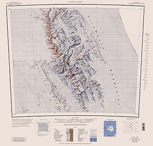
Maps of this area were created by the United States in 1961 and again in 1988. These maps help scientists and explorers understand the landscape.
How Goloe Pass Got Its Name
The name "Goloe Pass" comes from a very old place. It is named after an ancient and medieval fortress called Goloe. This fortress is located in Southeastern Bulgaria. Many features in Antarctica are named after places or people from different countries.


