Progled Saddle facts for kids
Progled Saddle is a special place in the Ellsworth Mountains of Antarctica. It's like a low pass or a dip between two higher points, sitting at an elevation of 2,500 meters (about 8,200 feet). This saddle connects Evans Peak to Versinikia Peak. It's part of a long ridge that stretches for 8.8 kilometers (about 5.5 miles) from Mount Giovinetto all the way to Debren Pass.
Progled Saddle is also important because it's a "glacial divide." This means it's a high point where glaciers on one side, like Patton Glacier, flow in one direction (southeast), and glaciers on the other side, like Rumyana Glacier, flow in a different direction (northwest).
The saddle gets its name from a small town called Progled in Southern Bulgaria.
What is a Mountain Saddle?
A mountain saddle is a low area between two higher peaks. Think of it like the dip in a horse's saddle. It's often an easier path to cross a mountain range than going over the very top of a peak. These saddles are important for explorers and scientists because they can be natural pathways through difficult terrain.
Where is Progled Saddle Located?
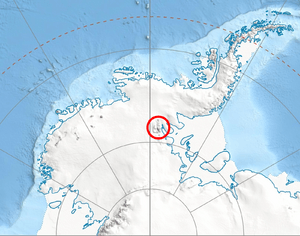
Progled Saddle is found in the northern-central part of the Sentinel Range within the Ellsworth Mountains. Its exact coordinates are 78°17′48″S, 85°49′22″W.
To give you a better idea of its location, it's:
- About 6.08 kilometers (3.78 miles) east-southeast of Mount Giovinetto.
- Around 4.12 kilometers (2.56 miles) south-southeast of Goloe Pass.
- About 4.17 kilometers (2.59 miles) southwest of Debren Pass.
- Roughly 8.2 kilometers (5.1 miles) north-northwest of Podgore Saddle.
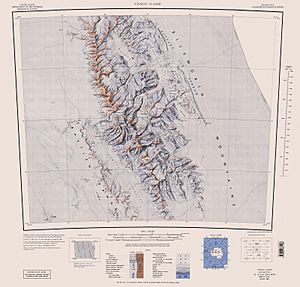
Scientists from the United States mapped this area in 1961 and again in 1988, helping us understand more about this remote part of Antarctica.


