Podgore Saddle facts for kids
Podgore Saddle is a flat, ice-covered area in Antarctica. It's like a low pass or a "saddle" between two higher points. This saddle is 2,250 meters (about 7,380 feet) high. It connects Tyree Ridge to Mount Bearskin on the eastern side of the Sentinel Range. The Sentinel Range is part of the Ellsworth Mountains.
Podgore Saddle also acts as a "glacial divide." This means it's a high point where ice and snow flow in different directions, feeding two different glaciers: Patton Glacier and Crosswell Glacier.
Where is Podgore Saddle?
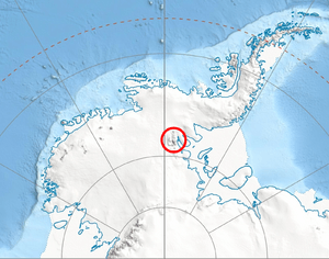
Podgore Saddle is located in Antarctica, a continent covered mostly by ice. Its exact position is 78°21′52″S 85°41′05″W / 78.36444°S 85.68472°W.
It is found in the Ellsworth Mountains, which are the highest mountains in Antarctica. Here are some nearby landmarks:
- It is about 2 kilometers (1.2 miles) west-southwest of Mount Bearskin.
- It is about 6.35 kilometers (3.9 miles) northeast of Mount Tyree.
- It is about 8.4 kilometers (5.2 miles) southeast of Evans Peak.
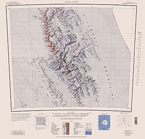
The United States mapped this area in 1988.
How Podgore Saddle Got Its Name
The name Podgore Saddle comes from a small town called Podgore in northwestern Bulgaria. Many places in Antarctica are named after towns, people, or features from different countries around the world. This helps to honor the international efforts in exploring and studying the icy continent. The Bulgarian name for the saddle is Bulgarian: седловина Подгоре, which is pronounced something like 'se-dlo-vi-na pod-'go-re.
 | Aaron Henry |
 | T. R. M. Howard |
 | Jesse Jackson |


