Mount Bearskin facts for kids
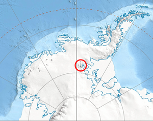
Mount Bearskin (78°20′S 85°37′W / 78.333°S 85.617°W) is a tall mountain in Antarctica, standing at 2,850 meters (about 9,350 feet) high. It is located in the Sentinel Range, which is part of the Ellsworth Mountains. This mountain is found between two large ice rivers called Patton Glacier and Crosswell Glacier. It is also connected to Tyree Ridge by a lower area called Podgore Saddle. Mount Bearskin is about 9 kilometers (5 nautical miles) northeast of Mount Tyree, another important peak in the area.
How Mount Bearskin Was Discovered and Named
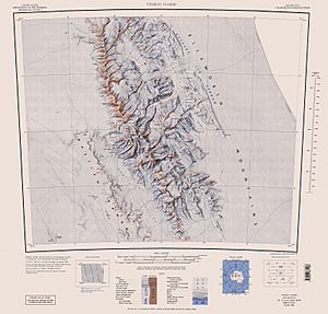
Mount Bearskin was first mapped by explorers between 1957 and 1959. The United States Geological Survey (USGS), a science agency in the U.S., used special surveys and aerial photographs taken by the United States Navy to create detailed maps of the area.
The mountain was officially named by the Advisory Committee on Antarctic Names (US-ACAN). This committee is in charge of naming places in Antarctica. They named it after Captain Leland S. Bearskin from the United States Air Force (USAF). Captain Bearskin was part of an important mission during the 1956–57 season. He helped set up the South Pole Station for the International Geophysical Year (IGY). The IGY was a big international science project where many countries worked together to study Earth.
More About This Region
The Ellsworth Mountains are the highest mountain range in Antarctica. They are located in a part of the continent called Ellsworth Land. This area is known for its extreme cold and vast, icy landscapes. Scientists and explorers often visit this region to study its unique geology and climate.
![]() This article incorporates public domain material from the United States Geological Survey document "Mount Bearskin" (content from the Geographic Names Information System). Lua error in Module:EditAtWikidata at line 29: attempt to index field 'wikibase' (a nil value).
This article incorporates public domain material from the United States Geological Survey document "Mount Bearskin" (content from the Geographic Names Information System). Lua error in Module:EditAtWikidata at line 29: attempt to index field 'wikibase' (a nil value).
 | Bessie Coleman |
 | Spann Watson |
 | Jill E. Brown |
 | Sherman W. White |


