Goreville, Illinois facts for kids
Quick facts for kids
Goreville, Illinois
|
|
|---|---|

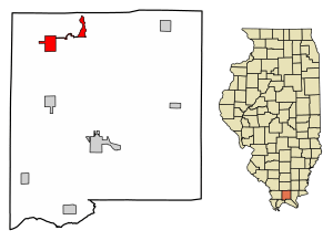
Location of Goreville in Johnson County, Illinois.
|
|

Location of Illinois in the United States
|
|
| Country | United States |
| State | Illinois |
| County | Johnson |
| Area | |
| • Total | 2.71 sq mi (7.01 km2) |
| • Land | 2.69 sq mi (6.96 km2) |
| • Water | 0.02 sq mi (0.06 km2) |
| Elevation | 722 ft (220 m) |
| Population
(2020)
|
|
| • Total | 1,068 |
| • Density | 397.62/sq mi (153.55/km2) |
| Time zone | UTC-6 (CST) |
| • Summer (DST) | UTC-5 (CDT) |
| ZIP Code(s) |
62939
|
| Area code(s) | 618 |
| FIPS code | 17-30575 |
| GNIS feature ID | 2398181 |
| Wikimedia Commons | Goreville, Illinois |
Goreville is a small village located in Johnson County, Illinois, in the United States. It's a quiet place where about 1,068 people lived according to the 2020 census. This was a slight increase from the 1,049 people counted in the 2010 census.
History of Goreville
The village of Goreville got its name from a man named John Gore. In 1854, John Gore bought 40 acres of land in this area. He opened a general store, which was a place where people could buy many different goods.
Later, in 1866, a post office was built on his land. It was named Goreville to honor John Gore. This helped the community grow.
In 1898, the Chicago and Eastern Illinois Railroad built train tracks nearby. Some businesses moved closer to the tracks, and new ones started there. The Village of Goreville officially became a village on April 18, 1900. At that time, its population was 406 people.
Geography of Goreville
Goreville is located in the northwestern part of Johnson County. It is found at the coordinates 37.553212 degrees North and -88.972783 degrees West. To the south of the village is Ferne Clyffe State Park, a beautiful natural area.
Illinois Route 37 is a main road that goes through Goreville. If you go south on this road for about 6 miles, you will reach Buncombe. If you go north for about 5 miles, you will get to Interstate 57. This is a major highway that connects to Interstate 24 nearby.
According to the 2010 census, Goreville covers a total area of about 1.68 square miles (4.35 square kilometers). Most of this area, about 1.66 square miles (4.30 square kilometers), is land. Only a small part, about 0.019 square miles (0.049 square kilometers), is water.
People in Goreville
The population of Goreville has changed over the years. Here's a look at how many people have lived there during different census counts:
| Historical population | |||
|---|---|---|---|
| Census | Pop. | %± | |
| 1900 | 406 | — | |
| 1910 | 554 | 36.5% | |
| 1920 | 581 | 4.9% | |
| 1930 | 531 | −8.6% | |
| 1940 | 508 | −4.3% | |
| 1950 | 581 | 14.4% | |
| 1960 | 625 | 7.6% | |
| 1970 | 1,109 | 77.4% | |
| 1980 | 978 | −11.8% | |
| 1990 | 872 | −10.8% | |
| 2000 | 938 | 7.6% | |
| 2010 | 1,049 | 11.8% | |
| 2020 | 1,068 | 1.8% | |
| U.S. Decennial Census | |||
In the year 2000, there were 938 people living in Goreville. These people lived in 392 households, and 286 of those were families. The average number of people in a household was about 2.39.
About 32.9% of the households had children under 18 living with them. Many households, 60.7%, were married couples living together. About 25.5% of all households were made up of people living alone.
The population was spread out by age. About 24.2% of the people were under 18 years old. About 18.1% were 65 years or older. The average age of people in Goreville was 38 years old.
In 2000, the median income for a household in Goreville was $33,750. For families, the median income was $42,563. The average income per person in the village was $16,491.
See also
 In Spanish: Goreville para niños
 | Frances Mary Albrier |
 | Whitney Young |
 | Muhammad Ali |

