Gouldtown, New Jersey facts for kids
Quick facts for kids
Gouldtown, New Jersey
|
|
|---|---|

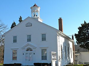
Trinity African Methodist Episcopal Church
|
|
| Country | |
| State | |
| County | Cumberland |
| Township | Fairfield |
| Area | |
| • Total | 2.83 sq mi (7.32 km2) |
| • Land | 2.83 sq mi (7.32 km2) |
| • Water | 0.00 sq mi (0.00 km2) |
| Elevation | 76 ft (23 m) |
| Population
(2020)
|
|
| • Total | 1,601 |
| • Density | 566.53/sq mi (218.76/km2) |
| Time zone | UTC−05:00 (Eastern (EST)) |
| • Summer (DST) | UTC−04:00 (EDT) |
| ZIP Code |
08302 (Bridgeton)
|
| Area code(s) | 856 |
| FIPS code | 34-27060 |
| GNIS feature ID | 2806089 |
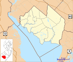
Gouldtown is a small community in Cumberland County, New Jersey. It is known as a census-designated place (CDP), which means it's a specific area that the government counts for population information. Gouldtown is located in the northern part of Cumberland County, within Fairfield Township. It sits right next to the city of Bridgeton, which is the county's main town. A major road, New Jersey Route 49, goes through Gouldtown, connecting it to other towns like Millville and Salem.
Who Lives in Gouldtown?
This section shares facts about the people living in Gouldtown. According to the 2020 United States census, the community had a population of 1,601 people.
| Historical population | |||
|---|---|---|---|
| Census | Pop. | %± | |
| 2020 | 1,601 | — | |
| U.S. Decennial Census 2020 |
|||
Gouldtown's Story
Gouldtown has a rich and important history. It was officially listed as a census-designated place before the 2020 United States census.
One of the most significant landmarks in Gouldtown is the Trinity African Methodist Episcopal Church. This church was first started in 1818. The building you see today was built in 1860. It is so important that it is listed on the National Register of Historic Places, which means it's recognized as a special historical site.
People Who Made a Difference
Many interesting people have come from Gouldtown. Here are a few who were born there or had strong ties to the community:
- Harold Gould (1924–2012) was a talented baseball pitcher. He played for the Philadelphia Stars in the Negro National League.
- Theophilus Gould Steward (1843–1924) was a U.S. Army chaplain. He was also a Buffalo Soldier, which was a name given to African American soldiers in the U.S. Army. He helped organize many A.M.E. congregations in South Carolina and Georgia.
 | Calvin Brent |
 | Walter T. Bailey |
 | Martha Cassell Thompson |
 | Alberta Jeannette Cassell |


