Gramercy, Louisiana facts for kids
Quick facts for kids
Gramercy
|
|
|---|---|
|
Town
|
|

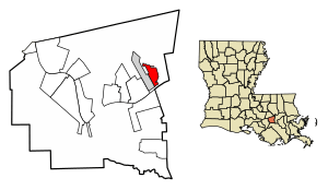
Location of Gramercy in St. James Parish, Louisiana.
|
|

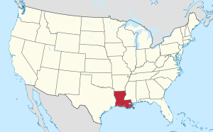
Location of Louisiana in the United States
|
|
| Country | United States |
| State | Louisiana |
| Parish | St. James |
| Area | |
| • Total | 2.04 sq mi (5.29 km2) |
| • Land | 2.01 sq mi (5.21 km2) |
| • Water | 0.03 sq mi (0.08 km2) |
| Elevation | 16 ft (5 m) |
| Population
(2020)
|
|
| • Total | 2,932 |
| • Density | 1,456.53/sq mi (562.50/km2) |
| Time zone | UTC-6 (CST) |
| • Summer (DST) | UTC-5 (CDT) |
| Area code(s) | 225 |
| FIPS code | 22-30550 |

Gramercy is a small town in Louisiana, a state in the United States. It's located in St. James Parish and is part of the bigger New Orleans area. In 2020, about 2,932 people lived there.
Contents
History of Gramercy
Gramercy started as a place where Native American and French people settled and traded. In 1739, a large part of what is now Gramercy was sold to Joseph Delille Dupart. He was a commissioner who worked with Native American groups.
The town of Gramercy officially became a town in November 1947. A historic sugar mill was built here in 1895. This mill later became the Colonial Sugar Refinery in 1902. The National Park Service has recognized this area as the Colonial Sugar National Historic District because of its important history.
Geography and Location
Gramercy is located at 30°3′14″N 90°41′21″W / 30.05389°N 90.68917°W. It is bordered on the west by the town of Lutcher. To the south, it is next to the mighty Mississippi River.
Gramercy is about 36 miles (58 kilometers) west of the big city of New Orleans. The town covers an area of about 2.1 square miles (5.4 square kilometers). Most of this area is land, with a small part being water.
People of Gramercy
The number of people living in Gramercy has changed over the years. Here's a quick look at the population from different U.S. censuses:
| Historical population | |||
|---|---|---|---|
| Census | Pop. | %± | |
| 1950 | 1,184 | — | |
| 1960 | 2,094 | 76.9% | |
| 1970 | 2,567 | 22.6% | |
| 1980 | 3,211 | 25.1% | |
| 1990 | 2,412 | −24.9% | |
| 2000 | 3,066 | 27.1% | |
| 2010 | 3,613 | 17.8% | |
| 2020 | 2,932 | −18.8% | |
| U.S. Decennial Census | |||
Racial and Ethnic Backgrounds
The people living in Gramercy come from many different backgrounds. The U.S. Census collects information about race and ethnicity.
| Race / Ethnicity (NH = Non-Hispanic) | Pop 2000 | Pop 2010 | Pop 2020 | % 2000 | % 2010 | % 2020 |
|---|---|---|---|---|---|---|
| White alone (NH) | 1,935 | 1,847 | 1,448 | 63.11% | 51.12% | 49.39% |
| Black or African American alone (NH) | 1,065 | 1,673 | 1,348 | 34.74% | 46.31% | 45.98% |
| Native American or Alaska Native alone (NH) | 14 | 20 | 7 | 0.46% | 0.55% | 0.24% |
| Asian alone (NH) | 3 | 16 | 12 | 0.10% | 0.44% | 0.41% |
| Pacific Islander alone (NH) | 0 | 0 | 0 | 0.00% | 0.00% | 0.00% |
| Some Other Race alone (NH) | 0 | 0 | 7 | 0.00% | 0.00% | 0.24% |
| Mixed Race or Multi-Racial (NH) | 27 | 21 | 64 | 0.88% | 0.58% | 2.18% |
| Hispanic or Latino (any race) | 22 | 36 | 46 | 0.72% | 1.00% | 1.57% |
| Total | 3,066 | 3,613 | 2,932 | 100.00% | 100.00% | 100.00% |
In 2020, there were 2,932 people living in Gramercy. There were 1,177 households, and 954 families. The average household had about 2.81 people.
In 2000, about 35% of households had children under 18. The median age in the town was 35 years old. This means half the people were younger than 35 and half were older.
Local Industries
Gramercy has been home to some important businesses.
- Zapp's Potato Chips: This popular snack company once had a factory in Gramercy.
- Louisiana Sugar Refining, LLC (LSR): This company operates a modern sugar refinery. It can process a lot of sugar every day, about 3,100 tons. The refinery provides jobs for about 150 people. LSR is located in the historic Colonial Sugars National Historic District.
See also
 In Spanish: Gramercy (Luisiana) para niños
 | Jackie Robinson |
 | Jack Johnson |
 | Althea Gibson |
 | Arthur Ashe |
 | Muhammad Ali |


