Granjeno, Texas facts for kids
Quick facts for kids
Granjeno, Texas
|
|
|---|---|

Location of Granjeno, Texas
|
|
| Country | United States |
| State | Texas |
| County | Hidalgo |
| Area | |
| • Total | 0.30 sq mi (0.79 km2) |
| • Land | 0.30 sq mi (0.79 km2) |
| • Water | 0.00 sq mi (0.00 km2) |
| Elevation | 108 ft (33 m) |
| Population
(2020)
|
|
| • Total | 283 |
| • Density | 930.92/sq mi (359.43/km2) |
| Time zone | UTC-6 (Central (CST)) |
| • Summer (DST) | UTC-5 (CDT) |
| ZIP code |
78572
|
| Area code(s) | 956 |
| FIPS code | 48-30608 |
| GNIS feature ID | 1336821 |

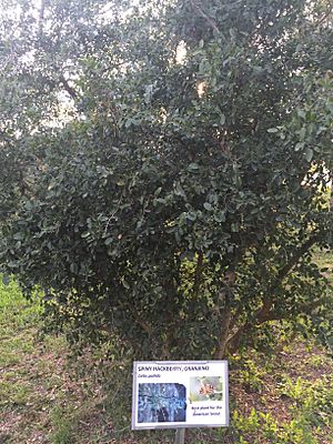
Granjeno is a small city located in Hidalgo County, Texas, in the United States. In 2020, about 283 people lived there. The city sits right on the banks of the Rio Grande river, which is close to the border with Mexico. Its name comes from a special local tree called the granjeno tree, also known as spiny hackberry.
Contents
History of Granjeno
Granjeno has a long history that started even before Texas became a state. It was founded in the late 1700s.
Early Community Development
The Granjeno Cemetery was started in 1872. People from both sides of the Rio Grande were buried there. By the mid-1930s, Granjeno had several homes. A school was built in Granjeno by 1948. Our Lady of Fatima Church was built in 1954 on land given by Jose Concepcion Anzaldua.
In the 1960s, the community grew because of new housing areas called colonias. A colonia is a rural community often lacking basic services. Granjeno officially became a city on January 26, 1993.
Local Landmarks and Features
Granjeno is next to the Anzalduas County Park. This park is famous for its trees covered in moss. The Anzalduas International Bridge was built nearby. Construction started in 2007, and the bridge opened in 2009. This bridge helps people and goods cross the border.
The El Granjeno Cemetery is a Texas Historic Landmark. It was established in 1872 when Don Antonio Garza was buried there. His brother, Don Juan Garza Escheverria, gave the land for the cemetery. It was for the communities of El Granjeno and nearby Madero. Don Juan, who was born in Mexico in 1854, is also buried there. Many of his family members are buried in a special reserved part of the cemetery. Veterans from the Civil War, World War I, and the Vietnam War are also buried there.
Geography of Granjeno
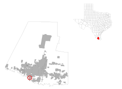
Granjeno is located at 26°8′18″N 98°18′13″W / 26.13833°N 98.30361°W. It is found near the meeting point of FM 494 and Old Military Road. This area is in the southern part of Hidalgo County. It is about four miles southwest of a larger city called McAllen. The city of Granjeno covers a total area of about 0.3 square miles (0.79 square kilometers). All of this area is land.
Population and People
| Historical population | |||
|---|---|---|---|
| Census | Pop. | %± | |
| 2000 | 313 | — | |
| 2010 | 293 | −6.4% | |
| 2020 | 283 | −3.4% | |
| U.S. Decennial Census | |||
Granjeno is part of two larger city areas. These are the McAllen–Edinburg–Mission area and the Reynosa–McAllen area.
2020 Census Information
The 2020 United States census counted 283 people living in Granjeno. There were 143 households and 91 families in the city at that time. Most of the people living in Granjeno are of Hispanic or Latino background.
Education in Granjeno
Public schools in Granjeno are part of the Hidalgo Independent School District. Students in Granjeno attend these schools:
- Salinas Elementary School
- Ida Diaz Jr. High School
- Hidalgo Early College High School
Also, the South Texas Independent School District has special magnet schools. These schools offer unique programs and are available to students in the Granjeno community.
See also
 In Spanish: Granjeno (Texas) para niños
 | Jewel Prestage |
 | Ella Baker |
 | Fannie Lou Hamer |


