Great Southern Rail Trail facts for kids
Quick facts for kids Great Southern Rail Trail |
|
|---|---|

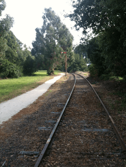
Great Southern Rail Trail with disused track at Leongatha
|
|
| Length | 68 km |
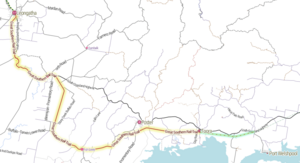
| Location | Melbourne, Victoria, Australia |
| Cycling details | |
| Trail difficulty | Easy to medium |
| Hazards | Some crossings of major highways |
| Surface | Compacted gravel |
| Hills | Multiple gentle hills |
| Water | Available in most towns |
| Connecting transport | |
| Train(s) | No regular passenger service |
| Bus | Available at Leongatha |
The Great Southern Rail Trail is an exciting 68-kilometre path in South Gippsland, Victoria, Australia. It stretches from Leongatha all the way to Welshpool. This special path used to be a railway line, but now it's a fantastic place for walking, cycling, and enjoying nature!
The trail is mostly flat or has gentle slopes. It takes you through beautiful dairy farms, green bushland, and quiet forests. You'll see amazing views of places like Wilsons Promontory and Corner Inlet. The path is well looked after and has a smooth gravel surface. If you're lucky, you might even spot Koalas, Wombats, and wallabies, especially in the early mornings or evenings!
A 10-kilometre part of the trail, from Toora to Welshpool, opened on February 7, 2015. Later, in March 2016, a section from Koonwarra to Minns Road also opened. This new part fixed up three old wooden bridges. It means you can now travel all the way from Leongatha to Welshpool without any breaks! From Welshpool, you can even connect to another 6-kilometre path that leads to Port Welshpool and its famous Long Jetty. The trail is still growing and might even reach Yarram one day.
Contents
History of the Trail
From Railway to Rail Trail
The path you ride or walk on today was once a busy railway line. It was called the South Gippsland railway line. This line first opened in 1892. It connected Dandenong to Port Albert. There were also smaller lines that went to other towns like Woodside and Wonthaggi.
The railway was super important for the people living in this area. It helped them move timber from forests and dairy products from farms to the big city of Melbourne. Imagine how hard it would have been to move all those goods without trains!
The Railway Closes
After being open for about 100 years, the railway line closed on June 30, 1992. This happened because the freight trains, which carried goods, stopped running. The tracks beyond Leongatha were taken up. These old tracks were even used again for another railway project in 1995!
For a short time, a special tourist railway called the South Gippsland Railway ran heritage trains on a part of the line. They operated until December 2015. But eventually, that tourist railway also stopped running. This meant the old railway line was ready for a new purpose: becoming the Great Southern Rail Trail!
Exploring the Trail Sections
The Great Southern Rail Trail is divided into different sections. Each part offers something unique to see and experience.
Leongatha to Koonwarra (8 km)
Your journey often starts in Leongatha. This town has about 5,000 people and is surrounded by rolling hills. As you leave Leongatha, you'll ride through wide-open spaces with green dairy farms. Then, the path enters beautiful bushland filled with teatrees and eucalyptus trees as you get closer to Koonwarra.
Koonwarra to Minns Road (3 km)
This section is quite new and exciting! It includes three old wooden bridges that have been fixed up. The path here winds around hills and over flat river areas. You'll get some really nice views of the countryside around you.
Minns Road to Meeniyan (6 km)
This part of the trail can be a bit rougher in places. You'll see an old timber bridge right next to a newer bridge over the Tarwin River, near Meeniyan. It's a cool reminder of the railway's past.
Meeniyan to Foster (32 km)
This is a longer stretch of the trail, passing through a few towns:
- Meeniyan to Stony Creek (3.5 km)
- Stony Creek to Buffalo (8 km)
- Buffalo to Fish Creek (8 km)
- Fish Creek to Lowrys Road (5 km)
- Lowrys Road to Foster (7.5 km)
This section has a smooth gravel surface. You'll ride through bushland, swampy areas, and forests. Keep your eyes peeled for wildlife! You might see kangaroos, wallabies, and many different kinds of birds. As you get closer to the Hoddle Range, the trail has some steeper parts and goes through cuttings and over embankments.
The town of Fish Creek is known for its art scene. It's a great place to stop for a snack or to refill your water bottle. From Fish Creek, there's a climb to Hoddle Summit. From the top, you can enjoy amazing views over Corner Inlet and Wilsons Promontory.
Foster is a small town that welcomes visitors. You'll find places to eat and stay if you need a break.
Foster to Welshpool (18 km)
The final stretch of the trail takes you to Welshpool:
- Foster to Charity Lane (1 km)
- Charity Lane to Toora (7 km)
- Toora to Welshpool (10 km)
This part of the trail offers more beautiful scenery as you head towards the coast.


