Tarwin River facts for kids
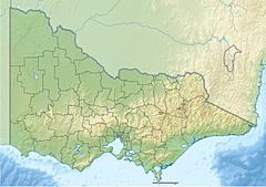
The Tarwin River is an important river in Victoria, Australia. It flows through the South Gippsland area. This river is the main water system for the South Gippsland Shire. It collects water from a large area of about 1,500 square kilometers (579 square miles). Most of this area is farmland, with some small towns. The river starts in the Strzlecki Ranges and flows south. It ends up in Anderson Inlet, which is a shallow bay connected to the Bass Strait.
Quick facts for kids Tarwin |
|
|---|---|
| Native name | Tarwin, Toulerm |
| Country | Australia |
| State | Victoria |
| Region | South East Coastal Plain (IBRA), South Gippsland |
| Local government areas | South Gippsland Shire, Baw Baw Shire |
| Physical characteristics | |
| Main source | Strzlecki Ranges |
| 2nd source | Tarwin River East Branch near the locality of Dollar 253 m (830 ft) |
| 3rd source | Tarwin River West Branch west of Mirboo North 91 m (299 ft) |
| River mouth | Anderson Inlet, Bass Strait Venus Bay 0 m (0 ft) 38°41′3″S 145°50′9″E / 38.68417°S 145.83583°E |
| Length | 36 km (22 mi) |
| Basin features | |
| River system | West Gippsland catchment |
| Tributaries |
|
Where the River Flows
The Tarwin River actually starts from two smaller rivers joining together. These are called the Tarwin River East Branch and the Tarwin River West Branch. They meet near a place called Tarwin, which is west of Meeniyan.
East Branch
The East Branch begins high up in the Strzlecki Ranges, about 253 meters (830 feet) above sea level. It flows north through Tarwin East and past Mirboo North. Then it turns south through a valley. When it reaches the open farmlands north of Dumbalk, the river can be up to 12 meters (39 feet) wide. The water here flows slowly, unless there's a flood.
West Branch
The West Branch starts from several small streams on the southern side of the Strzelecki Ranges. This is near the south of Mount Worth State Park. This branch flows through mostly steep farmlands that have been cleared. Six smaller streams join it as it flows south, east of Leongatha, towards Meeniyan. This part of the river generally flows through flat and gently rolling farmlands.
Joining Together
After the two branches meet, they form the main Tarwin River. It flows generally south and then west. Two more small streams join it along the way. The river flows through flat, open areas. It passes around Tarwin Lower, and sometimes floods local roads there. Finally, it flows into a large bay called Anderson Inlet, which then connects to the Bass Strait. This happens near the town of Venus Bay. The water in the lower parts of the Tarwin River can be affected by the ocean tides.
From its highest points in both the East and West branches, the Tarwin River drops a total of 253 meters (830 feet). Its combined path, including both branches, is about 82 kilometers (51 miles) long.
What's in a Name?
The name Tarwin comes from the Aboriginal Boonwurrung language. In this language, Tarwin means "thirsty." Another name for the river in Boonwurrung is Toulerm, which means "gum." The river was named from an Aboriginal word darwhin.
The Tarwin River is a popular place for fishing. People often catch a type of fish known as "Elephant Fish" there every season.
 | Misty Copeland |
 | Raven Wilkinson |
 | Debra Austin |
 | Aesha Ash |


