
Green, Kansas facts for kids
Quick facts for kids
Green, Kansas
|
|
|---|---|

Location within Clay County and Kansas
|
|

|
|
| Country | United States |
| State | Kansas |
| County | Clay |
| Incorporated | 1908 |
| Named for | Nehemiah Green |
| Area | |
| • Total | 0.20 sq mi (0.51 km2) |
| • Land | 0.20 sq mi (0.51 km2) |
| • Water | 0.00 sq mi (0.00 km2) |
| Elevation | 1,391 ft (424 m) |
| Population
(2020)
|
|
| • Total | 95 |
| • Density | 475/sq mi (186.3/km2) |
| Time zone | UTC-6 (CST) |
| • Summer (DST) | UTC-5 (CDT) |
| ZIP code |
67447
|
| Area code | 785 |
| FIPS code | 20-28425 |
| GNIS ID | 2394974 |
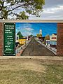
Green is a small city located in Clay County, Kansas, in the United States. It's a quiet place with a close-knit community. As of the 2020 census, 95 people lived in Green.
Contents
History of Green, Kansas
The story of Green began with a post office. In 1872, a post office opened in a nearby town called Powellsburgh. Later, in 1881, this post office was moved to the area that would become Green.
Green officially became a city in 1908. It was named after Nehemiah Green, who was the fourth Governor of Kansas. He offered to give the town a church bell if they named the city after him. Green was also an important stop for shipping goods on the Union Pacific Railroad.
Geography of Green
Green is a small city in terms of size. According to the United States Census Bureau, the city covers about 0.20 square miles (0.51 square kilometers). All of this area is land, meaning there are no large lakes or rivers within the city limits.
Who Lives in Green?
The number of people living in Green has changed over the years. Here's a look at the population from different census counts:
| Historical population | |||
|---|---|---|---|
| Census | Pop. | %± | |
| 1910 | 289 | — | |
| 1920 | 297 | 2.8% | |
| 1930 | 293 | −1.3% | |
| 1940 | 246 | −16.0% | |
| 1950 | 219 | −11.0% | |
| 1960 | 190 | −13.2% | |
| 1970 | 163 | −14.2% | |
| 1980 | 155 | −4.9% | |
| 1990 | 150 | −3.2% | |
| 2000 | 147 | −2.0% | |
| 2010 | 128 | −12.9% | |
| 2020 | 95 | −25.8% | |
| U.S. Decennial Census | |||
Green's Population in 2020
The 2020 United States census found that 95 people lived in Green. There were 43 households and 31 families. Most of the people living in Green, about 97.89%, identified as white. There was also a small percentage of Native American residents.
About 44.2% of the households in Green had children under 18 years old. Many households, 53.5%, were married couples living together. The average household had about 3 people.
The median age of people in Green was 45.2 years. This means half the people were younger than 45.2 and half were older. About 18.9% of the population was under 18 years old. Also, 22.1% of the people were 65 years or older.
Green's Population in 2010
In the 2010 United States census, 128 people lived in Green. There were 54 households and 34 families. The city's population density was about 640 people per square mile.
Most of the people, 97.7%, were white. About 1.6% were Native American. A small number, 2.3%, identified as Hispanic or Latino.
About 31.5% of households had children under 18. Many households were married couples. The average household size was 2.37 people. The median age in 2010 was 36.6 years.
Education in Green
Students in Green are part of the Clay County USD 379 public school district. This district provides education for children living in Green and the surrounding areas.
Images for kids
-
Green 1950 (2021)

See also
 In Spanish: Green (Kansas) para niños
