Green Lane, Pennsylvania facts for kids
Quick facts for kids
Borough of Green Lane
|
|
|---|---|

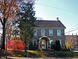
William and Caroline Schall House on Main Street
|
|

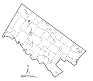
Location of Green Lane in Montgomery County, Pennsylvania
|
|
| Country | United States |
| State | Pennsylvania |
| County | Montgomery |
| Incorporated | December 10, 1875 |
| Government | |
| • Type | Council-manager |
| Area | |
| • Total | 0.33 sq mi (0.85 km2) |
| • Land | 0.32 sq mi (0.83 km2) |
| • Water | 0.01 sq mi (0.03 km2) |
| Elevation | 239 ft (73 m) |
| Population
(2020)
|
|
| • Total | 490 |
| • Density | 1,536.05/sq mi (593.05/km2) |
| Time zone | UTC-5 (EST) |
| • Summer (DST) | UTC-4 (EDT) |
| ZIP Code |
18054
|
| Area codes | 215, 267 & 445 |
| FIPS code | 42-31088 |
| School district | Upper Perkiomen School District |
| Website | https://greenlaneborough.org/ |
Green Lane is a small and friendly borough (which is like a town) located in Montgomery County, Pennsylvania. In 2020, about 490 people lived there. It's a quiet place that's part of the Upper Perkiomen School District.
Contents
History of Green Lane
Green Lane has some interesting history! One important building, the William and Caroline Schall House, was added to the National Register of Historic Places in 2007. This means it's a special place recognized for its historical importance.
Geography of Green Lane
Green Lane is located at 40°20′14″N 75°28′9″W / 40.33722°N 75.46917°W. The U.S. Census Bureau says the borough covers about 0.3 square miles (0.8 square kilometers) of land.
People and Population
The number of people living in Green Lane has changed over the years. Here's how the population has grown and shrunk:
| Historical population | |||
|---|---|---|---|
| Census | Pop. | %± | |
| 1880 | 187 | — | |
| 1890 | 237 | 26.7% | |
| 1900 | 272 | 14.8% | |
| 1910 | 372 | 36.8% | |
| 1920 | 332 | −10.8% | |
| 1930 | 388 | 16.9% | |
| 1940 | 478 | 23.2% | |
| 1950 | 550 | 15.1% | |
| 1960 | 582 | 5.8% | |
| 1970 | 543 | −6.7% | |
| 1980 | 542 | −0.2% | |
| 1990 | 442 | −18.5% | |
| 2000 | 584 | 32.1% | |
| 2010 | 508 | −13.0% | |
| 2020 | 490 | −3.5% | |
In 2010, most of the people living in Green Lane (about 97.4%) were White. There were also smaller groups of Black or African American, Native American, and Asian residents. About 1% of the population was of Hispanic or Latino background.
In 2000, there were 584 people living in Green Lane. There were 231 households, and 164 of these were families. The average household had about 2.5 people. The average family had almost 3 people.
The age groups in Green Lane in 2000 were:
- 24.8% were under 18 years old.
- 9.1% were between 18 and 24 years old.
- 32.7% were between 25 and 44 years old.
- 20.7% were between 45 and 64 years old.
- 12.7% were 65 years or older.
The average age in Green Lane was 36 years.
Fun and Recreation
Green Lane is home to the large Green Lane Park, which covers 3,400 acres (about 13.7 square kilometers). This park is a great place for outdoor activities!
- Trails: It has 25 miles (40 kilometers) of paved and dirt trails. You can use these trails all year round for horseback riding, walking, and biking.
- Water Activities: Visitors can also go fishing or boating in the park.
- Nature Center: There's a nature center where you can learn more about the local environment.
Getting Around Green Lane
As of 2016, Green Lane had about 3.10 miles (5 kilometers) of public roads. Some of these roads are taken care of by the Pennsylvania Department of Transportation (PennDOT), and others are maintained by the borough itself.
Two main highways pass through Green Lane:
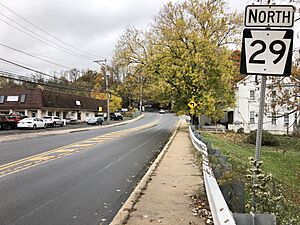
- Pennsylvania Route 29 (PA 29): This road goes north and south through the borough along a street called Gravel Pike.
- Pennsylvania Route 63 (PA 63): This road starts from PA 29 and heads east along Main Street.
See also
 In Spanish: Green Lane para niños
 | Jewel Prestage |
 | Ella Baker |
 | Fannie Lou Hamer |


