Green Point, New South Wales facts for kids
Quick facts for kids Green PointCentral Coast, New South Wales |
|||||||||||||||
|---|---|---|---|---|---|---|---|---|---|---|---|---|---|---|---|

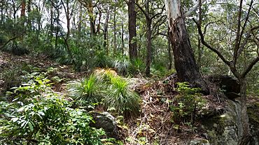
Kincumber Mountain Reserve at Green Point, NSW
|
|||||||||||||||
| Population | 6,810 (2021 census) | ||||||||||||||
| • Density | 811/km2 (2,100/sq mi) | ||||||||||||||
| Postcode(s) | 2251 | ||||||||||||||
| Area | 8.4 km2 (3.2 sq mi) | ||||||||||||||
| Location | |||||||||||||||
| LGA(s) | Central Coast Council | ||||||||||||||
| Parish | Kincumber | ||||||||||||||
| State electorate(s) | Terrigal | ||||||||||||||
| Federal Division(s) | Robertson | ||||||||||||||
|
|||||||||||||||
Green Point is a lovely suburb located on the Central Coast of New South Wales, Australia. It sits between the areas of Erina and Kincumber. You can easily reach Green Point by using Avoca Drive, a main road in the area. A natural border, Nunn's Creek, separates Green Point from Erina. This suburb is part of the Central Coast Council local government area.
Green Point is a great place to live with many natural features. Parts of the suburb are right next to Brisbane Water. This means many homes have amazing views of the water. It's a perfect spot for enjoying the outdoors and the beautiful scenery.
What's in Green Point?
Green Point has everything you need for daily life.
Shopping and Food
You'll find a few places to shop and eat here.
- The Green Point shopping centre has a Coles supermarket.
- There are also various cafes and restaurants where you can grab a bite.
- An Aldi supermarket is a bit further along Avoca Drive.
- For even more options, the large Erina Fair shopping complex is nearby. It has many stores, a cinema, and places to eat.
Schools
Education is important in Green Point.
- The suburb is home to Green Point Christian College. This is a private school that offers education from kindergarten to Year 12.
History and Heritage
Green Point has some interesting historical sites. These places are protected because they are important to the area's past.
Protected Sites
- Green Point Foreshore and Structures: This area at 9 Pixie Avenue is special. It includes parts of the coastline and old buildings that tell us about how people used to live and work here.
- Mulholland's Farm: Also at 9 Pixie Avenue, this farm is another important historical site. It shows us what farming was like in the past in this region.
 | Calvin Brent |
 | Walter T. Bailey |
 | Martha Cassell Thompson |
 | Alberta Jeannette Cassell |


