
Grizzly Flats, California facts for kids
Quick facts for kids
Grizzly Flats
|
|
|---|---|

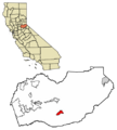
Location of Grizzly Flats in El Dorado County, California.
|
|

Grizzly Flats
Location in California
|
|
| Country | |
| State | |
| County | El Dorado |
| Area | |
| • Total | 6.629 sq mi (17.169 km2) |
| • Land | 6.629 sq mi (17.169 km2) |
| • Water | 0 sq mi (0 km2) 0% |
| Elevation | 3,868 ft (1,179 m) |
| Population
(2020)
|
|
| • Total | 1,093 |
| • Density | 164.88/sq mi (63.661/km2) |
| • Summer (DST) | UTC-7 (PDT) |
| ZIP code |
95636
|
| Area code(s) | 530 |
| GNIS feature IDs | 1658675; 2628736 |
Grizzly Flats is a small community in El Dorado County, California. It used to be known as Grizzly Flat or Chickenmasee. It sits about 3,868 feet (1,179 meters) above sea level. Grizzly Flats is the town closest to Baltic Peak, a smaller mountain nearby. In 2020, about 1,093 people lived here.
Contents
History of Grizzly Flats
Grizzly Flats began as a gold mining camp in the 1850s. People looking for gold, called prospectors, gave it its name in 1850. They were surprised to see a grizzly bear in the area!
By 1852, Grizzly Flats was growing. It had stores, bars, and places for people to stay. A post office opened in 1854, making it easier to send mail. A stagecoach route started in 1855, connecting the town to Diamond Springs. A Wells Fargo office also opened in 1857. Churches were built in the mid-1850s too.
Fires and Rebuilding
Sadly, big fires hit Grizzly Flats in 1866 and 1869. The 1869 fire was very destructive. It destroyed almost all the businesses and homes, and one person died. The town was only partly rebuilt after that.
Caldor Fire Impact
On August 17, 2021, a large wildfire called the Caldor Fire caused a lot of damage. Around 500 buildings in and near Grizzly Flats were destroyed. This included the historic 1850s post office, the newer post office, and Walt Tyler Elementary School. People had to leave their homes for safety. The evacuation order was lifted on September 6, allowing residents to return.
Population Information
Grizzly Flats was first officially counted as a "census-designated place" in the 2010 U.S. Census.
In 2010, the population was 1,066 people. By 2020, it had grown slightly to 1,093 people. Most of the people living in Grizzly Flats are White, but there are also people from many different backgrounds.
Climate
Grizzly Flats has a "Mediterranean Climate." This means it usually has hot, dry summers and mild, wet winters.
The table below shows the average weather in Grizzly Flats throughout the year:
| Climate data for Grizzly Flats | |||||||||||||
|---|---|---|---|---|---|---|---|---|---|---|---|---|---|
| Month | Jan | Feb | Mar | Apr | May | Jun | Jul | Aug | Sep | Oct | Nov | Dec | Year |
| Mean daily maximum °F (°C) | 51.1 (10.6) |
52.5 (11.4) |
57.2 (14.0) |
62.6 (17.0) |
71.3 (21.8) |
81.0 (27.2) |
89.6 (32.0) |
90.0 (32.2) |
83.7 (28.7) |
71.7 (22.1) |
57.1 (13.9) |
50.2 (10.1) |
68.2 (20.1) |
| Daily mean °F (°C) | 42.2 (5.7) |
43.1 (6.2) |
46.3 (7.9) |
49.9 (9.9) |
57.4 (14.1) |
65.8 (18.8) |
72.9 (22.7) |
72.6 (22.6) |
67.6 (19.8) |
58.4 (14.7) |
46.9 (8.3) |
41.3 (5.2) |
55.4 (13.0) |
| Mean daily minimum °F (°C) | 33.4 (0.8) |
33.7 (0.9) |
35.3 (1.8) |
37.2 (2.9) |
43.4 (6.3) |
50.5 (10.3) |
56.2 (13.4) |
55.3 (12.9) |
51.5 (10.8) |
45.1 (7.3) |
36.7 (2.6) |
32.4 (0.2) |
42.6 (5.9) |
| Average precipitation inches (mm) | 9.01 (229) |
8.02 (204) |
7.36 (187) |
4.36 (111) |
3.12 (79) |
0.79 (20) |
0.07 (1.8) |
0.08 (2.0) |
0.71 (18) |
2.83 (72) |
5.92 (150) |
8.17 (208) |
50.42 (1,281) |
| Source: PRISM Climate Group | |||||||||||||
Images for kids
-
Map showing the location of Grizzly Flats in El Dorado County, California.
See also
 In Spanish: Grizzly Flat para niños
