Grizzly Island facts for kids

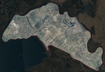
USGS aerial imagery of Grizzly Island.
|
|
| Geography | |
|---|---|
| Location | Northern California |
| Coordinates | 38°09′05″N 121°58′22″W / 38.15139°N 121.97278°W |
| Adjacent bodies of water | Suisun Bay |
| Administration | |
| State | |
| County | Solano |
Grizzly Island is a special island located in Grizzly Bay. This bay is part of Suisun Bay, which itself is a big part of the famous San Francisco Bay Area in California. Grizzly Island is found in Solano County. It's a really interesting place, especially for nature lovers!
Contents
Welcome to Grizzly Island!
Grizzly Island might be small, but it plays a big role in its local environment. It's known for its unique natural features and the efforts made to protect it. The island's exact location can be found using its coordinates: 38°09′05″N 121°58′22″W / 38.15139°N 121.97278°W.
Where is Grizzly Island?
This island sits in the northern part of California. It's surrounded by the waters of Suisun Bay. This area is a mix of fresh and saltwater, making it a unique habitat. The island is part of a larger network of waterways and wetlands.
Protecting the Land: Reclamation Districts
A big part of Grizzly Island is looked after by special groups called Reclamation Districts. These districts help manage the land and water. They work to protect the island from floods and keep the natural areas healthy. For Grizzly Island, some of these groups are Reclamation District 2112 (Schafer Pintail), 2129 (Frost Lake), and 2136 (Grizzly West). Their job is important for the island's future.
A Look Back in Time
Grizzly Island has been on maps for a long time. Early maps from the 1850s show parts of what is now Grizzly Island. For example, an 1850 survey map by Cadwalader Ringgold showed areas called "Warrington Island" and "Davis Island." An 1854 map by Henry Lange also featured these areas. These old maps help us see how the land has changed over many years.
Nature and Wildlife on Grizzly Island
Grizzly Island is a haven for many types of wildlife. It's mostly made up of wetlands and marshes. These environments are perfect homes for a variety of animals and plants. The island is a key part of the larger Suisun Marsh, which is one of the biggest tidal marshes in the United States.
Home to Amazing Animals
The island is especially famous for its bird population. Many different kinds of waterfowl, like ducks and geese, live here. They use the wetlands for feeding, resting, and raising their young. You might also spot other animals, such as various fish, amphibians, and even some mammals. Protecting these habitats is vital for the survival of these species.
Visiting Grizzly Island
Grizzly Island is part of the Grizzly Island Wildlife Area. This means that some parts of the island are open to the public. People can visit to enjoy nature, go birdwatching, or even participate in regulated hunting and fishing during certain seasons. It's a great place to learn about California's natural environment and see wildlife up close. Remember to always follow the rules to keep the area safe for everyone and for the animals.
 | Sharif Bey |
 | Hale Woodruff |
 | Richmond Barthé |
 | Purvis Young |


