Grouse Creek, Utah facts for kids
Quick facts for kids
Grouse Creek, Utah
|
|
|---|---|
| Country | United States |
| State | Utah |
| County | Box Elder |
| Settled | 1876 |
| Founded by | Benjamin F. Cook |
| Named for | Sage Grouse |
| Elevation | 5,331 ft (1,625 m) |
| Time zone | UTC-7 (Mountain (MST)) |
| • Summer (DST) | UTC-6 (MDT) |
| ZIP codes |
84313
|
| GNIS feature ID | 1428419 |
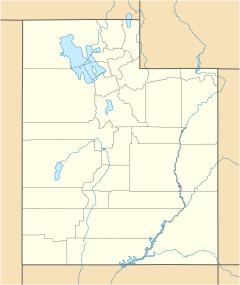
Grouse Creek (also known as Cookesville) is a small, quiet community. It is located in the very northwestern part of Box Elder County, Utah, United States. This area is near the borders of Idaho and Nevada.
You can find Grouse Creek along unpaved roads. It is north of State Route 30 in the Grouse Creek Mountains. The community sits at an elevation of 5,331 feet (1,625 meters) above sea level. Even though it is a small place, it has its own post office with the ZIP code 84313.
A Look Back: Grouse Creek's History
Grouse Creek became a settled community in 1876. People decided to name the area after a nearby creek. This creek was full of birds called grouse. That is how the community got its unique name.
Weather and Climate in Grouse Creek
Grouse Creek has what scientists call a semi-arid climate. This means it is usually dry, but not a complete desert. It gets some rain, but not a lot. On climate maps, this type of weather is shown as "BSk".
| Climate data for Grouse Creek, Utah, 1991–2020 normals, 1959-2020 extremes: 5320ft (1622m) | |||||||||||||
|---|---|---|---|---|---|---|---|---|---|---|---|---|---|
| Month | Jan | Feb | Mar | Apr | May | Jun | Jul | Aug | Sep | Oct | Nov | Dec | Year |
| Record high °F (°C) | 58 (14) |
65 (18) |
75 (24) |
84 (29) |
93 (34) |
100 (38) |
104 (40) |
101 (38) |
97 (36) |
87 (31) |
74 (23) |
63 (17) |
104 (40) |
| Mean maximum °F (°C) | 47.4 (8.6) |
52.3 (11.3) |
64.6 (18.1) |
74.9 (23.8) |
82.5 (28.1) |
90.6 (32.6) |
97.2 (36.2) |
95.8 (35.4) |
89.4 (31.9) |
79.4 (26.3) |
61.2 (16.2) |
50.6 (10.3) |
97.8 (36.6) |
| Mean daily maximum °F (°C) | 35.0 (1.7) |
39.5 (4.2) |
49.1 (9.5) |
56.5 (13.6) |
66.4 (19.1) |
77.3 (25.2) |
88.2 (31.2) |
87.3 (30.7) |
77.2 (25.1) |
62.4 (16.9) |
46.5 (8.1) |
35.2 (1.8) |
60.1 (15.6) |
| Daily mean °F (°C) | 24.0 (−4.4) |
27.7 (−2.4) |
36.3 (2.4) |
42.8 (6.0) |
51.4 (10.8) |
60.5 (15.8) |
69.6 (20.9) |
68.2 (20.1) |
58.9 (14.9) |
45.9 (7.7) |
33.3 (0.7) |
24.3 (−4.3) |
45.2 (7.4) |
| Mean daily minimum °F (°C) | 12.9 (−10.6) |
16.0 (−8.9) |
23.6 (−4.7) |
29.0 (−1.7) |
36.5 (2.5) |
43.6 (6.4) |
51.0 (10.6) |
49.1 (9.5) |
40.6 (4.8) |
29.3 (−1.5) |
20.2 (−6.6) |
13.3 (−10.4) |
30.4 (−0.9) |
| Mean minimum °F (°C) | −4.1 (−20.1) |
0.3 (−17.6) |
9.4 (−12.6) |
16.7 (−8.5) |
23.2 (−4.9) |
30.4 (−0.9) |
39.7 (4.3) |
37.4 (3.0) |
26.6 (−3.0) |
15.5 (−9.2) |
2.9 (−16.2) |
−3.8 (−19.9) |
−8.4 (−22.4) |
| Record low °F (°C) | −26 (−32) |
−18 (−28) |
−6 (−21) |
4 (−16) |
15 (−9) |
24 (−4) |
30 (−1) |
25 (−4) |
16 (−9) |
0 (−18) |
−12 (−24) |
−25 (−32) |
−26 (−32) |
| Average precipitation inches (mm) | 0.87 (22) |
0.67 (17) |
1.00 (25) |
1.15 (29) |
1.50 (38) |
1.03 (26) |
0.49 (12) |
0.92 (23) |
0.89 (23) |
0.72 (18) |
0.79 (20) |
1.03 (26) |
11.06 (279) |
| Average snowfall inches (cm) | 11.80 (30.0) |
7.40 (18.8) |
3.80 (9.7) |
1.20 (3.0) |
0.00 (0.00) |
0.00 (0.00) |
0.00 (0.00) |
0.00 (0.00) |
0.00 (0.00) |
0.20 (0.51) |
6.90 (17.5) |
11.10 (28.2) |
42.4 (107.71) |
| Source 1: NOAA (1981-2010 snowfall) | |||||||||||||
| Source 2: XMACIS2 (records & monthly max/mins) | |||||||||||||
Population Changes in Grouse Creek
The number of people living in Grouse Creek has changed over many years. This information comes from the U.S. Census Bureau.
| Historical population | |||
|---|---|---|---|
| Census | Pop. | %± | |
| 1880 | 267 | — | |
| 1890 | 274 | 2.6% | |
| 1900 | 278 | 1.5% | |
| 1910 | 337 | 21.2% | |
| 1920 | 342 | 1.5% | |
| 1930 | 329 | −3.8% | |
| 1940 | 267 | −18.8% | |
| 1950 | 167 | −37.5% | |
| Source: U.S. Census Bureau | |||
- In 1880, there were 267 people.
- The population slowly grew until 1920, reaching 342 people.
- After 1920, the number of residents started to decrease.
- By 1950, the population was 167 people.
 | John T. Biggers |
 | Thomas Blackshear |
 | Mark Bradford |
 | Beverly Buchanan |


