
Box Elder County, Utah facts for kids
Quick facts for kids
Box Elder County
|
|
|---|---|

Box Elder County Courthouse, January 2010
|
|

Location within the U.S. state of Utah
|
|
 Utah's location within the U.S. |
|
| Country | |
| State | |
| Founded | January 5, 1856 |
| Named for | Box elder tree |
| Seat | Brigham City |
| Largest city | Brigham City |
| Area | |
| • Total | 6,729 sq mi (17,430 km2) |
| • Land | 5,746 sq mi (14,880 km2) |
| • Water | 934 sq mi (2,420 km2) 15% |
| Population
(2020)
|
|
| • Total | 57,666 |
| • Density | 8.5698/sq mi (3.30881/km2) |
| Time zone | UTC−7 (Mountain) |
| • Summer (DST) | UTC−6 (MDT) |
| Congressional district | 1st |
Box Elder County is a county located in the northwestern part of Utah, United States. It's in the corner where Utah meets Nevada and Idaho. In 2020, about 57,666 people lived here.
The main city and county seat is Brigham City. The county got its name from the many box elder trees that grow in the area. Box Elder County is part of a larger group of cities called the Ogden-Clearfield Metropolitan Area. This area is also part of an even bigger region that includes Salt Lake City and Provo.
You can find two campuses of Utah State University in Box Elder County. They are located in Brigham City and Tremonton.
History

Box Elder County was created on January 5, 1856. It was formed from a part of Weber County. Its borders changed a few times over the years. But they have stayed the same since 1880.
An old path called the California Trail used to go through the northwestern part of the county. This trail was used by pioneers traveling west.
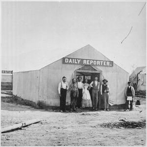
A very important event happened in Box Elder County in 1869. This was when the two parts of the first transcontinental railroad met at Promontory Summit, Utah. This connected the eastern and western United States by train.
In 1970, a famous art piece called the Spiral Jetty was built here. It's a large sculpture made from rocks and earth. You can find it on the north shore of the Great Salt Lake.
Geography

Box Elder County is in the northwest corner of Utah. It shares borders with Nevada to the west and Idaho to the north. The county has large areas of dry desert. But it also has tall mountains covered with forests.
The main cities are in the southeastern part of the county. This area is near the Wasatch Front. The land generally slopes south towards the Great Salt Lake. However, the northwest part of the county slopes north. Water from there flows into the Snake River.
The highest point in the county is a mountain ridge in the northwest. It is about 9,180 feet (2,800 meters) above sea level. The county covers a total area of about 6,729 square miles. About 5,746 square miles are land, and 984 square miles are water. This makes it the fourth-largest county in Utah by size.
In the east, you will find the Wellsville Mountains. These are part of the Wasatch Range. To the west is a large desert area. The Great Salt Lake is in the southeastern part of the county.
Major highways like Interstate 15 and Interstate 84 run through the eastern part of the county. They split near Tremonton. I-84 goes northwest into Idaho. I-15 goes north into eastern Idaho.
Major roads
 I-15
I-15 I-15 Bus.
 I-84
I-84 I-84 Bus.
 US-89
US-89 US-91
US-91 SR-13
SR-13- SR-30
- SR-38
- SR-42
- SR-82
- SR-83
- SR-102
Neighboring counties
- Cache County - northeast
- Weber County - east
- Davis County - southeast (across Great Salt Lake)
- Tooele County - south
- Elko County, Nevada - west
- Cassia County, Idaho - northwest
- Oneida County, Idaho - north
Protected natural areas
- Bear River Migratory Bird Refuge
- Caribou-Targhee National Forest (part)
- Golden Spike National Historic Site
- Sawtooth National Forest (part)
- Wasatch-Cache National Forest (part)
People and Population
| Historical population | |||
|---|---|---|---|
| Census | Pop. | %± | |
| 1860 | 1,608 | — | |
| 1870 | 4,855 | 201.9% | |
| 1880 | 6,761 | 39.3% | |
| 1890 | 7,642 | 13.0% | |
| 1900 | 10,009 | 31.0% | |
| 1910 | 13,894 | 38.8% | |
| 1920 | 18,788 | 35.2% | |
| 1930 | 17,810 | −5.2% | |
| 1940 | 18,832 | 5.7% | |
| 1950 | 19,734 | 4.8% | |
| 1960 | 25,061 | 27.0% | |
| 1970 | 28,129 | 12.2% | |
| 1980 | 33,222 | 18.1% | |
| 1990 | 36,485 | 9.8% | |
| 2000 | 42,745 | 17.2% | |
| 2010 | 49,975 | 16.9% | |
| 2020 | 57,666 | 15.4% | |
| US Decennial Census 1790–1960 1900–1990 1990–2000 2010–2018 2019 2020 |
|||
In 2020, Box Elder County had a population of 57,666 people. This means there were about 10 people for every square mile. Most people in the county are White, but there are also people from many other backgrounds. About 9.6% of the population is Hispanic or Latino.
The population is pretty balanced between males and females. Many young people live here, with about 31.7% of the population under 18 years old. The average age in the county is about 33 years old.
There are over 18,000 households in Box Elder County. Most of these are families, with many married couples. About 41% of households have children under 18. Most people in the county own their homes.
The average household income in Box Elder County was about $63,573 in 2020. The average family income was higher, at about $73,446. This shows that many families in the county are doing well financially.
Most adults in Box Elder County have finished high school. Many have also gone on to college or earned a degree. This shows a good level of education in the community.
People in Box Elder County have diverse family histories. Many residents report having ancestors from England, Germany, and Denmark. Other common ancestries include American, Irish, and Scottish roots.
Education
Box Elder County has many schools for students of all ages.
Elementary schools
- Century
- Discovery
- Fielding
- Foothill
- Garland
- Grouse Creek
- Lake View
- McKinley
- Mountain View
- North Park
- Park Valley
- Snowville
- Three Mile Creek
- Willard
Intermediate schools
- Alice C. Harris
- Adele C. Young
Middle schools
- Bear River
- Box Elder
High schools
- Bear River High School - Garland
- Box Elder High School - Brigham City
- Sunrise High School - Brigham City
Specialty schools
- Early Learning Center
- Independent Life Skills Center
Colleges and universities
- Utah State University-Brigham City
- Utah State University-Tremonton
- Bridgerland Technical College - Brigham City
Communities

Cities
- Bear River City
- Brigham City (county seat)
- Corinne
- Garland
- Honeyville
- Perry
- Tremonton
- Willard
Towns
Census-designated places
- Riverside
- South Willard
- Thatcher
Unincorporated communities
Ghost towns
- Blue Creek
- Cedar Creek
- Golden
- Hardup
- Jackson
- Kelton
- Kosmo
- Lucin
- Matlin
- Promontory Point
- Russian Settlement
- Terrace
- Washakie
- Salinburg, Utah
See also
 In Spanish: Condado de Box Elder para niños
