Bear River Migratory Bird Refuge facts for kids
Quick facts for kids Bear River Migratory Bird Refuge |
|
|---|---|
|
IUCN Category IV (Habitat/Species Management Area)
|
|
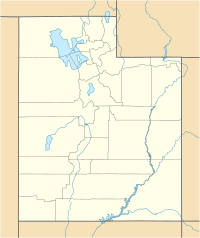
| Location | Box Elder County, Utah, United States |
| Nearest city | Brigham City, Utah |
| Area | 79,000 acres (320 km2) |
| Established | 1928 |
| Governing body | U.S. Fish and Wildlife Service |
| Website | Bear River Migratory Bird Refuge |
The Bear River Migratory Bird Refuge is a very special place in Utah. It covers about 74,000 acres (300 km²) and was created in 1928. This refuge is part of a large national system of lands bought to protect wildlife. It's managed by the U.S. Fish and Wildlife Service.
What is the Refuge?
The refuge is located where the Bear River flows into the northern part of the Great Salt Lake. This area is in Box Elder County. It has many different kinds of natural areas.
You can find open water, muddy areas called mudflats, and wet lands known as wetlands. There are also higher, drier areas called uplands. All these different habitats make it a perfect home for many animals.
Home to Many Birds
Millions of migratory birds visit the Bear River Migratory Bird Refuge every year. These birds travel long distances between their summer and winter homes. The refuge provides a safe place for them to rest, eat, and raise their young.
Some of the amazing birds you might see include the majestic bald eagle and the beautiful tundra swan. The refuge has over 41,000 acres (166 km²) of freshwater wetlands. These wetlands are very important for the birds.
Learning and Exploring
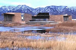
The refuge has a great place for visitors called the James V. Hansen Wildlife Education Center. Inside, you can find fun exhibits that teach you all about the birds and wetlands of the refuge. It's a great way to learn about nature.
Outside the center, there is a 1/2-mile walking trail. This trail is easy to use and lets you explore a wetland habitat up close. The center also offers special programs, talks, and public events for everyone to enjoy.
You can also explore the refuge by car. There is a one-way, 12-mile (19 km) auto route. You can download an audio tour and a map from the official website to guide you. It's a wonderful way to see the different parts of the refuge.
Dealing with Changes
In 1983, the refuge faced a big challenge. The water levels of the Great Salt Lake rose a lot, causing severe floods. This flooding changed parts of the refuge.
To help visitors return and learn about the refuge, a new wildlife education center was opened in 2006. It is located right off Interstate 15, making it easier for people to visit and enjoy this special place.
 | John T. Biggers |
 | Thomas Blackshear |
 | Mark Bradford |
 | Beverly Buchanan |


