Wellsville Mountains facts for kids
Quick facts for kids Wellsville Mountains |
|
|---|---|

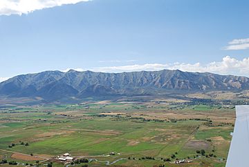
The Wellsville Mountains as seen from the air in mid-September. Box Elder peak and the Wellsville cone are both visible, September 2009.
|
|
| Highest point | |
| Peak | Box Elder Peak |
| Elevation | 9,372 ft (2,857 m) |
| Dimensions | |
| Length | 28 mi (45 km) N/S |
| Width | 17 mi (27 km) E/W |
| Area | 307 sq mi (800 km2) |
| Naming | |
| Etymology | Nearby City of Wellsville |
| Geography | |
| Country | United States |
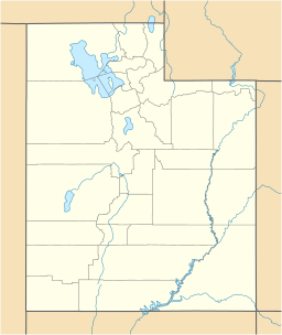
| State | Utah |
| Parent range | Wasatch Range |
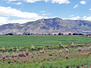
The Wellsville Mountains are a cool mountain range in northern Utah, United States. They are often thought of as part of the bigger Wasatch Mountains. These mountains are known for being super steep!
Contents
Exploring the Wellsville Mountains
Location and What They Do
These mountains act like a natural wall. They separate Cache Valley from the Wasatch Front area. The Wasatch Front is a busy part of Utah. The mountains also form part of the border between Box Elder and Cache counties.
Almost all the water that falls on the Wellsville Mountains flows into the Bear River. This river is important for the region.
How Steep Are They?
The Wellsville Mountains are not super tall, but they are very narrow. Because they are so narrow, they rise sharply from the ground. This is why many people say they are one of the steepest mountain ranges in North America.
Highest Points and Roads
The two highest peaks in the Wellsville Mountains are Box Elder Peak and the Wellsville Cone. Box Elder Peak is about 9,372 feet (2,857 meters) tall. The Wellsville Cone is just a little bit shorter at 9,356 feet (2,852 meters).
You can drive through parts of these mountains. US-89 and US-91 go through canyons like Box Elder Canyon. This road starts near Brigham City and goes north. It then turns northeast and enters Cache Valley near Wellsville.
How the Mountains Got Their Name
The Wellsville Mountains were named after the nearby city of Wellsville. This city is located right next to the mountains.
 | Claudette Colvin |
 | Myrlie Evers-Williams |
 | Alberta Odell Jones |


