Mendon Peak (Vermont) facts for kids
Quick facts for kids Mendon Peak |
|
|---|---|
| Highest point | |
| Elevation | 3,840 ft (1,170 m) |
| Prominence | 280 ft (85 m) |
| Listing | #85 New England 100 Highest |
| Geography | |
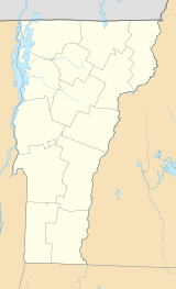
| Location | Rutland County, Vermont, U.S. |
| Parent range | Green Mountains |
| Topo map | USGS Killington Peak |
| Climbing | |
| Easiest route | Logging road, bushwhack |
Mendon Peak is a mountain found in Rutland County, Vermont. It is part of the Green Mountains and stands within the Calvin Coolidge State Forest. This mountain is a smaller peak that branches off the main Coolidge Range.
Mendon Peak is located to the west of another mountain called Little Killington. It is also special because it is on a list of the "Hundred Highest" peaks in New England. This means it is one of the 100 tallest mountains in the region. There are no marked trails to the very top of Mendon Peak, but people can reach the summit using different paths.
Contents
About Mendon Peak
Mendon Peak is a notable mountain in Vermont. It is part of the larger Green Mountains range. The mountain is known for being a "spur," which means it's like a smaller branch coming off a bigger mountain range. It is a great place for nature lovers to explore.
Where is Mendon Peak Located?
Mendon Peak is found in Rutland County, Vermont. It is nestled within the beautiful Calvin Coolidge State Forest. This forest is a protected area, full of trees and wildlife. The mountain's location makes it a quiet and natural spot.
How Tall is Mendon Peak?
Mendon Peak stands at an elevation of 3,840 feet (about 1,170 meters) above sea level. While it might not be the tallest mountain in the world, it is still quite high. Its height earns it a spot on the "Hundred Highest" list for New England. This list includes the tallest peaks in the area.
Reaching the Summit
Unlike many mountains, Mendon Peak does not have official hiking trails leading to its summit. This means that reaching the top can be more challenging. Hikers often need to find their own way through the woods, which is called "bushwhacking." This makes the climb a unique adventure for experienced hikers.
Water Flow Around Mendon Peak
The water that falls on Mendon Peak eventually travels a long way. The mountain is part of a "watershed." A watershed is an area of land where all the water drains into a common river or lake. For Mendon Peak, this means water flows into the Cold River.
The Journey of Water
The Cold River is a "tributary" of Otter Creek. A tributary is a smaller stream or river that flows into a larger one. Otter Creek then flows into Lake Champlain. From Lake Champlain, the water continues its journey into the Richelieu River in Québec, Canada. After that, it joins the mighty Saint Lawrence River, which finally empties into the Gulf of Saint Lawrence and the Atlantic Ocean.
Water Flow on Different Sides of the Mountain
- North Side: Water from the north side of Mendon Peak flows into a stream called Eddy Brook. Eddy Brook then joins the North Branch of the Cold River.
- South Side: On the south side of Mendon Peak, water drains into a stream that flows into Sargent Brook. Sargent Brook then connects with Gould Brook, which also leads to the Cold River.
 | Precious Adams |
 | Lauren Anderson |
 | Janet Collins |


