Guadalupe, Cáceres facts for kids
Quick facts for kids
Guadalupe
|
|||
|---|---|---|---|
 |
|||
|
|||
| Country | Spain | ||
| Autonomous community | Extremadura | ||
| Province | Cáceres | ||
| Area | |||
| • Total | 68.19 km2 (26.33 sq mi) | ||
| Elevation | 640 m (2,100 ft) | ||
| Population
(2018)
|
|||
| • Total | 1,887 | ||
| • Density | 27.673/km2 (71.672/sq mi) | ||
| Time zone | UTC+1 (CET) | ||
| • Summer (DST) | UTC+2 (CEST) | ||
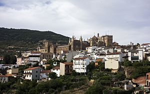
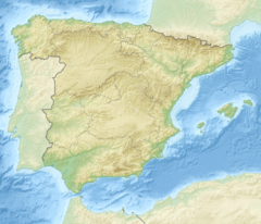
Guadalupe is a small town in Spain. It is located in the province of Cáceres, which is part of the Extremadura region. The town covers an area of about 68 square kilometers.
As of January 1, 2021, Guadalupe had a population of 1,822 people. It is most famous for the Monastery of Santa María de Guadalupe. This historic monastery is a very important landmark in Spain.
Geography and Nature
The town of Guadalupe is surrounded by beautiful natural areas. The Guadalupe River starts its journey near the town. This river flows from the nearby Sierra de las Villuercas mountains.
The highest point in this area is a mountain called Pico la Villuerca. It stands tall at 1,603 meters (about 5,259 feet) above sea level. The landscape around Guadalupe is known for its hills and natural beauty.
See also
 In Spanish: Guadalupe (España) para niños
 | Jackie Robinson |
 | Jack Johnson |
 | Althea Gibson |
 | Arthur Ashe |
 | Muhammad Ali |


