Guatay, California facts for kids
Quick facts for kids
Guatay
|
|
|---|---|
| Country | |
| State | |
| County | |
| Elevation | 3,999 ft (1,219 m) |
| Time zone | UTC-8 (Pacific (PST)) |
| • Summer (DST) | UTC-7 (PDT) |
| ZIP codes |
91931
|
| GNIS feature ID | 1656536 |
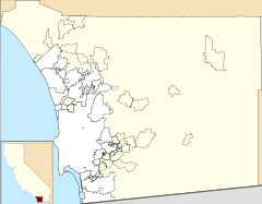
Guatay is a small community in California. It is not a city, but an unincorporated area. This means it does not have its own local government. Guatay is located in the Cuyamaca Mountains. These mountains are in the southeastern part of San Diego County. The Kumeyaay people, who are Native Americans, called this place Na-wa Ti'e. This name means "Big House."
Where is Guatay?
Guatay is located high up in the mountains. Its elevation is about 3,999 feet (1,219 meters) above sea level. Even though it's a community, Guatay does not have its own post office. The ZIP code for Guatay is 91931.
Guatay's History
In the 1800s, Guatay was an important stop. It had a stagecoach station. Stagecoaches were like buses pulled by horses. They carried people and mail across the country. Guatay was part of the San Antonio-San Diego Mail Line. This was a route for mail and travelers.
Local Plants and Animals
Near Guatay, there is a mountain called Guatay Mountain. This mountain is part of the Cuyamaca Mountains. It is home to a special type of tree. This tree is called the Tecate Cypress. It is a rare tree. It is also endemic to the area. This means it grows naturally only in this specific region and nowhere else in the world.
See also
 In Spanish: Guatay (California) para niños
 | Shirley Ann Jackson |
 | Garett Morgan |
 | J. Ernest Wilkins Jr. |
 | Elijah McCoy |


