Guayabo, Aguada, Puerto Rico facts for kids
Quick facts for kids
Guayabo
|
|
|---|---|
|
Barrio
|
|

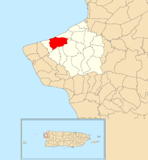
Location of Guayabo within the municipality of Aguada shown in red
|
|
| Commonwealth | |
| Municipality | |
| Area | |
| • Total | 2.42 sq mi (6.3 km2) |
| • Land | 2.20 sq mi (5.7 km2) |
| • Water | 0.22 sq mi (0.6 km2) |
| Elevation | 10 ft (3 m) |
| Population
(2010)
|
|
| • Total | 3,273 |
| • Density | 1,494.5/sq mi (577.0/km2) |
| Source: 2010 Census | |
| Time zone | UTC−4 (AST) |
Guayabo is a special kind of neighborhood, called a barrio. It is located in the town of Aguada, Puerto Rico. In 2010, about 3,273 people lived there.
Contents
A Look at Guayabo's Past
After the Spanish–American War, Spain gave Puerto Rico to the United States in 1898. This happened because of a peace agreement called the Treaty of Paris of 1898. Puerto Rico then became a territory of the United States.
In 1899, the United States Department of War conducted a count of all the people in Puerto Rico. They found that Guayabo, along with two other nearby neighborhoods called Cruces and Río Grande, had a total population of 1,533 people.
How Guayabo's Population Grew
The number of people living in Guayabo has changed over the years. Here's a quick look at its population from different census counts:
| Historical population | |||
|---|---|---|---|
| Census | Pop. | %± | |
| 1950 | 970 | — | |
| 1960 | 825 | −14.9% | |
| 1980 | 2,108 | — | |
| 1990 | 2,680 | 27.1% | |
| 2000 | 2,961 | 10.5% | |
| 2010 | 3,273 | 10.5% | |
| U.S. Decennial Census 1899 (shown as 1900) 1910-1930 1930-1950 1960 1980-2000 2010 |
|||
Exploring Guayabo's Smaller Areas
Barrios like Guayabo are often divided into even smaller local areas. These smaller areas are called sectores (which means sectors in English). The names for these sectors can be different. Some might be called urbanización, reparto, barriada, or residencial.
Here are some of the sectors you can find within Guayabo barrio:
- Avenida Nativo Alers
- Condominio Mar Azul
- Condominio Ocean View Castle
- Extensión Casualidad
- Sector El Palmar
- Sector El Túnel
- Sector Hacienda El Palmar
- Sector Juan Cardona
- Sector La Mora
- Sector Las Cruces
- Sector Miguel A. Ruíz
- Sector Pancho Agudo
- Sector Pascual Muñoz
- Sector Silva
- Tramo Carretera 115 (which is part of Highway 115)
- Urbanización El Palmar
- Urbanización Villas del Palmar
Part of Guayabo barrio is also considered to be within the main urban area of Aguada.
See also
 In Spanish: Guayabo (Aguada) para niños
- List of communities in Puerto Rico
- List of barrios and sectors of Aguada, Puerto Rico
 | Roy Wilkins |
 | John Lewis |
 | Linda Carol Brown |


