
Gubbata facts for kids
Quick facts for kids GubbataNew South Wales |
|
|---|---|

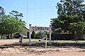
The platform sign from the former Gubbata station
|
|

Gubbata
Location in New South Wales
|
|
| Postcode(s) | 2669 |
| Location |
|
| LGA(s) | Bland Shire |
| County | Dowling |
| Parish | Blairgowrie |
Gubbata is a small place in the Central West region of New South Wales, Australia. It is about 432 kilometres (268 mi) west of Sydney, the state capital. Gubbata is part of the Bland Shire local government area.
Contents
Gubbata's History
The land where Gubbata is located originally belonged to the Wiradjuri people. The name Gubbata likely comes from an Aboriginal language word.
How Gubbata Started
The village of Gubbata officially began in December 1930. This was when the land around it was opened up for farming. A railway line was also built, which helped the area grow.
Some of the new farms were given to soldier settlers. These were soldiers who had returned from war. They were given land to start new lives as farmers.
A Small Settlement
Even though Gubbata was planned to be a bigger town, it never grew as much as people hoped. However, a small community did form there.
Gubbata had a public school for many years. It was open from 1934 to 1946, and again from 1961 to 1983. There was also a post office that opened by 1934 and closed in 1981. Like many small communities, Gubbata also had a public hall for gatherings.
The Railway Line
Gubbata is located on the Naradhan Railway Line. The train station opened on February 11, 1929. It stopped taking passengers on May 4, 1975.
There was a special track called a siding with a loading area. This was used to load goods onto trains. However, the main grain silo, which stores large amounts of grain, was built at the next station, Kikoira, in 1933.
Mining in the Area
There were some mines near Gubbata. Two underground gold mines, called Blairgowrie Mine and Gubbata Mine, were located just off Naradhan Road.
In 1938, tin was discovered closer to the nearby village of Kikoira. This discovery helped Kikoira grow larger and last longer than Gubbata. Today, not much remains of the original Gubbata village.
Gubbata Nature Reserve
When the village of Gubbata was planned, some of the natural bushland was left untouched. This was because the village was only partly settled. The land around it, however, was cleared for agriculture (farming).
This untouched area of native bushland became the Gubbata Nature Reserve. It is an important place because it protects a sample of the original plant life.
Plants in the Reserve
The reserve has many types of mallee trees. These include pointed mallee, congoo mallee, and yorrel. You can also find spinifex and scrub cypress trees there.
The Gubbata Nature Reserve is managed to protect these unique mallee habitats. It is important to keep this area natural because much of the surrounding land has been cleared for farms.
Gubbata's Climate
Gubbata can have very hot and very cold temperatures. The highest temperature ever recorded there was 46.2 degrees C. The lowest temperature recorded was -4.8 degrees C.
The area usually gets between 30 millimetres (1.2 in) and 40 millimetres (1.6 in) of Rainfall throughout the year. Gubbata is about 204 metres (669 ft) above sea level.
Images for kids
-
The platform sign from the former Gubbata station
