Honey Creek Township, White County, Indiana facts for kids
Quick facts for kids
Honey Creek Township
|
|
|---|---|

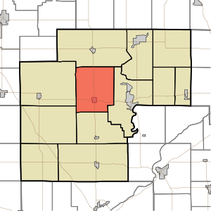
Location in White County
|
|
| Country | United States |
| State | Indiana |
| County | White |
| Government | |
| • Type | Indiana township |
| Area | |
| • Total | 42.36 sq mi (109.7 km2) |
| • Land | 42.35 sq mi (109.7 km2) |
| • Water | 0.01 sq mi (0.03 km2) 0.02% |
| Elevation | 686 ft (209 m) |
| Population
(2020)
|
|
| • Total | 1,188 |
| • Density | 28.045/sq mi (10.828/km2) |
| ZIP codes |
47959, 47960, 47980
|
| GNIS feature ID | 453418 |
Honey Creek Township is one of twelve townships in White County, Indiana, United States. A township is a small local area or district within a county. As of the 2020 census, about 1,188 people lived here. There were also 503 housing units, which are homes or apartments.
Honey Creek Township was officially created in 1855. It got its name from a nearby stream called Honey Creek.
Contents
Population Changes Over Time
The number of people living in Honey Creek Township has changed throughout history. Here is a look at the population from 1890 to 2020:
| Historical population | |||
|---|---|---|---|
| Census | Pop. | %± | |
| 1890 | 893 | — | |
| 1900 | 1,215 | 36.1% | |
| 1910 | 946 | −22.1% | |
| 1920 | 871 | −7.9% | |
| 1930 | 596 | −31.6% | |
| 1940 | 772 | 29.5% | |
| 1950 | 651 | −15.7% | |
| 1960 | 632 | −2.9% | |
| 1970 | 614 | −2.8% | |
| 1980 | 570 | −7.2% | |
| 1990 | 569 | −0.2% | |
| 2000 | 590 | 3.7% | |
| 2010 | 585 | −0.8% | |
| 2020 | 583 | −0.3% | |
| Source: US Decennial Census | |||
Geography of Honey Creek Township
Honey Creek Township covers a total area of about 42.36 square miles. Almost all of this area, about 42.35 square miles, is land. Only a very small part, about 0.01 square miles, is water. This means the township is mostly land.
Towns and Historic Sites
The main town in Honey Creek Township is Reynolds. It is located about five miles west of Monticello. Reynolds is found where Indiana State Road 43 meets U.S. Routes 24 and 421. A short railway line, the Toledo, Peoria and Western Railway, also runs through Reynolds.
There was once an unincorporated area called Guernsey. It was located on the eastern edge of the township, near Union Township. Guernsey had a railroad siding, a post office from 1882 to 1907, and a grain elevator. The grain elevator was removed around 1950.
Neighboring Townships
Honey Creek Township shares its borders with several other townships:
- Monon Township to the north
- Union Township to the east
- Big Creek Township to the south
- West Point Township to the southwest
- Princeton Township to the west
Cemeteries in the Township
The township is home to two cemeteries. These are places where people are buried. The two cemeteries are named Bunnell and Swisher.
Airports and Landing Strips
There is one airport located within Honey Creek Township. It is called Klopfenstein Airport.
School Districts
Children living in Honey Creek Township attend schools managed by the North White School Corporation. This is the main school district serving the area.
See also
 In Spanish: Municipio de Honey Creek (condado de White) para niños

