Guichen Bay facts for kids
Quick facts for kids Guichen Bay |
|
|---|---|

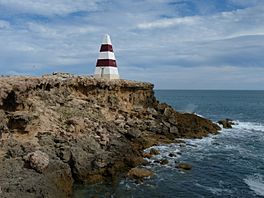
The Robe Obelisk
|
|
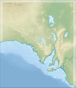
| Location | Limestone Coast, South Australia |
| Coordinates | 37°7′14″S 139°45′58″E / 37.12056°S 139.76611°E |
| Type | Bay |
| Basin countries | Australia |
| Max. length | 6 km (3.7 mi) |
| Max. width | 3.4 km (2.1 mi) |
| Max. depth | 11.3 m (37 ft) |
| Settlements | Robe |
Guichen Bay is a beautiful bay on the south-east coast of South Australia. It's about 115 kilometers northwest of Mount Gambier. The state capital, Adelaide, is about 270 kilometers to the north-northwest.
This bay got its name in 1802 from a French exploration trip called the Baudin expedition. They named it after a French war hero, Luc Urbain de Bouëxic, comte de Guichen. The popular town of Robe is located right at the southern end of the bay.
Contents
Exploring Guichen Bay
Guichen Bay stretches between two points: Cape Thomas in the north and Cape Dombey in the south. The eastern side of the bay has a long, sandy beach known as Long Beach. This beach runs for about 6 kilometers south from Cape Thomas.
The southern shore of the bay has rocky areas and smaller sandy spots. Some rocks stick out from the shore into the water. The water in most of the bay is quite deep, usually between 9.1 and 11 meters. There's also a rocky point called Boatswain Point that extends south from Cape Thomas. At the very south end of the bay, you'll find Robe Point, another rocky area.
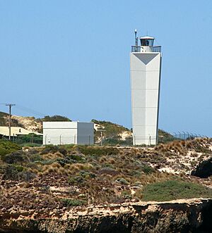
Around Cape Dombey, at the southern end of the bay, you'll find several important lights that help ships. The main one is the lighthouse called the Robe Lighthouse, located on Cape Dombey itself. There's also a flashing light near Commodore Point, just south of Cape Dombey.
Inside the bay, there are two more lights. One marks the end of the breakwater at the entrance to the Lake Butler marina in Robe. The other is a flashing light near Robe Point. Before the Robe Lighthouse was built in 1972, sailors used a tall, striped tower called the Robe Obelisk to guide them. It's painted with red and white bands and is still a famous landmark.
A Look Back in Time
Long before Europeans arrived, the Bungandidj people lived in the area around Robe. They were the original inhabitants of this land.
The bay was first mapped in 1802 by Baudin and Péron during their expedition. Baudin first called it "Ances des Albatross." However, after Baudin passed away, the name was changed to Guichen Bay to honor the French war hero.
In the 1830s, a Bungandidj woman known as "Black Maggie" was likely the first Indigenous person to meet Europeans in this area. These Europeans were probably whalers, sealers, or sailors visiting the coast. This happened even before the South Australian province was officially set up and settled by Europeans.
Robe: The Main Town
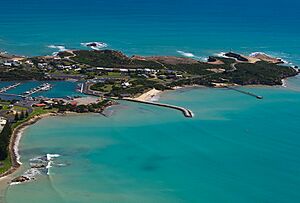
The town of Robe is the only settlement and port located on Guichen Bay. It has a jetty and a marina. The marina is protected by a strong breakwater, which keeps the boats safe from waves.
Protected Natural Areas
Guichen Bay is surrounded by important protected areas. These include the Upper South East Marine Park, which helps protect the marine life in the water. The Guichen Bay Conservation Park also helps look after the land and natural environment around the bay. These parks ensure that the beautiful nature of Guichen Bay is preserved for the future.
 | Calvin Brent |
 | Walter T. Bailey |
 | Martha Cassell Thompson |
 | Alberta Jeannette Cassell |


