Hà Giang province facts for kids
Quick facts for kids
Hà Giang province
Tỉnh Hà Giang
|
|
|---|---|
|
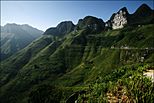
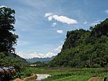
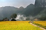
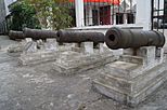
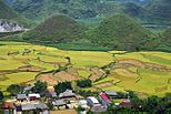
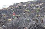
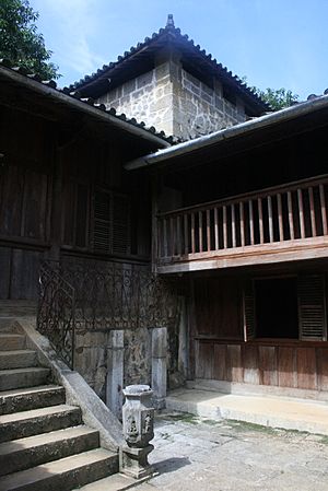
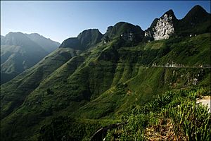
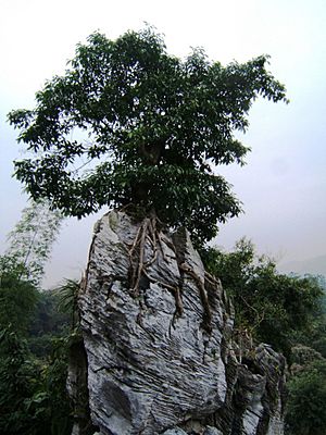
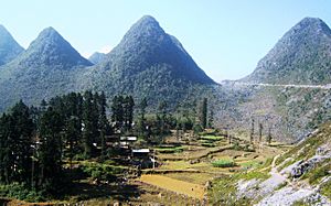
Mã Pí Lèng Pass • Farm Nông - Lâm • Paddy field in Hà Giang • Museum Hà Giang • River Lô • Tam Sơn Mountain • Quản Bạ Mountain • Dong Van Karst Plateau Geopark • Mansion SaPhin • Đồng Văn Temple
|
|
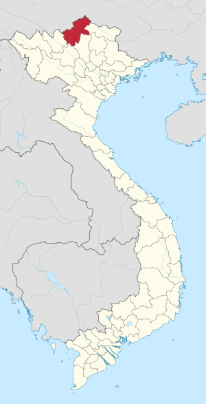
Location of Hà Giang within Vietnam
|
|
| Country | |
| Region | Northeast |
| Capital | Hà Giang |
| Subdivision | 1 city, 10 rural districts |
| Government | |
| • Type | Province |
| • Body | Hà Giang Provincial People's Council |
| Area | |
| • Province | 7,929.5 km2 (3,061.6 sq mi) |
| Population
(2021)
|
|
| • Province | 858,465 |
| • Density | 108.2622/km2 (280.3978/sq mi) |
| • Urban | 138,214 |
| Ethnic groups | |
| • Mông | 34.25% |
| • Tày | 22.55% |
| • Dao | 14.88% |
| • Vietnamese | 12.32% |
| • Nùng | 9.53% |
| • Giáy | 2.03% |
| • La Chí | 1.62% |
| • Others | 2.82% |
| Time zone | UTC+07:00 (ICT) |
| Area codes | 219 |
| ISO 3166 code | VN-03 |
Hà Giang (pronounced "Ha Jang") is a beautiful province in the far north of Vietnam. It's known as Vietnam's "final frontier" because it shares a long border with China. This province is famous for its stunning mountains and unique cultures.
Hà Giang covers about 7,929.48 km2 (3,061.6 sq mi). It has one main city and ten rural districts. In 2019, over 850,000 people lived here. The capital city, also called Hà Giang, is about 320 km from Hanoi. It's connected by Highway 2. The province is one of Vietnam's poorest areas. This is because its mountainous land isn't great for farming.
Contents
Exploring Hà Giang's Geography
Hà Giang is surrounded by other Vietnamese provinces like Cao Bằng, Tuyên Quang, Lào Cai, and Yên Bái. To the north, it shares a border with China. The province is full of tall, rocky mountains, amazing limestone formations, and clear springs. Important mountains include Cam and Mỏ Neo. The main rivers are the Lô River and Miện River. Hà Giang city sits on the left bank of the Lô River.
Hà Giang's Climate and Weather
The weather in Hà Giang is interesting. It has a "temperate" climate, but conditions can change a lot from one area to another. This is due to the high mountains. The province has two main seasons: a dry season and a monsoon (rainy) season. These seasons depend on how high up a place is. The northern parts of the province are affected by two climate zones from nearby Indochina.
Lower areas have small hills and the Lô River Valley. In Cao Bồ district, the dry season is from mid-September to late May. The monsoon season is from early June to mid-September. But in Du Già district, the rainy season starts a month earlier. The average yearly temperature in Hà Giang city is about 22.78 °C (73.00 °F). It's coolest in January (around 15.48 °C (59.86 °F)) and warmest in July (about 27.88 °C (82.18 °F)). The city gets a lot of rain, about 2,430.1 millimetres (95.67 in) per year. July is the wettest month. The air is usually quite humid, around 84%.
Mountains and Natural Resources
Hà Giang has many mountains. The two tallest peaks are Tây Côn Lĩnh (2,419 metres (7,936 ft)) and Kiều Liêu Ti (2,402 metres (7,881 ft)). The province also has large forests that provide wood. These forests are home to about 1,000 types of herbal plants. You might also find animals like tigers, peafowl, pheasants, and pangolins here. Hà Giang city was damaged during a conflict with China in 1979 but has been rebuilt.
Plant Life in Hà Giang
In Hà Giang, you'll find different types of plants depending on the elevation.
- Below 800 metres (2,600 ft), people grow crops and raise animals.
- Between 800 metres (2,600 ft) and 950 metres (3,120 ft), there are grasses and small shrubs, usually less than 3 metres (9.8 ft) tall.
- Above 1,000 metres (3,300 ft), you can see patches of forest with tall trees, up to 30 metres (98 ft) high. These forests have thick plants on the ground, with large vines, tree ferns, and rhododendrons.
- Banana and bamboo also grow along forest paths. The forests have many beautiful streams, waterfalls, and pools.
- Above 1,100 metres (3,600 ft), there are steep limestone cliffs.
- Higher up, above 2,000 metres (6,600 ft), you'll find a special type of forest called a "cloud forest." Here, many tree trunks are covered with bryophyte mosses.
Animal Life in Hà Giang
Hà Giang is home to many different animals. Scientists have found:
- 16 types of reptiles (like snakes and lizards).
- 36 types of amphibians (like frogs and salamanders).
Small mammals found in the Tây Côn Lĩnh II area include different kinds of bats, shrews, rats, and squirrels.
Hà Giang's Rich History
People have lived in the Hà Giang region for a very long time. Digs near Hà Giang city at Đồi Thông (Pine Hill) show that people were here about 30,000 years ago. During the Bronze Age, the Tày Yu tribes lived here. They had rich traditions. Bronze drums from that time, used for ceremonies, are still used today by the Lô Lô and Pu Péo tribes.
The area that became Hà Giang province was once part of a region called Tân Hưng. Later, during the Ming dynasty's time in Vietnam, it was known as Bình Nguyên district. It was then renamed Vị Xuyên.
French Rule and Rebellions
The French took control of this region in 1886. They set up a military base on the Lô River. This base became one of the four main French military posts in North Vietnam by 1905. The Vietnamese Dao tribes fought against French rule.
- In 1901, Triệu Tiến Kiến and Triệu Tài Lộc led a rebellion, but it was stopped.
- In 1913, Triệu Tài Lộc started another revolt with Triệu Tiến Tiến. This lasted until 1915. Their slogan was "No forced labor, no taxes for the French; drive out the French to get our country back; freedom for the Dao."
- This revolt was called the White Hat Revolt because the Vietnamese carried white flags. The rebellion spread to other provinces. In 1915, the French stopped the rebellion harshly, sending many Vietnamese away and hanging many "rebels."
Before 1975, Hà Giang included several districts like Đồng Văn and Vị Xuyên. The name Hà Giang comes from old Sino-Vietnamese words meaning "river" and "poplar."
The H'Mông Lords of Sà Phìn
The history of the H'Mông Lords is important to Hà Giang. These leaders ruled the northern part of the province near China (in Đồng Văn and Mèo Vạc) from the late 1700s. The Vương family of the Huang clan became powerful in Đồng Văn and Mèo Vạc. The Nguyễn Kings supported their rule.
When the French were in charge, they also supported the H'Mông Lord to control the border area. Vương Chính Đức was recognized as the king of the H'Mông people in 1900. A grand palace was built for him between 1902 and 1903 in Sà Phìn. Chinese architects helped design it. The Lord helped the French put down other rebellions. Because of this, he was made a General in the French Army.
Later, as Vietnamese people fought more against French rule, the Lord tried to stay neutral. Vương Chú Sển, who took over after his father died in 1944, decided to support Hồ Chí Minh. The Vương Lord's palace is built in a traditional Northeast Asian royal style. It has four two-story wings and three open courtyards. A moat surrounds the palace. The walls are made of bricks, and other parts are wood. The tombs of the royal family are outside the palace walls and have detailed wood carvings.
How Hà Giang is Divided
Hà Giang province is split into 11 main areas:
- 10 districts:
- Bắc Mê
- Bắc Quang
- Đồng Văn
- Hoàng Su Phì
- Mèo Vạc
- Quản Bạ
- Quang Bình
- Vị Xuyên
- Xín Mần
- Yên Minh
- 1 provincial city:
- Hà Giang (this is the capital city)
These areas are further divided into smaller towns and communes.
People and Cultures of Hà Giang
In 2019, Hà Giang province had about 854,679 people. It's one of the less crowded provinces in northern Vietnam. Most people live in rural areas.
Hà Giang is home to 43 different ethnic groups. Each group has its own language, traditions, and unique culture. The largest groups are:
- Mông (34.25%)
- Tày (22.55%)
- Dao (14.88%)
- Vietnamese (12.32%)
- Nùng (9.53%)
- Giáy (2.03%)
- La Chí (1.62%)
- Other groups make up the rest (2.82%).
Many different languages are spoken in Hà Giang, including various Hmong-Mien, Tai, Kra, and Tibeto-Burman languages.
Hà Giang's Economy
Hà Giang is very mountainous, which can make travel difficult. Much of the land is too steep for farming, so it's covered in forests. However, the central plateau of Hà Giang is good for growing fruits like plums, peaches, and persimmons, which the province sells. Tea is also a big crop here. Farmers are also growing more oranges and mandarins, which helps many families earn a good income. The area for growing soybeans has also increased.
Hà Giang is one of Vietnam's poorer provinces. For a long time, its economy was mostly based on farming and forestry. But recently, there have been efforts to start manufacturing industries. Roads, schools, and health services are getting better, but they are still not as developed as in other parts of Vietnam.
Tea Industry and Minerals
Hà Giang has helped local people grow their tea industry. They offer financial help and advice on how to plant, care for, and process tea. This has greatly increased tea production. Famous quality tea comes from areas like Cao Bồ, Lũng Phìn, and Ngam La. Hà Giang tea is even popular in other countries.
The province is also rich in minerals. There are 149 mines with 28 different types of minerals, including antimony, iron, manganese, zinc, tin, copper, gold, and gemstones. These minerals help the province's industrial growth. Hà Giang is working to attract foreign investments, with companies from China, South Korea, and Thailand already investing in mining and processing.
Amazing Places to Visit in Hà Giang
Hà Giang has many beautiful and interesting places to explore.
Quản Bạ Valley: Heaven's Gate
Quản Bạ Valley is about 45 kilometres (28 mi) from Hà Giang city. It's known as "Heaven's Gate" and offers amazing views from its high peaks. You can see the unique, uniformly shaped hills of the valley, sometimes called "double stalagmite" hills. The valley has forests and meadows. Temperatures are mild, from 10 °C (50 °F) in winter to 24 °C (75 °F) in summer. It's famous for hidden caves, colorful orchids, and fruit trees like plum, peach, and persimmon. The town of Đồng Văn is known for Phó Bảng Street, with its old buildings made of clay bricks and tiled roofs. The weekly market is a lively place where Tày and H'Mông people trade goods and beautiful handmade fabrics.
Phương Thiện Cave and Other Caves
Phương Thiện Cave is about 7 kilometres (4.3 mi) south of Hà Giang city. This area has many natural caves and grottoes, including Doi, Lang Lô, and Phương Thiện. The surrounding land is also known for its delicious fruits like plums, pears, oranges, and apples. High up, above 900 metres (3,000 ft), you'll find Tuyết Sơn tea.
- Chui Cave is also 7 kilometres (4.3 mi) south of Hà Giang. It's set about 100 metres (330 ft) into the side of a hill.
- Tiên Cave is only 2 kilometres (1.2 mi) from Hà Giang city. Local stories say that heavenly female beings used to bathe here during the Lunar New Year, which is how it got its name ("Fairy Cave"). People still use it as a water source and pray for good luck there.
Đồng Văn: A Highland Town
Đồng Văn is a market town about 16 kilometres (9.9 mi) from Sà Phìn and 3 kilometres (1.9 mi) from the Chinese border. It's home to the Tày and H'Mông people. Located at an altitude of 1,025 metres (3,363 ft), it can get cold in winter (around 0 °C (32 °F)) and warm in summer (around 24 °C (75 °F)). This highland region is famous for fruits like Hau plums, peaches, and seedless persimmons. You can also find special plants like ginseng, cinnamon, and anise here.
Mã Pí Lèng Pass: A Scenic Drive
Mã Pí Lèng is a mountain pass about 1,500 metres (4,900 ft) high. It's a restricted zone near the Nho Quế River on the border with China. The views from here are breathtaking.
Khâu Vai Love Market
The famous Khâu Vai "Love Market" happens only once a year, on the 27th day of the third lunar month, in Khâu Vai commune. It's based on an old folk tale. Long ago, a young couple from different villages fell in love. Their villages fought over them. To stop the fighting, the couple decided to break up but promised to meet secretly once a year at Khâu Vai. Since then, it became a special meeting place for couples. Today, it's also a market where different ethnic groups, like the White H'Mông, Tày, and Lô Lô, gather, especially young people looking for partners. The Lô Lô people, in particular, come in their colorful traditional clothes.
Đồi Thông: Ancient Settlement
Đồi Thông (Pine Hill) is an ancient settlement that dates back 30,000 years. This was discovered through archaeological digs. They found old axe heads and tools, which you can see in the Hà Giang museum and the History Museum in Hanoi.
Hà Giang Museum
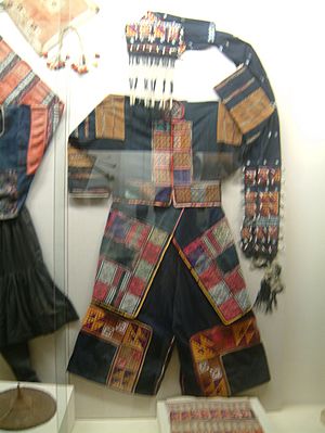
The Hà Giang museum is in the center of Hà Giang city. It displays items found from ancient digs, historical artifacts, and a collection of bronze drums. You can also see traditional costumes of the local ethnic groups. The museum building itself is designed to look like a large lotus flower opening its petals, in red and white colors.
Hà Giang Market
Hà Giang market is an important trading spot in Hà Giang city, located on the east bank of the Lô River. Every Sunday, people from the Tày, Nùng, Red Dao, and White H'Mông ethnic groups gather here to trade goods.
Lang Si Village
Lang Si is a village at the Lang Si pass. The White H'Mông tribes have a market here every six days. The village is 116 kilometres (72 mi) from Hà Giang. You can still see parts of the border wall built by the French army here. Lang Si is also known for producing honey and has many bee farms.
Sà Phìn: Home of the H'Mông Lords
Sà Phìn is a small town in a remote valley, about 2 kilometres (1.2 mi) from the Chinese border. This is where the H'Mông Lords once ruled. A unique feature here is the large, two-story houses built in a Chinese style, with yellow bricks and Chinese-style roofs. The twin white-towered palace building stands out among the other buildings.
Vương Family Mansion
The Vương family mansion is a special architectural site in Sà Phìn commune, Đồng Văn district. The government recognized it as an important heritage site in 1993. In the early 1900s, Vương Chính Đức, a H'Mông leader, expanded his family home into this grand mansion. He worked from here. Its style is rare for this mountainous part of northern Vietnam. The building was designed in the style of China's later Qing dynasty. It has three sections: front, middle, and rear. It includes 64 rooms and covers about 1,120 metres (3,670 ft) of land. A stone wall, about 0.6–0.9 metres (2.0–3.0 ft) wide and 2.5–3 metres (8.2–9.8 ft) high, surrounds the mansion. It's located about 145 kilometres (90 mi) northwest of Hà Giang city.
Festivals and Celebrations
Hà Giang has many lively cultural festivals. This is because over 20 different ethnic minority groups live here. Many of these groups are known for their artistic skills, especially their weaving and handmade textiles. The Spring Festival is celebrated by the H'Mông and Dao people. It usually happens shortly after the Lunar New Year and lasts for three to seven days. People celebrate with singing, dancing, and big feasts.
See also
 In Spanish: Provincia de Hà Giang para niños
 | Janet Taylor Pickett |
 | Synthia Saint James |
 | Howardena Pindell |
 | Faith Ringgold |


