Half Acre, Alabama facts for kids
Quick facts for kids
Half Acre, Alabama
|
|
|---|---|
| Nickname(s):
Hell's Half Acre
|
|
| Country | United States |
| State | Alabama |
| County | Marengo |
| Elevation | 115 ft (35 m) |
| Time zone | UTC-6 (Central (CST)) |
| • Summer (DST) | UTC-5 (CDT) |
| Area code(s) | 334 |
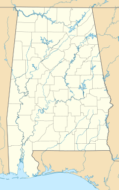
Half Acre is a small, quiet place in Marengo County, Alabama, in the United States. It's called an "unincorporated community," which means it doesn't have its own local government like a city or town. Over the years, Half Acre has had a few different names. It used to be a busy place with its own post office, but now it's much smaller.
History of Half Acre
Half Acre was first settled in the 1830s. Back then, it was known as Beaver Creek. By 1870, it had grown into a busy community. There was a post office, several general stores, and places to process cotton. It also had a hotel and stables for horses.
How Half Acre Got Its Name
The story of how Half Acre got its name is quite interesting! There was a small piece of land, about half an acre, at a crossroads next to the hotel. When the area was first measured, this tiny piece of land was missed.
County records show that when this overlooked land was found, it was officially given to "The Devil"! Because of this, the community started calling itself Hell's Half Acre. A saloon was built on this spot, but it later burned down.
Years later, the community wanted to build a church on the same land where the saloon had been. To do this, they needed to change who owned the land. A special court officially transferred the ownership from "The Devil" to the Half Acre Community Church. After this, the "Hell's" part was dropped, and the whole community became known simply as Half Acre.
Half Acre Today
After World War II, many people started moving away from Half Acre. Today, it's a much smaller place. It is mainly home to the church and a few houses.
Geography of Half Acre
Half Acre is located above Beaver Creek. It is about 4 miles (6.4 km) east of the Tombigbee River. The community is found at coordinates 32°11′42″N 87°54′43″W / 32.195°N 87.912°W. It sits at an elevation of about 115 feet (35 meters) above sea level.
 | Mary Eliza Mahoney |
 | Susie King Taylor |
 | Ida Gray |
 | Eliza Ann Grier |


