Hallowing Run facts for kids
Quick facts for kids Hallowing Run |
|
|---|---|

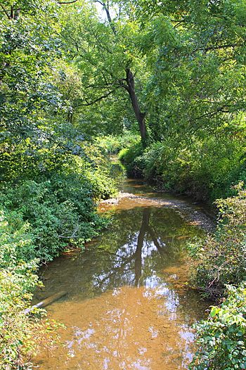
Hallowing Run looking downstream in its lower reaches
|
|
| Physical characteristics | |
| Main source | small valley in Lower Augusta Township, Northumberland County, Pennsylvania between 760 and 780 feet (232 and 238 m) |
| River mouth | Susquehanna River in Lower Augusta Township, Northumberland County, Pennsylvania 413 ft (126 m) 40°46′19″N 76°50′46″W / 40.7719°N 76.8460°W |
| Length | 6.1 mi (9.8 km) |
| Basin features | |
| Progression | Susquehanna River → Chesapeake Bay |
| Basin size | 7.71 sq mi (20.0 km2) |
| Tributaries |
|
Hallowing Run (also known as Hollowing Run) is a stream in Northumberland County, Pennsylvania. It flows into the Susquehanna River. This stream is about 6.1 miles (9.8 kilometers) long.
Hallowing Run flows through Lower Augusta Township. The land area that drains water into the stream, called its watershed, covers 7.71 square miles (19.97 square kilometers). It is considered a stream of "local importance" and is located between Little Mountain and the Shamokin Hills.
People settled near Hallowing Run in the early 1800s. Several bridges have been built over the stream since then. The stream's watershed is a good place for fish, especially warmwater fish and fish that travel to different waters.
Contents
The Stream's Journey
Hallowing Run starts in a small valley in Lower Augusta Township. It flows north for a short distance. Then, it enters a much larger and deeper valley.
In this bigger valley, the stream flows north-northwest. After a short while, it turns to flow west-southwest for a few miles. Along this path, it runs next to Hallowing Run Road.
The stream receives water from many smaller streams, called tributaries. Seven of these join from the left side, and three join from the right side.
Later, Hallowing Run turns south-southwest, and its valley becomes narrower. It starts flowing alongside Pennsylvania Route 147. A little further downstream, it leaves its valley and turns west.
Finally, the stream crosses Pennsylvania Route 147 and a railroad track. It then reaches its meeting point with the Susquehanna River. Hallowing Run joins the Susquehanna River about 117.22 miles (188.64 kilometers) upstream from the Susquehanna's mouth.
Stream Health
Hallowing Run is a healthy stream. It is not listed as a polluted or "impaired" waterbody. This means the water quality is good.
Land and Rocks Around the Stream
The land around the mouth of Hallowing Run is 413 feet (126 meters) above sea level. The stream's starting point, its source, is higher up. It is between 760 and 780 feet (232 and 238 meters) above sea level.
Sometimes, large rocks called riprap are placed along the stream banks. These rocks help prevent the soil from washing away. Dark olive-colored rocks from the Chemung Formation can be found near the stream's mouth.
In an 1891 book, Hallowing Run was described as a stream of "local importance." It flows between two notable land features: the Shamokin Hills and Little Mountain.
The Hallowing Run Watershed
The watershed of Hallowing Run covers an area of 7.71 square miles (19.97 square kilometers). A watershed is all the land where water drains into a particular stream or river. This stream is entirely within the Sunbury area on maps made by the United States Geological Survey.
Hallowing Run is important for aquatic life. This means it provides a good home for fish and other water creatures.
Sometimes, heavy rains can cause flash flooding along parts of Hallowing Run. These floods can damage farms and cause the soil to wash away from the streambanks. However, normal rainfall and moderate flooding usually do not cause problems for the stream.
In January 1996, Hallowing Run and other nearby streams experienced bank flooding. But recovery and repairs were underway later that same year. In 2013, the Northumberland County Conservation District received a grant of $356,000. This money was for projects to help Hallowing Run and Schwaben Creek.
History of the Area
Hallowing Run was officially added to the Geographic Names Information System on August 2, 1979. Its special identification number is 1176401. The stream is also known by the name Hollowing Run. This other name appeared in a book from 1883 about the geology of the Susquehanna River region.
By the early to mid-1800s, people had started to settle in the area around Hallowing Run. There were farms, mills, and a few schoolhouses. A road called Hallowing Run Road also passed through the area. It connected to other important roads like the Harrisburg Road. Many of the first settlers in this area were of Scotch-Irish descent.
In 1840, a man named Mr. DeWitt built a mill about 6 miles (9.7 kilometers) from Sunbury. He used the water power from Hallowing Run to run his mill.
Over the years, several bridges have been built over Hallowing Run:
- A steel bridge was built in 1904. It carries Township Road T-394 and is 26.9 feet (8.2 meters) long.
- A concrete bridge was built in 1921 in the village of Asherton. It carries State Route 4020 and is 30.8 feet (9.4 meters) long.
- Another steel bridge carrying the same road was built in 1973. It is 24.9 feet (7.6 meters) long and is located west of Augustaville.
- In the past, at least one wooden covered bridge also crossed Hallowing Run.
Aquatic Life and Fishing
The watershed of Hallowing Run is a special area for fish. It is designated as a Warmwater Fishery and a Migratory Fishery. This means it supports fish that prefer warmer water and fish that travel between different bodies of water.
The lower 0.5 miles (0.8 kilometers) of Hallowing Run have special fishing rules. The Pennsylvania Fish and Boat Commission has "catch and release" rules for bass in this section. This means anglers must release any bass they catch back into the stream.
 | Delilah Pierce |
 | Gordon Parks |
 | Augusta Savage |
 | Charles Ethan Porter |


