Hanapepe, Hawaii facts for kids
Quick facts for kids
Hanapepe, Hawaii
|
|
|---|---|
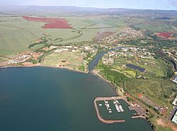
Aerial view of Hanapepe
|
|
| Nickname(s):
Kauai's Biggest Little Town
|
|
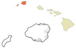
Location in Kauai County and the state of Hawaii
|
|
| Country | United States |
| State | Hawaii |
| County | Kauai |
| Area | |
| • Total | 1.03 sq mi (2.67 km2) |
| • Land | 0.93 sq mi (2.42 km2) |
| • Water | 0.10 sq mi (0.25 km2) |
| Elevation | 92 ft (28 m) |
| Population
(2020)
|
|
| • Total | 2,678 |
| • Density | 2,867.24/sq mi (1,106.84/km2) |
| Time zone | UTC−10:00 (Hawaii-Aleutian) |
| ZIP Code |
96716
|
| Area code(s) | 808 |
| FIPS code | 15-11800 |
| GNIS feature ID | 0359058 |
Hanapepe (or Hanapēpē) is a historic town located in Kauai County, Hawaii, United States. The name means "crushed bay" in the Hawaiian language. This might refer to landslides that happened in the area a long time ago.
Hanapepe is known as "Kauai's Biggest Little Town." It is a census-designated place (CDP), which means it's an area defined by the government for counting people. In 2020, about 2,678 people lived there.
Contents
Discovering Hanapepe's Past
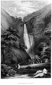
Hanapepe has a rich history. It was one of the places visited by the United States Exploring Expedition. This group, led by Charles Wilkes, explored Hawaii in late 1840.
Unlike many towns on the island, Hanapepe was not started by sugarcane plantations. In 1924, a disagreement happened between sugar workers and their employers. This event is known as the Hanapepe massacre.
Exploring Hanapepe's Location
Hanapepe is found on the southern side of the island of Kauai. To its east, across the Hanapēpē River and Hanapepe Bay, is the community of Eleele.
Hawaii Route 50 goes through the southern part of Hanapepe. This road leads east about 17 miles (27 km) to Lihue. It also goes northwest about 6 miles (10 km) to Waimea.
The area defined as the Hanapepe CDP covers about 1.0 square mile (2.6 km²). Most of this area is land, about 0.9 square miles (2.4 km²). The rest, about 0.1 square miles (0.2 km²), is water.
Who Lives in Hanapepe?
| Historical population | |||
|---|---|---|---|
| Census | Pop. | %± | |
| 2020 | 2,678 | — | |
| U.S. Decennial Census | |||
In 2000, there were 2,153 people living in Hanapepe. These people lived in 706 households, with 533 of them being families.
The people living in Hanapepe come from many different backgrounds. About 16% were White, and nearly half (48.6%) were Asian. About 8.5% were Pacific Islander. Many people (26.3%) were from two or more races. About 8.6% of the population was Hispanic or Latino.
Many households had children under 18 (41.8%). Most families (57.2%) were married couples living together. About 12.3% of households had a female head without a husband present.
The population has a good mix of ages. About 32% were under 18 years old. About 12.1% were 65 years or older. The average age in Hanapepe was 35 years old.
Hanapepe's Local Economy
Hanapepe's main street is quite special. It has buildings built in the 1930s and 1940s. These buildings are in a plantation style.
Today, these buildings are home to many interesting places. You can find art galleries, places to eat, and small shops. Hanapepe is also where the ice cream company Lappert's Hawaii started. It is also home to The Bookstore - Talk Story, which is the westernmost bookstore in the United States!
See also
 In Spanish: Hanapepe para niños
 | Roy Wilkins |
 | John Lewis |
 | Linda Carol Brown |


