Hanover, Illinois facts for kids
Quick facts for kids
Hanover
|
|
|---|---|
 |
|
| Nicknames:
Mallard Capital of the World
Gateway to Jo Daviess County Hills |
|

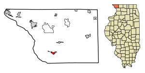
Location of Hanover in Jo Daviess County, Illinois
|
|

Location of Illinois in the United States
|
|
| Country | United States |
| State | Illinois |
| County | Jo Daviess |
| Township | Hanover |
| Area | |
| • Total | 1.12 sq mi (2.91 km2) |
| • Land | 1.12 sq mi (2.91 km2) |
| • Water | 0 sq mi (0 km2) |
| Elevation | 627 ft (191 m) |
| Population
(2020)
|
|
| • Total | 863 |
| • Density | 769.16/sq mi (296.91/km2) |
| Time zone | UTC-6 (CST) |
| • Summer (DST) | UTC-5 (CDT) |
| ZIP Code(s) |
61041
|
| Area code(s) | 815 |
| FIPS code | 17-32707 |
| Wikimedia Commons | Hanover, Illinois |
| Website | http://www.hanover-il.com/ |
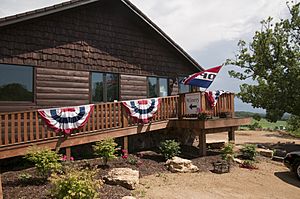
Hanover is a small village in Jo Daviess County, Illinois, United States. It sits right next to the Apple River. A long time ago, the town was called Wapello. It was named after Chief Wapello of the Meskwaki people. In 2020, about 863 people lived in Hanover.
Contents
Where is Hanover Located?
Hanover is found at 42°15′22″N 90°16′50″W / 42.25611°N 90.28056°W. It covers about 1.12 square miles of land. This village is in the very northwest part of Illinois. It is only about five miles from the big Mississippi River.
Illinois Route 84 goes through the center of Hanover. This road is part of the beautiful Great River Road. The Apple River, which flows into the Mississippi, also winds its way through and around Hanover.
How Many People Live in Hanover?
| Historical population | |||
|---|---|---|---|
| Census | Pop. | %± | |
| 1880 | 459 | — | |
| 1890 | 743 | 61.9% | |
| 1900 | 785 | 5.7% | |
| 1910 | 650 | −17.2% | |
| 1920 | 737 | 13.4% | |
| 1930 | 806 | 9.4% | |
| 1940 | 899 | 11.5% | |
| 1950 | 1,643 | 82.8% | |
| 1960 | 1,396 | −15.0% | |
| 1970 | 1,243 | −11.0% | |
| 1980 | 1,069 | −14.0% | |
| 1990 | 908 | −15.1% | |
| 2000 | 836 | −7.9% | |
| 2010 | 844 | 1.0% | |
| 2020 | 863 | 2.3% | |
| U.S. Decennial Census | |||
As of the census in 2000, there were 836 people living in Hanover. These people lived in 394 households. About 230 of these households were families.
The population was spread out by age. About 20.8% of the people were under 18 years old. About 19.7% were 65 years old or older. The average age in the village was 42 years.
Education in Hanover
The public schools in the Hanover area are run by the River Ridge Community Unit School District 210. This includes River Ridge High School.
Famous People from Hanover
Some well-known people have lived in or had ties to Hanover:
- Carol C. Cleven was a state representative in Massachusetts.
- Adlai Stevenson III was a U.S. Senator. He also served as the Illinois Treasurer. He was a member of the Illinois House of Representatives. He used to be a farmer in rural Hanover.
- Charles W. Woodford was also an Illinois Treasurer. He lived in Hanover.
Images for kids
See also
 In Spanish: Hanover (Illinois) para niños
 | Sharif Bey |
 | Hale Woodruff |
 | Richmond Barthé |
 | Purvis Young |


