Harrisville, Rhode Island facts for kids
Quick facts for kids
Harrisville, Rhode Island
|
|
|---|---|

RI Route 98
|
|

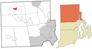
Location in Providence County and the state of Rhode Island.
|
|
| Country | |
| State | |
| County | Providence |
| Area | |
| • Total | 0.86 sq mi (2.22 km2) |
| • Land | 0.81 sq mi (2.10 km2) |
| • Water | 0.04 sq mi (0.11 km2) |
| Elevation | 325 ft (99 m) |
| Population
(2020)
|
|
| • Total | 1,745 |
| • Density | 2,149.01/sq mi (829.57/km2) |
| Time zone | UTC-5 (Eastern (EST)) |
| • Summer (DST) | UTC-4 (EDT) |
| ZIP code |
02830
|
| Area code(s) | 401 |
| FIPS code | 44-33400 |
| GNIS feature ID | 1218783 |
|
Harrisville Historic District
|
|
| Location | Burrillville, Rhode Island |
|---|---|
| Architectural style | American Colonial, Federal, Victorian |
| NRHP reference No. | 84002010 |
| Added to NRHP | March 21, 1984 |
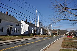
Harrisville is a small village in the town of Burrillville, located in Providence County, Rhode Island. It is also known as a "census-designated place" (CDP). This means it's an area defined by the government for counting people.
In 2020, about 1,745 people lived in Harrisville. A large part of the village is a historic district. This means it has many old buildings and places that are important to history.
History of Harrisville
The village of Harrisville was named after a man named Andrew Harris. He was a manufacturer who lived in the 1800s. Before it was called Harrisville, the village had a different name: Rhodesville.
Rhodesville was named after Captain William Rhodes. He was a privateer in the 1700s. Privateers were like legal pirates who were allowed by their government to attack enemy ships.
Where is Harrisville?
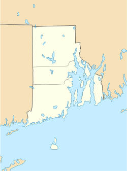
Harrisville is located in Rhode Island. You can find it at these coordinates: 41°58′7″N 71°40′48″W / 41.96861°N 71.68000°W.
The United States Census Bureau says that Harrisville covers a total area of about 2.2 square kilometers (0.9 square miles). Most of this area is land, about 2.1 square kilometers (0.8 square miles). A small part, about 0.1 square kilometers (0.04 square miles), is water.
People in Harrisville
| Historical population | |||
|---|---|---|---|
| Census | Pop. | %± | |
| 2020 | 1,745 | — | |
| U.S. Decennial Census | |||
According to the 2020 United States census, 1,745 people lived in Harrisville. There were 799 households, which are groups of people living together.
About 19.4% of the people were under 18 years old. About 20.5% of the people were 65 years old or older. The average age of people in Harrisville was 44.6 years.
See also
 In Spanish: Harrisville (Rhode Island) para niños
 | Jessica Watkins |
 | Robert Henry Lawrence Jr. |
 | Mae Jemison |
 | Sian Proctor |
 | Guion Bluford |


