
Burrillville, Rhode Island facts for kids
Quick facts for kids
Burrillville, Rhode Island
|
||
|---|---|---|

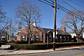
Town office building (2013)
|
||
|
||
| Motto(s):
"Embracing Our Past...Envisioning Our Future"
|
||

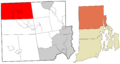
Location within Providence County and Rhode Island.
|
||
| Country | United States | |
| State | Rhode Island | |
| County | Providence | |
| Incorporated | 1806 | |
| Named for | James Burrill Jr. | |
| Government | ||
| • Type | Council–Manager | |
| Area | ||
| • Total | 57.1 sq mi (148.0 km2) | |
| • Land | 55.6 sq mi (143.9 km2) | |
| • Water | 1.6 sq mi (4.1 km2) | |
| Elevation | 371 ft (113 m) | |
| Population
(2020)
|
||
| • Total | 16,158 | |
| • Density | 282.98/sq mi (109.18/km2) | |
| Time zone | UTC−5 (EST) | |
| • Summer (DST) | UTC−4 (EDT) | |
| ZIP Codes | ||
| Area code | 401 | |
| FIPS code | 44-11800 | |
| GNIS ID | 1220081 | |

Burrillville (pronounced BUH-reh-vil) is a town in Providence County, Rhode Island. In 2020, about 16,158 people lived there. It's a great place to learn about New England history and nature.
Contents
Discovering Burrillville's Past
Burrillville was likely first settled around 1662. This was when Europeans began moving into lands belonging to the Nipmuc people. The town was originally part of Glocester, Rhode Island. Early settlers included John Smith and members of the Saulsbury family.
How Burrillville Became a Town
In 1806, Burrillville officially became its own town. It was separated from Glocester. The town was named after James Burrill, Jr., who was a U.S. Senator and Rhode Island's Attorney General. At first, Burrillville covered about 60 square miles (155 square kilometers). It was located in the northwestern corner of Rhode Island, next to Connecticut and Massachusetts. Over time, its borders changed a bit.
Early Life and Villages
The Nipmuc word for snake was "askug" or "askoog." This word likely inspired the name of Burrillville's main village, Pascoag. Pascoag is located on a stream, which was important for early settlements.
During the 1800s, many mills and villages grew in Burrillville. These included Harrisville, Mapleville, and Oakland. These mills were important for making textiles and other goods. The town is now part of the Blackstone River Valley National Heritage Corridor. This area is a historic national park that tells the story of New England's industrial past. Many old mills in Burrillville have been changed, but some have been renovated. For example, the Stillwater Mill Complex in Harrisville now has apartments and the Jesse Smith Library.
The Sherman Farm Story
Until 1846, the Sherman Farm was a very large farm in Burrillville. It covered over 1,100 acres (4.5 square kilometers). It was once the biggest fruit and dairy farm in Rhode Island. The farmhouse itself had 32 rooms!
Exploring Burrillville's Geography
Burrillville covers about 57.2 square miles (148.0 square kilometers). Most of this area is land, with about 1.6 square miles (4.1 square kilometers) being water.
Burrillville's Villages
Burrillville is made up of several smaller communities, called villages. These include:
Burrillville's Weather
Burrillville has a climate with warm summers and cold, snowy winters.
| Climate data for Burrillville, Rhode Island | |||||||||||||
|---|---|---|---|---|---|---|---|---|---|---|---|---|---|
| Month | Jan | Feb | Mar | Apr | May | Jun | Jul | Aug | Sep | Oct | Nov | Dec | Year |
| Record high °F (°C) | 67 (19) |
68 (20) |
88 (31) |
94 (34) |
93 (34) |
94 (34) |
97 (36) |
97 (36) |
94 (34) |
84 (29) |
78 (26) |
75 (24) |
97 (36) |
| Mean daily maximum °F (°C) | 35 (2) |
38 (3) |
47 (8) |
58 (14) |
69 (21) |
76 (24) |
81 (27) |
79 (26) |
72 (22) |
61 (16) |
50 (10) |
39 (4) |
59 (15) |
| Mean daily minimum °F (°C) | 16 (−9) |
19 (−7) |
27 (−3) |
36 (2) |
46 (8) |
55 (13) |
60 (16) |
59 (15) |
51 (11) |
39 (4) |
32 (0) |
22 (−6) |
39 (4) |
| Record low °F (°C) | −13 (−25) |
−11 (−24) |
−1 (−18) |
14 (−10) |
27 (−3) |
38 (3) |
42 (6) |
39 (4) |
31 (−1) |
21 (−6) |
4 (−16) |
−15 (−26) |
−15 (−26) |
| Average precipitation inches (mm) | 4.97 (126) |
4.00 (102) |
5.09 (129) |
4.49 (114) |
4.00 (102) |
4.04 (103) |
3.84 (98) |
4.51 (115) |
3.99 (101) |
4.61 (117) |
4.97 (126) |
4.66 (118) |
53.17 (1,351) |
| Average snowfall inches (cm) | 11.5 (29) |
10 (25) |
2.1 (5.3) |
0.9 (2.3) |
0 (0) |
0 (0) |
0 (0) |
0 (0) |
0 (0) |
0.2 (0.51) |
2 (5.1) |
10.7 (27) |
37.4 (94.21) |
People of Burrillville
| Historical population | |||
|---|---|---|---|
| Census | Pop. | %± | |
| 1810 | 1,834 | — | |
| 1820 | 2,164 | 18.0% | |
| 1830 | 2,196 | 1.5% | |
| 1840 | 1,982 | −9.7% | |
| 1850 | 3,538 | 78.5% | |
| 1860 | 4,140 | 17.0% | |
| 1870 | 4,674 | 12.9% | |
| 1880 | 5,714 | 22.3% | |
| 1890 | 5,492 | −3.9% | |
| 1900 | 6,317 | 15.0% | |
| 1910 | 7,878 | 24.7% | |
| 1920 | 8,696 | 10.4% | |
| 1930 | 7,677 | −11.7% | |
| 1940 | 8,185 | 6.6% | |
| 1950 | 8,774 | 7.2% | |
| 1960 | 9,119 | 3.9% | |
| 1970 | 10,087 | 10.6% | |
| 1980 | 13,164 | 30.5% | |
| 1990 | 16,230 | 23.3% | |
| 2000 | 15,796 | −2.7% | |
| 2010 | 15,955 | 1.0% | |
| 2020 | 16,158 | 1.3% | |
| U.S. Decennial Census | |||
In 2000, there were about 15,796 people living in Burrillville. Most residents were White (98.56%). A small percentage were African American, Native American, or Asian. About 0.84% of the population identified as Hispanic or Latino.
The average family size was about 3 people. Many households (36.6%) had children under 18 living there. The median age in town was 38 years old. This means half the people were younger than 38, and half were older.
Famous People from Burrillville
- Vice Admiral Walter E. Carter Jr. - A high-ranking naval officer and president of the U.S. Naval War College.
- Oscar Lapham - A U.S. Congressman who represented Rhode Island.
- Henry Francis Walling - A skilled mapmaker.
Historic Places in Burrillville
Burrillville has several places listed on the National Historic Register. These sites are important because they help us understand the town's history.
- Bridgeton School (built in 1897)
- Harrisville Historic District
- Moses Taft House (Burrillville, Rhode Island) (built in 1786)
- Oakland Historic District
- Pascoag Grammar School (built in 1917)
Images for kids
-
Town office building (2013)
-
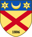
Coat of arms of Burrillville
-
Location within Providence County and Rhode Island.
See also
 In Spanish: Burrillville para niños
