Glocester, Rhode Island facts for kids
Quick facts for kids
Glocester, Rhode Island
|
|
|---|---|

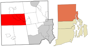
Location in Providence County and the state of Rhode Island.
|
|
| Country | United States |
| State | Rhode Island |
| County | Providence |
| Incorporated | February 20, 1731 |
| Government | |
| • Type | Town meeting |
| Area | |
| • Total | 56.8 sq mi (147.2 km2) |
| • Land | 54.8 sq mi (142.0 km2) |
| • Water | 2.0 sq mi (5.2 km2) |
| Elevation | 597 ft (182 m) |
| Population
(2020)
|
|
| • Total | 9,974 |
| • Density | 182/sq mi (70.2/km2) |
| Time zone | UTC−5 (Eastern (EST)) |
| • Summer (DST) | UTC−4 (EDT) |
| ZIP Codes | |
| Area code(s) | 401 |
| FIPS code | 44-30340 |
| GNIS feature ID | 1220070 |
| Website | Town of Glocester |
Glocester is a town located in Providence County, Rhode Island, United States. It is a special type of town found in New England. In 2020, about 9,974 people lived there.
Glocester is home to the villages of Chepachet and Harmony. A main road called Putnam Pike (U.S. Route 44) goes through the town center. It then continues west into Putnam, Connecticut.
Contents
History of Glocester
Early Beginnings and Name Change
Glocester was first called Gloucester. It was named after Henry Stuart, Duke of Gloucester. The town was part of Providence until 1731. That year, it became its own independent town.
In 1806, the northern part of Glocester became a separate town called Burrillville. At the same time, people in Glocester voted to change the spelling of their town's name. They changed it to Glocester to make it different from Gloucester, Massachusetts. The spelling "Glocester" is an old way of writing Gloucester.
Glocester During the American Revolution
During the American Revolution, some people who supported the British were sent to Glocester. They were called Loyalists. One Loyalist, Thomas Vernon, lived on a farm in Glocester in 1776. He wrote that the people in Glocester talked a lot about "liberty." He also noted that many people in the town were New Light Baptists. They often practiced baptism by dipping in water.
Around the late 1700s, a doctor named Samuel Willard (physician) helped people in North Glocester. He treated those who had smallpox.
Important Events and Traditions
The Dorr Rebellion started in Glocester in 1841. This was a time when people in Rhode Island wanted to change the state's voting laws.
Since 1927, Chepachet has hosted a fun event every Fourth of July. It's called the Ancient and Horribles Parade. During this parade, people create floats that are both traditional and funny. Many floats make fun of politics.
Geography of Glocester
Glocester covers a total area of about 56.8 square miles (147.2 square kilometers). Most of this area, about 54.8 square miles (142.0 square kilometers), is land. The rest, about 2.0 square miles (5.2 square kilometers), is water.
One of the important bodies of water in Glocester is the Waterman Reservoir.
Population and People
| Historical population | |||
|---|---|---|---|
| Census | Pop. | %± | |
| 1790 | 4,025 | — | |
| 1800 | 4,009 | −0.4% | |
| 1810 | 2,310 | −42.4% | |
| 1820 | 2,504 | 8.4% | |
| 1830 | 2,521 | 0.7% | |
| 1840 | 2,304 | −8.6% | |
| 1850 | 2,872 | 24.7% | |
| 1860 | 2,427 | −15.5% | |
| 1870 | 2,385 | −1.7% | |
| 1880 | 2,250 | −5.7% | |
| 1890 | 2,095 | −6.9% | |
| 1900 | 1,402 | −33.1% | |
| 1910 | 1,404 | 0.1% | |
| 1920 | 1,389 | −1.1% | |
| 1930 | 1,693 | 21.9% | |
| 1940 | 2,099 | 24.0% | |
| 1950 | 2,682 | 27.8% | |
| 1960 | 3,397 | 26.7% | |
| 1970 | 5,160 | 51.9% | |
| 1980 | 7,550 | 46.3% | |
| 1990 | 9,227 | 22.2% | |
| 2000 | 9,948 | 7.8% | |
| 2010 | 9,746 | −2.0% | |
| 2020 | 9,974 | 2.3% | |
| U.S. Decennial Census | |||
In 2000, there were 9,948 people living in Glocester. The town had 3,559 households and 2,818 families. The population density was about 181.5 people per square mile.
About 38% of households had children under 18 living with them. The average household had 2.80 people. The average family had 3.14 people.
The population was spread out by age. About 26.8% of the people were under 18 years old. About 9.2% were 65 years or older. The average age in Glocester was 38 years.
Education in Glocester
Glocester has several schools for its students.
- West Glocester Elementary School is located in West Glocester.
- Fogarty Memorial School is in Harmony.
After elementary school, students from both schools go to Ponaganset Middle School. They then attend Ponaganset High School for their high school education.
Notable People from Glocester
Many interesting people have connections to Glocester:
- Charles J. Fogarty was a state senator and the 67th Lieutenant Governor of Rhode Island. He lived in Glocester.
- Ray Fogarty was a state representative in Rhode Island. He also lived in Glocester.
- Paul Fogarty was a Rhode Island politician who was born in Glocester.
- Charles H. Page was a Rhode Island politician, born in Glocester.
- Arthur Steere was a businessman and a Rhode Island state senator. He was born in Glocester.
National Historic Sites in Glocester
Glocester is home to several places that are important to history. These are recognized as National Historic Sites:
- Chepachet Village Historic District
- Cherry Valley Archeological Site, RI-279
- Glocester Town Pound (built in 1748)
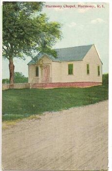
- Harmony Chapel and Cemetery (built in 1816)
- Manton-Hunt-Farnum Farm (built in 1793)
See also
 In Spanish: Glocester para niños
 | Tommie Smith |
 | Simone Manuel |
 | Shani Davis |
 | Simone Biles |
 | Alice Coachman |


