Harrodsburg, Indiana facts for kids
Quick facts for kids
Harrodsburg, Indiana
|
|
|---|---|

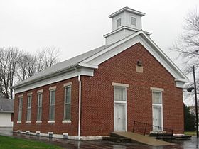
Harrodsburg Church of Christ
|
|

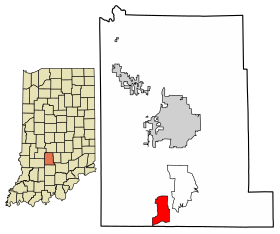
Location in Monroe County, Indiana
|
|
| Country | United States |
| State | Indiana |
| County | Monroe |
| Township | Clear Creek |
| Area | |
| • Total | 4.35 sq mi (11.27 km2) |
| • Land | 4.31 sq mi (11.17 km2) |
| • Water | 0.04 sq mi (0.09 km2) |
| Elevation | 627 ft (191 m) |
| Population
(2020)
|
|
| • Total | 656 |
| • Density | 152.06/sq mi (58.71/km2) |
| Time zone | UTC-5 (Eastern (EST)) |
| • Summer (DST) | UTC-4 (EDT) |
| ZIP codes |
47434, 47403 (Bloomington), 47462 (Springville)
|
| Area code(s) | 812, 930 |
| FIPS code | 18-32170 |
| GNIS feature ID | 2583454 |
Harrodsburg is a small community located in Monroe County, Indiana, in the United States. It's called an unincorporated community because it doesn't have its own local government like a city or town. It's also a census-designated place (CDP), which means the U.S. Census Bureau counts its population separately. In 2020, about 656 people lived there.
Contents
A Look Back: Harrodsburg's History
Harrodsburg has a cool history! It was first called "Newgene." In 1836, the area was platted, which means its streets and land lots were officially mapped out and planned. A post office has been open in Harrodsburg since 1840, helping people send and receive mail for a very long time!
Exploring Harrodsburg's Geography
Harrodsburg is found in the southern part of Monroe County. It's right next to Indiana State Road 37. This road goes north about 12 miles (19 km) to Bloomington, which is the main city and county seat (where the county government is located). If you go south on the same road, you'll reach Bedford, also about 12 miles (19 km) away.
The Harrodsburg area covers about 4.35 square miles (11.3 km²). Most of this is land, with a small part, about 0.04 square miles (0.1 km²), being water. The community gets its water from Clear Creek. This creek flows southeast and eventually joins Salt Creek. Salt Creek then flows into the East Fork of the White River near Bedford.
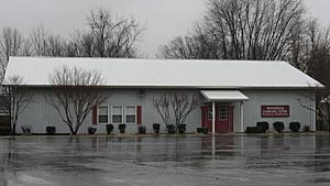
Harrodsburg Community Center
The Harrodsburg Community Building was built in 1992. It's a really important place for the community! People use it for all sorts of events and public meetings. It also serves as a polling place, which is where people go to vote during elections. To help pay for keeping the center running, the community holds an annual Heritage Days Festival.
Fun Things to Do: Attractions and Events
Harrodsburg has some fun events for everyone!
Heritage Days Festival
The Harrodsburg Heritage Days Festival is a popular event that happens every May. It's free to attend and a great way to enjoy the community spirit.
Harrodsburg Haunted House (Past Attraction)
For many years, from 1981 to 2013, the Harrodsburg Haunted House was a very popular attraction in Monroe County. It opened on weekends throughout October, drawing many visitors. It closed because new rules and permits were needed to operate it.
Who Lives Here: Demographics
| Historical population | |||
|---|---|---|---|
| Census | Pop. | %± | |
| 2010 | 691 | — | |
| 2020 | 656 | −5.1% | |
| U.S. Decennial Census | |||
Demographics is a fancy word for studying the population of a place. It looks at things like how many people live there and how that number changes over time. In 2010, Harrodsburg had 691 residents. By 2020, the population was 656 people.
See also
 In Spanish: Harrodsburg para niños
 | John T. Biggers |
 | Thomas Blackshear |
 | Mark Bradford |
 | Beverly Buchanan |


