Monroe County, Indiana facts for kids
Quick facts for kids
Monroe County
|
||
|---|---|---|
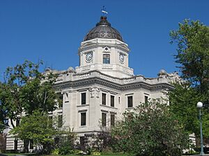
Monroe County courthouse in Bloomington, Indiana
|
||
|
||
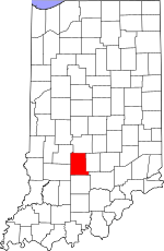
Location within the U.S. state of Indiana
|
||
 Indiana's location within the U.S. |
||
| Country | ||
| State | ||
| Founded | January 14, 1818 | |
| Named for | James Monroe | |
| Seat | Bloomington | |
| Largest city | Bloomington | |
| Area | ||
| • Total | 411.32 sq mi (1,065.3 km2) | |
| • Land | 394.51 sq mi (1,021.8 km2) | |
| • Water | 16.81 sq mi (43.5 km2) 4.09%% | |
| Population
(2020)
|
||
| • Total | 139,718 | |
| • Estimate
(2023)
|
139,342 |
|
| • Density | 339.682/sq mi (131.1520/km2) | |
| Time zone | UTC−5 (Eastern) | |
| • Summer (DST) | UTC−4 (EDT) | |
| Congressional district | 9th | |
| Indiana county number 53 | ||
Monroe County is a county in the state of Indiana, USA. It is a place where many people live and work. In 1910, experts figured out that the average center of the US population was right here in Monroe County!
The county's main city and government center is Bloomington. In 2020, about 139,718 people lived in Monroe County. It is also part of a larger area called the Bloomington Metropolitan Statistical Area.
Contents
History of Monroe County
Monroe County was officially created on January 14, 1818. It was formed from parts of Orange County. The county was named after James Monroe. He was the fifth President of the United States. He served as president from 1817 to 1825.
People and Population
| Historical population | |||
|---|---|---|---|
| Census | Pop. | %± | |
| 1820 | 2,679 | — | |
| 1830 | 6,577 | 145.5% | |
| 1840 | 10,143 | 54.2% | |
| 1850 | 11,286 | 11.3% | |
| 1860 | 12,847 | 13.8% | |
| 1870 | 14,168 | 10.3% | |
| 1880 | 15,875 | 12.0% | |
| 1890 | 17,673 | 11.3% | |
| 1900 | 20,873 | 18.1% | |
| 1910 | 23,426 | 12.2% | |
| 1920 | 24,519 | 4.7% | |
| 1930 | 35,974 | 46.7% | |
| 1940 | 36,534 | 1.6% | |
| 1950 | 50,080 | 37.1% | |
| 1960 | 59,225 | 18.3% | |
| 1970 | 84,849 | 43.3% | |
| 1980 | 98,785 | 16.4% | |
| 1990 | 108,978 | 10.3% | |
| 2000 | 120,563 | 10.6% | |
| 2010 | 137,974 | 14.4% | |
| 2020 | 139,718 | 1.3% | |
| 2023 (est.) | 139,342 | 1.0% | |
| US Decennial Census 1790–1960 1900–1990 1990–2000 2010 |
|||
In 2020, the county had 139,718 people living in 56,399 homes. On average, there were about 2.34 people in each home. The county had about 354 people per square mile.
Most people in Monroe County are white (86.0%). Other groups include Asian (6.9%), Black or African American (3.9%), and American Indian (0.3%). About 2.8% of people are from two or more races. People of Hispanic or Latino background make up 3.8% of the population.
In 2021, there were 56,714 households. About 22.1% of these homes had children under 18 living there. Many people (37.3%) lived alone.
Geography of Monroe County
Monroe County covers about 411 square miles. Most of this area (about 394 square miles) is land. The rest (about 16 square miles) is water. The land has gentle, rolling hills. These hills are covered with plants and are used for farming or city areas. The eastern part of the county has many small valleys and streams that lead to Griffy Lake. The highest point in the county is McGuire Benchmark, which is about 994 feet above sea level.
Neighboring Counties
Monroe County shares its borders with several other counties:
- Morgan County (to the north)
- Brown County (to the northeast)
- Jackson County (to the southeast)
- Lawrence County (to the south)
- Greene County (to the southwest)
- Owen County (to the northwest)
Lakes and Rivers
Monroe County has water flowing into two main river systems. These are the East Fork and West Fork of Indiana's White River. Water in the northern part of the county flows to the West Fork. Water in the southern part flows to the East Fork, mostly through Salt Creek and its smaller streams. One of these is Clear Creek, which is also known as the "Jordan River" on the Indiana University Bloomington campus.
Several artificial lakes have been built by damming creeks in the county.
- Monroe Lake is the largest. It is a big lake on Salt Creek in the southeastern part of the county. People use it for fun activities like boating and fishing. It also provides drinking water for the city.
- Lake Lemon was built in 1953. It used to be the main water source until the late 1960s. Now, it is a backup water source and is mostly used for recreation.
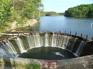
- Griffy Lake is the third largest. It was built in 1924 by damming Griffy Creek. It was Bloomington's main water source until 1954. Now, it is mainly used for recreation. It can also be used for water in emergencies. In 2012–2013, the lake was drained to fix the dam, and then it was refilled.
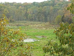
- Weimer Lake (also called Wapehani) was built for water supply. For most of its history, it was used for recreation, mainly fishing. In 2017, plans were made to drain this lake permanently because it was not considered safe. This happened in the summer of 2018.
Limestone has been taken from quarries in Monroe County since 1826. Many old limestone quarries are now lakes surrounded by cliffs. You can see these in the 1979 movie Breaking Away.
Protected Natural Areas
- Hoosier National Forest (part of it is in Monroe County)
Cool Natural Spots
- Buckner Cave
- Leonard Springs Nature Park, where water from Sinking Creek comes back to the surface in springs.
Communities in Monroe County
Monroe County has different types of communities where people live.
Cities
Towns
Census-Designated Places
These are areas that are like towns but are not officially incorporated as cities or towns.
Unincorporated Communities
These are smaller communities that are not part of any city or town government.
- Arlington
- Broadview
- Buenavista
- Cascade
- Chapel Hill
- Clear Creek
- Dolan
- Eastern Heights
- Elwren
- Fairfax
- Fleener
- Forest Park Heights
- Garden Acres
- Handy
- Highland Village
- Hindustan
- Hoosier Acres
- Kirby
- Kirksville
- Knight Ridge
- Lancaster Park
- Leonard Springs
- Marlin Hills
- Modesto
- Mount Tabor
- New Unionville
- Ridgemede
- Sanders
- Smithville
- Stanford
- Sunny Slopes
- Unionville
- Van Buren Park
- Victor
- Wayport
- West Brook Downs
- Woodbridge
- Woodville Hills
- Yellowstone
Former Communities
- Paynetown - This community was flooded when Lake Monroe was created.
Townships
Monroe County is divided into smaller areas called townships.
- Bean Blossom
- Benton
- Bloomington
- Clear Creek
- Indian Creek
- Perry
- Polk
- Richland
- Salt Creek
- Van Buren
- Washington
Climate and Weather
| Weather chart for Bloomington, Indiana | |||||||||||||||||||||||||||||||||||||||||||||||
|---|---|---|---|---|---|---|---|---|---|---|---|---|---|---|---|---|---|---|---|---|---|---|---|---|---|---|---|---|---|---|---|---|---|---|---|---|---|---|---|---|---|---|---|---|---|---|---|
| J | F | M | A | M | J | J | A | S | O | N | D | ||||||||||||||||||||||||||||||||||||
|
2.7
36
19
|
2.7
42
23
|
3.7
52
32
|
4.3
64
41
|
5.1
74
52
|
4.1
82
61
|
4.3
86
65
|
4
84
62
|
3.6
78
55
|
3.1
67
44
|
4
54
35
|
3.4
41
24
|
||||||||||||||||||||||||||||||||||||
| temperatures in °F precipitation totals in inches source: The Weather Channel |
|||||||||||||||||||||||||||||||||||||||||||||||
|
Metric conversion
|
|||||||||||||||||||||||||||||||||||||||||||||||
The weather in Bloomington changes throughout the year. In January, the average temperature is around 19°F (about -7°C). In July, it's warmer, with an average high of 86°F (about 30°C). The coldest temperature ever recorded was -21°F (-29°C) in January 1985. The hottest was 110°F (43°C) in July 1936.
The amount of rain and snow also changes. January usually gets about 2.66 inches of precipitation. May is the wettest month, with about 5.12 inches.
Education
The Monroe County Public Library has branches in Bloomington and Ellettsville. Monroe County is also home to Indiana University Bloomington, a large university.
Transportation
Major Roads
 I-69
I-69 Indiana State Road 37
 Indiana State Road 45
 Indiana State Road 46
 Indiana State Road 48
 Indiana State Road 446
For many years, Monroe County was special because it didn't have any major US highways or Interstate highways. But in December 2015, the I-69 extension was finished. This new highway now goes through the county. It was extended even further north in 2018.
Railways
Monroe County has a long history with trains. Today, the only active railway is the Indiana Rail Road. Its main line crosses the county from northeast to southwest. There are also smaller lines to some factories. There are no passenger trains for people to ride.
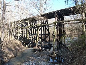
From 1854 to 2004, an important train line connected the Ohio River to Lake Michigan. This line went through towns like Stinesville, Ellettsville, Bloomington, Smithville, and Harrodsburg in Monroe County. The Monon Railroad operated it for a long time. The last passenger train service on this line was Amtrak's Floridian from 1972 to 1979. After 1979, Monroe County no longer had passenger train service. The line was used for freight until 2004. Now, large parts of it have been turned into trails for walking and biking.
Air Travel
- Monroe County Airport is southwest of Bloomington. Around 1997, regular passenger flights to this airport stopped. Since then, it has only been used by smaller, private planes.
See also
 In Spanish: Condado de Monroe (Indiana) para niños
 | Anna J. Cooper |
 | Mary McLeod Bethune |
 | Lillie Mae Bradford |


