Harrold, South Dakota facts for kids
Quick facts for kids
Harrold, South Dakota
|
|
|---|---|

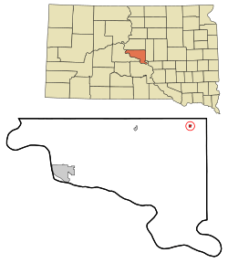
Location in Hughes County and the state of South Dakota
|
|
| Country | United States |
| State | South Dakota |
| County | Hughes |
| Incorporated | 1886 |
| Area | |
| • Total | 0.41 sq mi (1.07 km2) |
| • Land | 0.41 sq mi (1.07 km2) |
| • Water | 0.00 sq mi (0.00 km2) |
| Elevation | 1,791 ft (546 m) |
| Population
(2020)
|
|
| • Total | 101 |
| • Density | 245.15/sq mi (94.63/km2) |
| Time zone | UTC-6 (Central (CST)) |
| • Summer (DST) | UTC-5 (CDT) |
| ZIP code |
57536
|
| Area code(s) | 605 |
| FIPS code | 46-27420 |
| GNIS feature ID | 1267412 |
Harrold is a small town located in Hughes County, South Dakota, in the United States. It is part of the Pierre, South Dakota Micropolitan Statistical Area. In 2020, the town had a population of 101 people.
Contents
History of Harrold
The first people settled in Harrold in 1881. A post office was opened in 1882, and it was first called Harold. The name was changed to Harrold in 1890. The town was named after an official who worked for the railroad.
Geography of Harrold
Harrold is a small town with a total area of about 0.27 square miles (0.70 square kilometers). All of this area is land, meaning there are no large bodies of water within the town limits.
Population and People
| Historical population | |||
|---|---|---|---|
| Census | Pop. | %± | |
| 1900 | 57 | — | |
| 1910 | 230 | 303.5% | |
| 1920 | 252 | 9.6% | |
| 1930 | 309 | 22.6% | |
| 1940 | 229 | −25.9% | |
| 1950 | 263 | 14.8% | |
| 1960 | 255 | −3.0% | |
| 1970 | 184 | −27.8% | |
| 1980 | 196 | 6.5% | |
| 1990 | 167 | −14.8% | |
| 2000 | 209 | 25.1% | |
| 2010 | 124 | −40.7% | |
| 2020 | 101 | −18.5% | |
| U.S. Decennial Census | |||
Harrold's Population in 2010
In 2010, the town of Harrold had 124 residents. These people lived in 57 different homes, and 36 of these were families.
The town had about 459 people per square mile (177 people per square kilometer). There were 74 housing units, which are places where people can live.
Most of the people in Harrold were White (95.2%). A small number were African American (0.8%) or Native American (1.6%). About 2.4% of the residents were from two or more racial backgrounds.
Harrold Households and Families
Out of the 57 homes in Harrold, 26.3% had children under 18 living there. About half of the homes (50.9%) were married couples living together. A small number of homes had a female head of household without a husband (1.8%) or a male head of household without a wife (10.5%). About 36.8% of the homes were not families.
About 28.1% of all homes had only one person living in them. Also, 12.3% of homes had someone aged 65 or older living by themselves. On average, there were 2.18 people in each home and 2.64 people in each family.
Age and Gender in Harrold
The average age of people in Harrold in 2010 was 49.8 years old.
- 19.4% of residents were under 18 years old.
- 3.9% were between 18 and 24 years old.
- 18.6% were between 25 and 44 years old.
- 39.6% were between 45 and 64 years old.
- 18.5% were 65 years or older.
The town had a nearly equal number of males and females. About 50.8% of the residents were male, and 49.2% were female.
See also
 In Spanish: Harrold (Dakota del Sur) para niños
 | Sharif Bey |
 | Hale Woodruff |
 | Richmond Barthé |
 | Purvis Young |


