Pierre, South Dakota facts for kids
Quick facts for kids
Pierre
|
|||||
|---|---|---|---|---|---|
|
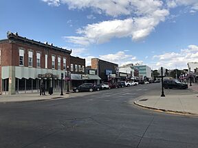
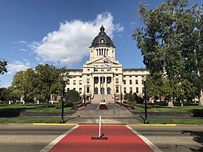
From left to right, from top: Downtown, Federal Building, St. Charles Hotel, Pierre Street Historic District, and the South Dakota State Capitol.
|
|||||
|
|||||
| Motto(s):
"On The River-On The Move"
|
|||||
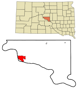
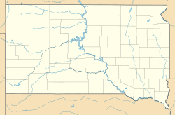
Location within Hughes County in South Dakota
|
|||||
| Country | United States | ||||
| State | South Dakota | ||||
| County | Hughes | ||||
| Founded | 1880 | ||||
| Incorporated | 1883 | ||||
| Chartered | 1900 | ||||
| Named for | Pierre Chouteau Jr. | ||||
| Area | |||||
| • Total | 13.05 sq mi (33.80 km2) | ||||
| • Land | 13.03 sq mi (33.74 km2) | ||||
| • Water | 0.02 sq mi (0.05 km2) 0.08% | ||||
| Elevation | 1,700 ft (500 m) | ||||
| Population
(2020)
|
|||||
| • Total | 14,091 | ||||
| • Density | 1,081.68/sq mi (417.63/km2) | ||||
| Time zone | UTC−6 (Central) | ||||
| • Summer (DST) | UTC−5 (Central) | ||||
| ZIP code |
57501
|
||||
| Area code(s) | 605 | ||||
| FIPS code | 46-49600 | ||||
| GNIS feature ID | 1267533 | ||||
Pierre (pronounced "PEER") is the state capital of South Dakota. It is also the main city of Hughes County. In 2020, about 14,091 people lived there. This makes it the second smallest state capital in the United States by population, after Montpelier, Vermont. Pierre is the 9th largest city in South Dakota.
The city was started in 1880 along the Missouri River. When South Dakota became a state in 1889, Pierre was chosen as its capital. It is located near the center of the state. Pierre was built across the river from an older settlement called Fort Pierre. It also became important because of a railroad crossing over the river.
Contents
History of Pierre, South Dakota
Pierre was founded in 1880 on the east side of the Missouri River. It was built across from Fort Pierre, which was an old trading post. On November 2, 1889, South Dakota became a state, and Pierre was named its capital.
Another city, Huron, also wanted to be the capital. But Pierre was chosen because it is more in the middle of the state. Fort Pierre was settled much earlier, around 1817, as a fur trading post. The area was named after Pierre Chouteau, Jr.. He was a French-American fur trader from St. Louis, Missouri.
The city of Pierre grew more when the Rapid City, Pierre and Eastern Railroad was built. This railroad helped move goods and people across the state. The train tracks cross the Missouri River on the Chicago and North Western Railroad Bridge. After World War II, more people started using cars and trucks. This made Pierre feel a bit cut off because it is not on a major interstate highway. It is one of only four state capitals without an interstate highway.
Geography and Climate of Pierre
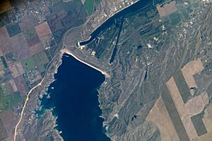
Pierre covers about 13.07 square miles (33.80 square kilometers). Most of this area is land.
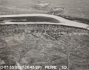
The city sits on hills next to the east bank of the Missouri River. It is also close to Lake Oahe, which is one of the world's largest man-made lakes. This lake was created to control floods and help with farming. Now, it is a popular place for fishing.
Weather Patterns in Pierre
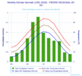
Pierre has a dry climate with four seasons. Winters are long, dry, and cold. Summers are hot. Spring and fall are short. The average temperature in January is about 19.1°F (-7.2°C). In July, it's about 74.9°F (23.8°C).
Snow usually falls in small amounts. The most snow falls in February and March. On average, Pierre gets about 37.2 inches (94 cm) of snow each year. Winters can feel even colder because of strong winds from the Great Plains.
Summers often have very hot days. The temperature can go above 100°F (38°C) about 6-7 days a year. It can reach over 90°F (32°C) for more than a month. The highest temperature ever recorded was 117°F (47°C) in July 2006. The lowest was -35°F (-37°C) in February 1994.
Rainfall is lighter in winter. Most rain falls in late spring and summer. The city gets about 20 inches (51 cm) of rain each year. On July 23, 1973, a strong F3 tornado hit Pierre. It caused 10 injuries and was the strongest tornado ever in Hughes County.
| Climate data for Pierre, South Dakota (Pierre Regional Airport), 1991−2010 normals, extremes 1933–present | |||||||||||||
|---|---|---|---|---|---|---|---|---|---|---|---|---|---|
| Month | Jan | Feb | Mar | Apr | May | Jun | Jul | Aug | Sep | Oct | Nov | Dec | Year |
| Record high °F (°C) | 68 (20) |
75 (24) |
88 (31) |
98 (37) |
105 (41) |
112 (44) |
117 (47) |
114 (46) |
108 (42) |
98 (37) |
87 (31) |
77 (25) |
117 (47) |
| Mean maximum °F (°C) | 52.5 (11.4) |
58.2 (14.6) |
74.0 (23.3) |
84.3 (29.1) |
89.8 (32.1) |
96.6 (35.9) |
103.0 (39.4) |
101.9 (38.8) |
97.5 (36.4) |
86.1 (30.1) |
69.1 (20.6) |
54.5 (12.5) |
105.0 (40.6) |
| Mean daily maximum °F (°C) | 29.0 (−1.7) |
33.7 (0.9) |
45.7 (7.6) |
58.5 (14.7) |
69.5 (20.8) |
80.0 (26.7) |
88.3 (31.3) |
86.6 (30.3) |
77.5 (25.3) |
60.7 (15.9) |
44.9 (7.2) |
32.4 (0.2) |
58.9 (14.9) |
| Daily mean °F (°C) | 19.1 (−7.2) |
23.2 (−4.9) |
34.3 (1.3) |
45.9 (7.7) |
57.2 (14.0) |
67.8 (19.9) |
74.9 (23.8) |
73.0 (22.8) |
63.6 (17.6) |
48.5 (9.2) |
34.1 (1.2) |
22.8 (−5.1) |
47.0 (8.3) |
| Mean daily minimum °F (°C) | 9.3 (−12.6) |
12.6 (−10.8) |
22.9 (−5.1) |
33.3 (0.7) |
44.9 (7.2) |
55.6 (13.1) |
61.6 (16.4) |
59.4 (15.2) |
49.7 (9.8) |
36.2 (2.3) |
23.2 (−4.9) |
13.2 (−10.4) |
35.2 (1.8) |
| Mean minimum °F (°C) | −13.6 (−25.3) |
−8.8 (−22.7) |
−0.2 (−17.9) |
17.2 (−8.2) |
30.2 (−1.0) |
43.9 (6.6) |
50.5 (10.3) |
47.4 (8.6) |
33.4 (0.8) |
18.9 (−7.3) |
5.3 (−14.8) |
−8.0 (−22.2) |
−18.8 (−28.2) |
| Record low °F (°C) | −33 (−36) |
−35 (−37) |
−20 (−29) |
0 (−18) |
21 (−6) |
34 (1) |
42 (6) |
39 (4) |
21 (−6) |
2 (−17) |
−18 (−28) |
−31 (−35) |
−35 (−37) |
| Average precipitation inches (mm) | 0.45 (11) |
0.74 (19) |
0.96 (24) |
1.93 (49) |
3.25 (83) |
3.69 (94) |
2.39 (61) |
1.95 (50) |
1.74 (44) |
1.69 (43) |
0.77 (20) |
0.64 (16) |
20.20 (513) |
| Average snowfall inches (cm) | 5.1 (13) |
8.0 (20) |
5.0 (13) |
5.3 (13) |
0.0 (0.0) |
0.0 (0.0) |
0.0 (0.0) |
0.0 (0.0) |
0.0 (0.0) |
1.3 (3.3) |
6.3 (16) |
6.2 (16) |
37.2 (94) |
| Average precipitation days (≥ 0.01 in) | 5.9 | 5.8 | 5.6 | 8.7 | 11.0 | 11.4 | 9.1 | 7.9 | 6.4 | 6.8 | 5.3 | 5.6 | 89.5 |
| Average snowy days (≥ 0.1 in) | 5.6 | 5.3 | 3.3 | 2.0 | 0.0 | 0.0 | 0.0 | 0.0 | 0.0 | 0.7 | 3.9 | 5.2 | 26.0 |
| Source: NOAA | |||||||||||||
Education in Pierre
The Pierre School District runs the public schools in the city. It includes three elementary schools, one middle school, and T. F. Riggs High School.
There is also a private Catholic elementary school called St. Joseph. It is managed by the local church and the Diocese of Sioux Falls. Other schools in Pierre include For His Glory and the Pierre Indian Learning Center. The Learning Center is a tribal school connected to the Bureau of Indian Education.
Media and News in Pierre
Television Channels
| Television | Channel (Digital) |
Callsign | |
|---|---|---|---|
| 7.1 | K14IO-D | ||
| 11.1 | KPLO-LD | ||
| 11.2 | KPLO-LD | ||
| 13.1 | KPRY | ||
| 13.2 | KPRY | ||
| 13.3 | KPRY | ||
| 34.1 | K34GM-D | ||
| 46.1 | K27HJ-D | ||
| 46.2 | K27HJ-D | ||
AM Radio Stations
| AM radio stations | |||||
|---|---|---|---|---|---|
| Frequency | Call sign | ||||
| 1060 AM | KGFX | ||||
| 1240 AM | KCCR | ||||
FM Radio Stations
| FM radio stations | |
|---|---|
| Frequency | Call sign |
| 89.1 FM | KVFL |
| 89.5 FM | K208FM |
| 90.3 FM | KSLP |
| 91.7 FM | KTSD |
| 92.7 FM | KGFX-FM |
| 94.5 FM | KPLO-FM |
| 95.3 FM | KLXS |
| 96.3 FM | K242CH |
| 98.9 FM | K255DE |
| 100.1 FM | KJBI |
| 100.5 FM | K263AW |
| 104.5 FM | KCCR-FM |
| 105.1 FM | KPGN-LP |
| 107.1 FM | K296FI |
Local Newspaper
The local newspaper in Pierre is called the Capital Journal. It has been printed since 1881. OaheTV is the local cable channel for public, education, and government programs. It serves Pierre and Fort Pierre.
Transportation in Pierre
Public transportation in Pierre is provided by River Cities Public Transit.
Pierre Regional Airport has flights from one commercial airline.
Pierre is in the middle of South Dakota, but it is one of only four state capitals not served by an Interstate highway. The closest Interstate highway is Interstate 90, which is about 34 miles (55 km) south of Pierre. You can reach it using U.S. Highway 83.
The Rapid City, Pierre and Eastern Railroad runs through the city from east to west. This railroad crosses the Missouri River on the Chicago and North Western Railroad Bridge.
Famous People from Pierre
- Angela Aames, an actress
- Floyd Bannister, a Major League Baseball player
- Joseph Bottum, a writer
- Robert Gleckler, an actor
- Dusty Johnson, a U.S. representative from South Dakota (born in Pierre in 1976)
- Byron S. Payne, a former Attorney General of South Dakota
- Rex Robbins, an actor
- Mike Rounds, a U.S. senator from South Dakota and former governor of South Dakota (lives in Fort Pierre)
- John Thune, a U.S. senator from South Dakota (born in Pierre in 1961)
Images for kids
See also
 In Spanish: Pierre (Dakota del Sur) para niños
 | Delilah Pierce |
 | Gordon Parks |
 | Augusta Savage |
 | Charles Ethan Porter |


