Oahe Dam facts for kids
Quick facts for kids Oahe Dam |
|
|---|---|
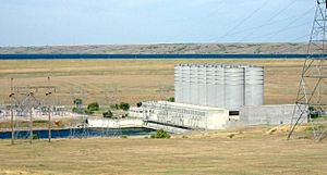
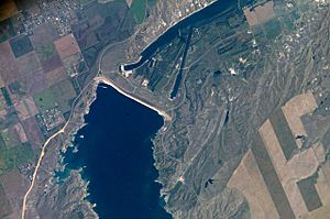
Oahe powerhouse showing surge chambers and powerhouse, looking to north-west.
|
|
|
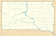
Location of Oahe Dam in USA South Dakota
|
|
| Location | Hughes/Stanley counties, South Dakota |
| Coordinates | 44°27′07″N 100°23′57″W / 44.45194°N 100.39917°W |
| Construction began | 1948 |
| Opening date | 1962 |
| Construction cost | $340 Million |
| Operator(s) | |
| Dam and spillways | |
| Type of dam | Embankment, Rolled-earth fill & shale berms |
| Impounds | Missouri River |
| Height | 245 feet (75 m) |
| Length | 9,360 feet (2,850 m) |
| Width (base) | 3,500 feet (1,100 m) |
| Dam volume | 93,122,000 cubic yards ([convert: unit mismatch]) |
| Spillways | 8 50-foot x 23.5-foot tainter gates |
| Spillway capacity | 304,000 cfs at 1,644.4 feet msl pool elevation |
| Reservoir | |
| Creates | Lake Oahe |
| Total capacity | 23,137,000 acre-feet (28.539 km3) |
| Surface area | 374,000 acres (151,000 ha) (max) |
| Power station | |
| Commission date | April 1962–June 1963 |
| Turbines | 7x 112.29 MW |
| Installed capacity | 786 MW |
| Annual generation | 2,621 GWh |
| Website U.S. Army Corps of Engineers - Oahe Project |
|
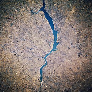
The Oahe Dam is a huge dam made of earth. It is built on the Missouri River in South Dakota, United States. This dam creates Lake Oahe, which is the fourth-largest man-made lake in the U.S. The lake stretches for 231 miles (372 km) up the Missouri River.
The Oahe Dam is very important. It helps control floods and makes electricity for many homes. It also helps with irrigation for farms and makes it easier for boats to travel. The dam is one of six main dams on the Missouri River. It is named after the Oahe Indian Mission, which was started in 1874 for the Lakota Sioux.
Contents
Building the Oahe Dam
The idea for the Oahe Dam came from the Flood Control Act of 1944. Building started in 1948 by the United States Army Corps of Engineers. This group is in charge of many water projects in the U.S.
An amazing invention helped build the dam. In 1952, the world's first rock tunnel boring machine (TBM) was created for this project. This machine made digging tunnels much faster and safer. The main part of the dam was finished in 1959.
President John F. Kennedy officially opened the dam on August 17, 1962. That same year, it started making electricity. The whole project cost about $340 million.
Quick Facts About Oahe Dam
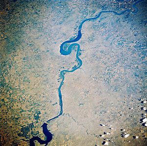
The Oahe Dam is a massive structure. Here are some interesting facts about it:
- Dam height: 245 feet (75 m) – that's like a 20-story building!
- Amount of earth used: 92,000,000 cubic yards (70,000,000 m³)
- Lake Oahe's deepest point: 205 feet (62 m)
- Water speed in tunnels: 11 mph (5 m/s)
- Number of turbines: 7 large turbines
- Electricity from each turbine: 112.29 MW
- Total lake storage: 23,500,000 acre-feet (29.0 km3) of water
- States getting electricity: North Dakota, South Dakota, Nebraska, Minnesota, and Montana
- Recreation areas: There are 51 places around the lake for fun activities.
- Shore length: The lake's shoreline is 2,250 miles (3,620 km) long.
Visiting the Dam
If you want to learn more, you can take a tour of the Oahe Dam's power plant. Tours are given every day from Memorial Day (late May) through Labor Day (early September). It's a great way to see how the dam works up close!
Impact on Native American Lands
Building the Oahe Dam had a big impact on the Native Americans who lived nearby. Their homes and lands were flooded to create Lake Oahe.
- The Cheyenne River Indian Reservation lost 150,000 acres (61,000 hectares) of land.
- The Standing Rock Indian Reservation lost 55,993 acres (22,660 ha) of land.
Much of this land was important for farming and traditional ways of life. People had to move to new areas. The loss of their land and resources changed their lives a lot. Even today, some groups are still working to address these past losses.
The Huff Archeological Site is an old Mandan village. It is now on the bank of Lake Oahe. This site is a National Historic Landmark, but the lake's water is causing erosion.
Major Flooding in 2011
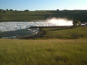
In 2011, there was a lot of rain and melting snow. This caused the Missouri River to flood. The Oahe Dam had to open its release gates to let out a huge amount of water.
The dam released 160,000 cu ft/s (4,531 m3/s) of water. This was a record amount for the dam. The previous record was much lower, at 53,900 cu ft/s (1,526 m3/s) in 1997. This shows how important the dam is for flood control.
See also
 In Spanish: Presa y lago Oahe para niños
 | Sharif Bey |
 | Hale Woodruff |
 | Richmond Barthé |
 | Purvis Young |


