Hughes County, South Dakota facts for kids
Quick facts for kids
Hughes County
|
|
|---|---|

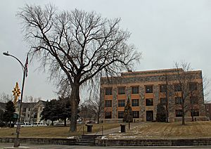
Hughes County Courthouse in Pierre
|
|

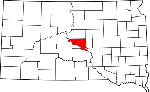
Location within the U.S. state of South Dakota
|
|
 South Dakota's location within the U.S. |
|
| Country | |
| State | |
| Founded | January 8, 1873 (created) November 26, 1880 (organized) |
| Named for | Alexander Hughes |
| Seat | Pierre |
| Largest city | Pierre |
| Area | |
| • Total | 801 sq mi (2,070 km2) |
| • Land | 742 sq mi (1,920 km2) |
| • Water | 59 sq mi (150 km2) 7.4% |
| Population
(2020)
|
|
| • Total | 17,765 |
| • Estimate
(2023)
|
17,624 |
| • Density | 22.179/sq mi (8.563/km2) |
| Time zone | UTC−6 (Central) |
| • Summer (DST) | UTC−5 (CDT) |
| Congressional district | At-large |
Hughes County is a place in South Dakota, a state in the United States. In 2020, about 17,765 people lived there. It's the county with the fewest people that also has a state capital. It's also the 12th most populated county in South Dakota. Its main city, called the county seat, is Pierre. Pierre is also the capital city of South Dakota.
Hughes County was started in 1873 and officially set up in 1880. It got its name from Alexander Hughes, who was a lawmaker. Later, in 1891, a place called Farm Island in the Missouri River was added to the county. Hughes County is also part of the Pierre Micropolitan Area, which is a group of nearby towns and cities that are connected.
Contents
Understanding Hughes County's Geography
The Missouri River forms the southwestern border of Hughes County. The land here has rolling hills, with some valleys and streams. Parts of the county are used for farming, and you might see special watering systems called center pivot irrigation.
The land generally slopes towards the southeast. The highest point in the county is about 1,952 feet (595 meters) above sea level. Hughes County covers a total area of 801 square miles (2,075 square kilometers). Most of this, 742 square miles (1,922 square kilometers), is land. The rest, 59 square miles (153 square kilometers), is water.
Main Roads in Hughes County
Local Airport
The Pierre Regional Airport (PIR) helps people travel to and from Hughes County and nearby areas.
Neighboring Counties
- Sully County - to the north
- Hyde County - to the east
- Lyman County - to the south
- Stanley County - to the west
Parks and Protected Areas
Hughes County has many natural areas where people can enjoy the outdoors. These include:
- Arikara State Game Production Area
- Buckeye State Game Production Area
- Cowan State Game Production Area
- DeGrey State Game Production Area
- DeGrey State Lakeside Use Area
- Dry Run State Game Production Area
- East Shore State Lakeside Use Area
- Farm Island State Recreation Area
- Fort George State Game Production Area
- Fort George State Lakeside Use Area
- Gutenkauf State Game Production Area
- Joe Creek Recreation Area
- LaFramboise Island State Nature Area
- North Bend State Lakeside Use Area
- North Big Bend State Game Production Area
- Oahe Mission Recreation Area
- Peoria Flats State Game Production Area
- Peoria Flats State Lakeside Use Area
- Rousseau State Game Production Area
- Rousseau State Lakeside Use Area
- Sand Creek State Game Production Area
- Spring Creek State Recreation Area
- Tailrace Recreation Area
- Valley state Game Production Area
- West Bend State Recreation Area
- West Big Bend State Game Production Area
- West DeGrey State Game Production Area
- Woodruff Lake State Game Production Area
Lakes in the County
Hughes County is home to parts of these large lakes:
- Lake Oahe
- Lake Sharpe
- Woodruff Lake
People Living in Hughes County
| Historical population | |||
|---|---|---|---|
| Census | Pop. | %± | |
| 1880 | 268 | — | |
| 1890 | 5,044 | 1,782.1% | |
| 1900 | 3,684 | −27.0% | |
| 1910 | 6,271 | 70.2% | |
| 1920 | 5,711 | −8.9% | |
| 1930 | 7,009 | 22.7% | |
| 1940 | 6,624 | −5.5% | |
| 1950 | 8,111 | 22.4% | |
| 1960 | 12,725 | 56.9% | |
| 1970 | 11,632 | −8.6% | |
| 1980 | 14,220 | 22.2% | |
| 1990 | 14,817 | 4.2% | |
| 2000 | 16,481 | 11.2% | |
| 2010 | 17,022 | 3.3% | |
| 2020 | 17,765 | 4.4% | |
| 2023 (est.) | 17,624 | 3.5% | |
| U.S. Decennial Census 1790-1960 1900-1990 1990-2000 2010-2020 |
|||
Population in 2020
In 2020, there were 17,765 people living in Hughes County. There were 7,240 households, which are groups of people living together. The average number of people per square mile was about 24.
Population in 2010
In 2010, about 17,022 people lived in the county. Most people (85.7%) were white. About 10.5% were American Indian. Other groups included Black or African American, Asian, and people from two or more races. About 1.8% of the population was of Hispanic or Latino background.
Many people in Hughes County have German (42.7%), Norwegian (12.4%), Irish (9.8%), or English (9.7%) family backgrounds. The average age of people in the county was about 39.8 years old.
Towns and Cities in Hughes County
Cities
Town
Census-Designated Place
- Oahe Acres (This is a special area counted by the census but not officially a city or town.)
Unincorporated Communities
- Canning (These are small communities without their own local government.)
Townships
- Raber
- Valley
Unorganized Territories
- Crow Creek
- North Hughes
- West Hughes
Schools in Hughes County
The school districts that serve Hughes County include:
- Agar-Blunt-Onida School District 58-3
- Highmore-Harrold School District 34-2
- Pierre School District 32-2
See also
 In Spanish: Condado de Hughes (Dakota del Sur) para niños
 | Bessie Coleman |
 | Spann Watson |
 | Jill E. Brown |
 | Sherman W. White |

