
Sully County, South Dakota facts for kids
Quick facts for kids
Sully County
|
|
|---|---|

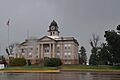
Sully Courthouse (2013)
|
|

Location within the U.S. state of South Dakota
|
|
 South Dakota's location within the U.S. |
|
| Country | |
| State | |
| Founded | 1873 (created) 1883 (organized) |
| Named for | Alfred Sully |
| Seat | Onida |
| Largest city | Onida |
| Area | |
| • Total | 1,070 sq mi (2,800 km2) |
| • Land | 1,007 sq mi (2,610 km2) |
| • Water | 63 sq mi (160 km2) 5.9% |
| Population
(2020)
|
|
| • Total | 1,446 |
| • Estimate
(2023)
|
1,494 |
| • Density | 1.351/sq mi (0.5218/km2) |
| Time zone | UTC−6 (Central) |
| • Summer (DST) | UTC−5 (CDT) |
| Congressional district | At-large |
Sully County is a county in the state of South Dakota. In 2020, about 1,446 people lived there. This makes it one of the counties with the fewest people in South Dakota. The main town and county seat is Onida.
Sully County was created in 1873 and officially started in 1883. It is named after General Alfred Sully. He was a general who built Fort Sully. Sully County is also part of the larger area around Pierre.
Sully County was home to the largest settlement of African American homesteaders in South Dakota. Homesteaders were people who moved to new land to farm it. This settlement was called the Blair Colony. A man named Norvel Blair came to Fairbank Township in 1884. He had sent his sons to check out the area first.
Blair did very well by farming and raising racehorses. His success brought many other Black families to the colony. Blair even became the first Black person in South Dakota to serve on a school board.
Later, farming became very hard in South Dakota during the Great Depression. This was a time when the economy was very bad. Because of this, most people from the Blair Colony moved away. They looked for work in bigger cities like Minneapolis and Chicago. Today, a special marker in Onida remembers the Blair Colony.
Contents
Geography of Sully County
The western border of Sully County follows the Missouri River. This river flows south along the county's edge. The land in the county has rolling hills. It is somewhat dry, but parts are used for farming. The land slopes down towards the south and east. However, the western part of the county slopes towards the river valley.
The highest point in Sully County is on its northern border. It is about 1,949 feet (594 meters) above sea level. The county covers a total area of about 1,070 square miles (2,770 square kilometers). Of this, 1,007 square miles (2,608 square kilometers) is land. The remaining 63 square miles (163 square kilometers) is water.
Sully County is in the Central Time Zone. This is the same time zone as many other counties in eastern South Dakota.
Main Roads in Sully County
 U.S. Highway 83
 South Dakota Highway 1804
Neighboring Counties
Sully County shares borders with several other counties:
- Potter County to the north
- Hyde County to the east
- Hughes County to the south
- Stanley County to the southwest (this county is in a different time zone)
- Dewey County to the northwest (also in a different time zone)
Protected Natural Areas
Sully County has several protected natural areas. These places help protect wildlife and nature. Some of them are:
- Bush's Landing State Lakeside Use Area
- Cottonwood Lake State Game Production Area
- Cow Creek State Recreation Area
- Fort Sully State Game Production Area
- Okobojo Point State Recreation Area
- Spring Creek Recreation Area
- Stone Lake State Game Production Area
Lakes in Sully County
Several lakes are found in Sully County, including:
- Cottonwood Lake
- Fuller Lake
- Lake Oahe (a large part of this lake is in the county)
- Lake Okobojo
- Stone Lake
- Sully Lake
Population of Sully County
| Historical population | |||
|---|---|---|---|
| Census | Pop. | %± | |
| 1880 | 296 | — | |
| 1890 | 2,412 | 714.9% | |
| 1900 | 1,715 | −28.9% | |
| 1910 | 2,462 | 43.6% | |
| 1920 | 2,831 | 15.0% | |
| 1930 | 3,852 | 36.1% | |
| 1940 | 2,668 | −30.7% | |
| 1950 | 2,713 | 1.7% | |
| 1960 | 2,607 | −3.9% | |
| 1970 | 2,362 | −9.4% | |
| 1980 | 1,990 | −15.7% | |
| 1990 | 1,589 | −20.2% | |
| 2000 | 1,556 | −2.1% | |
| 2010 | 1,373 | −11.8% | |
| 2020 | 1,446 | 5.3% | |
| 2023 (est.) | 1,494 | 8.8% | |
| U.S. Decennial Census 1790–1960 1900–1990 1990–2000 2010–2020 |
|||
The population of Sully County has changed over the years. In 1880, there were only 296 people. The population grew a lot by 1930, reaching 3,852 people. Since then, the number of people living in the county has slowly gone down.
Sully County in 2020
In 2020, the census counted 1,446 people living in Sully County. There were 635 households and 428 families. This means there were about 1.4 people per square mile. There were also 892 homes in the county.
Sully County in 2010
In 2010, the census showed 1,373 people lived in Sully County. Most people (96.6%) were white. About 1.2% were American Indian. A small number of people (0.9%) were of Hispanic or Latino background.
The average household had 2.25 people. The average family had 2.82 people. The median age of people in the county was 46.6 years old.
The median income for a household was $48,958. For families, it was $58,875. This means half of the households earned more than this amount, and half earned less. About 8.0% of all people in the county lived below the poverty line. This included 12.8% of those under 18 years old.
Towns and Areas
Sully County has a few towns and special areas.
City
- Onida is the main city and the county seat.
Town
- Agar is another town in the county.
Census-designated place
- Cow Creek is a place that the census counts, but it's not an official city or town.
Unorganized Territories
Sully County does not have smaller divisions called townships. Instead, its area is split into two "unorganized territories." These are called West Sully and East Sully.
Notable People
- Irwin Gunsalus (1912–2008) was a biochemist. He was born in Sully County.
Images for kids
-
Sully Courthouse (2013)
See also
 In Spanish: Condado de Sully para niños
