
Potter County, South Dakota facts for kids
Quick facts for kids
Potter County
|
|
|---|---|

Potter County Courthouse (July 2013)
|
|

Location within the U.S. state of South Dakota
|
|
 South Dakota's location within the U.S. |
|
| Country | |
| State | |
| Founded | 1873 (created) 1883 (organized) |
| Named for | Joel A. Potter |
| Seat | Gettysburg |
| Largest city | Gettysburg |
| Area | |
| • Total | 899 sq mi (2,330 km2) |
| • Land | 861 sq mi (2,230 km2) |
| • Water | 38 sq mi (100 km2) 4.2% |
| Population
(2020)
|
|
| • Total | 2,472 |
| • Estimate
(2023)
|
2,413 |
| • Density | 2.7497/sq mi (1.0617/km2) |
| Time zone | UTC−6 (Central) |
| • Summer (DST) | UTC−5 (CDT) |
| Congressional district | At-large |
Potter County is a place in South Dakota where people live and work. It's called a county. In 2020, about 2,472 people lived here. The main town, or county seat, is Gettysburg. Potter County was officially started in 1873 and got its organization in 1883.
Contents
Exploring Potter County's Geography
Potter County is located in South Dakota. The big Missouri River flows along its western side. The land here has gentle, rolling hills. Most of the land is used for farming.
The county generally slopes downwards towards the south. However, the western part slopes into the river valley. Potter County covers a total area of about 899 square miles. Most of this (861 square miles) is land, and 38 square miles (about 4.2%) is water.
Time Zone and Location
South Dakota has two different time zones. Most counties in the eastern part of the state use Central Time. Counties in the western part use Mountain Time. Potter County is the furthest west county that uses Central Time.
Main Roads in Potter County
 U.S. Highway 83
 U.S. Highway 212
 South Dakota Highway 20
 South Dakota Highway 47
 South Dakota Highway 1804
Neighboring Counties
- Walworth County - to the north
- Edmunds County - to the northeast
- Faulk County - to the east
- Hyde County - to the southeast
- Sully County - to the south
- Dewey County - to the west (this county uses Mountain Time)
Special Areas and Lakes
Potter County has several protected areas. These are often used for outdoor activities like hunting or enjoying nature. Some of these areas include:
- Dodge Draw State Game Production Area
- Dodge Draw State Lakeside Use Area
- East Whitlock State Lakeside Use Area
- Forest City State Game Production Area
- Green Lake State Game Production Area
- Potts Dam State Game Production Area
- Siebrasse State Game Production Area
- West Whitlock State Recreation Area
- Whitlocks Bay State Game Production Area
The county also has a few lakes:
- Green Lake
- Lake Hurley
- Lake Oahe (part of this large lake is in Potter County)
People of Potter County
| Historical population | |||
|---|---|---|---|
| Census | Pop. | %± | |
| 1890 | 2,910 | — | |
| 1900 | 2,988 | 2.7% | |
| 1910 | 4,466 | 49.5% | |
| 1920 | 4,382 | −1.9% | |
| 1930 | 5,762 | 31.5% | |
| 1940 | 4,614 | −19.9% | |
| 1950 | 4,688 | 1.6% | |
| 1960 | 4,926 | 5.1% | |
| 1970 | 4,449 | −9.7% | |
| 1980 | 3,674 | −17.4% | |
| 1990 | 3,190 | −13.2% | |
| 2000 | 2,693 | −15.6% | |
| 2010 | 2,329 | −13.5% | |
| 2020 | 2,472 | 6.1% | |
| 2023 (est.) | 2,413 | 3.6% | |
| U.S. Decennial Census 1790-1960 1900-1990 1990-2000 2010-2020 |
|||
Every ten years, the United States counts its population in a census. This helps us understand how many people live in different areas.
Population in 2020
According to the 2020 census, 2,472 people lived in Potter County. There were 1,127 households and 753 families. The population density was about 2.9 people for every square mile.
Population in 2010
In the 2010 census, there were 2,329 people. Most people (97.6%) were white. About 0.9% were Native American. People from German backgrounds made up the largest group, at 65.3%.
Towns and Areas
Potter County has one main city and several smaller towns.
City
- Gettysburg (This is the county seat, meaning it's where the county government is located.)
Towns
Unincorporated Area
- Forest City
County Divisions
Potter County does not have organized townships like some other counties. Instead, it is divided into three large unorganized areas: West Potter, Central Potter, and East Potter.
Images for kids
-
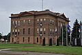
Potter County Courthouse (July 2013)
-
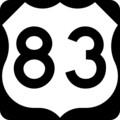
U.S. Highway 83 sign
-
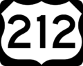
U.S. Highway 212 sign
-
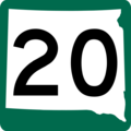
South Dakota Highway 20 sign
-
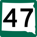
South Dakota Highway 47 sign
-
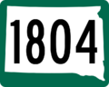
South Dakota Highway 1804 sign


See also
 In Spanish: Condado de Potter (Dakota del Sur) para niños
