Hatherleigh, South Australia facts for kids
Quick facts for kids HatherleighSouth Australia |
|||||||||||||||
|---|---|---|---|---|---|---|---|---|---|---|---|---|---|---|---|
| Established | 20 November 1879 (town) 23 February 1995 (locality) |
||||||||||||||
| Postcode(s) | 5280 | ||||||||||||||
| Time zone | ACST (UTC+9:30) | ||||||||||||||
| • Summer (DST) | ACST (UTC+10:30) | ||||||||||||||
| Location |
|
||||||||||||||
| LGA(s) | Wattle Range Council | ||||||||||||||
| Region | Limestone Coast | ||||||||||||||
| State electorate(s) | Mackillop | ||||||||||||||
| Federal Division(s) | Barker | ||||||||||||||
|
|||||||||||||||
| Footnotes | Adjoining localities | ||||||||||||||
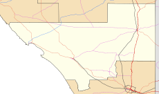
Hatherleigh is a small area in the Australian state of South Australia. It's known as a locality, which is like a small community or district. Hatherleigh is part of the beautiful Limestone Coast region.
It is located about 322 kilometers (about 200 miles) south-east of Adelaide, which is the capital city of South Australia. Hatherleigh is also quite close to Millicent, being only about 15 kilometers (about 9 miles) north-west of that town.
Contents
About Hatherleigh
Hatherleigh is a quiet rural area. It was first recognized as a town on 20 November 1879. Later, on 23 February 1995, it was officially named a "locality." This means it's a defined geographic area, often with a small population or scattered homes.
Where is Hatherleigh located?
Hatherleigh is found in the south-east part of South Australia. This area is famous for its unique geology, especially the limestone caves and sinkholes. The region is known as the Limestone Coast.
Nearby Places
Hatherleigh is surrounded by other small localities. These include:
- Furner to the north, north-east, and east.
- Sebastopol to the east, south-east, and south.
- Rendelsham to the south, south-west, and west.
- Thornlea to the west and north-west.
How Hatherleigh is Governed
Even small places like Hatherleigh are part of bigger government systems. This helps manage services like roads, schools, and local rules.
Local Government
Hatherleigh is part of the Wattle Range Council. This is the local government body that looks after the area. They make decisions about local services and community needs.
State Government
For state-level decisions, Hatherleigh is in the Electoral district of Mackillop. When people vote for their state representatives, they vote for someone to represent this area in the South Australian Parliament.
Federal Government
At the national level, Hatherleigh is part of the Division of Barker. This is a federal electoral division. People in Hatherleigh vote for a Member of Parliament to represent them in the Australian Parliament in Canberra.
 | Selma Burke |
 | Pauline Powell Burns |
 | Frederick J. Brown |
 | Robert Blackburn |


