Furner, South Australia facts for kids
Quick facts for kids FurnerSouth Australia |
|||||||||||||||
|---|---|---|---|---|---|---|---|---|---|---|---|---|---|---|---|
| Established | 11 November 1886 (town) 23 February 1995 (locality) |
||||||||||||||
| Postcode(s) | 5280 | ||||||||||||||
| Location | 27 km (17 mi) N of Millicent | ||||||||||||||
| LGA(s) | Wattle Range Council | ||||||||||||||
| Region | Limestone Coast | ||||||||||||||
| County | Grey | ||||||||||||||
| State electorate(s) | MacKillop | ||||||||||||||
| Federal Division(s) | Barker | ||||||||||||||
|
|||||||||||||||
|
|||||||||||||||
| Footnotes | Adjoining localities | ||||||||||||||
Furner is a small town and a specific area, also called a locality, in the Australian state of South Australia. It is known mostly as a farming community. People in Furner work with the land to grow crops or raise animals.
Contents
Discover Furner
Furner is located in the beautiful Limestone Coast region of South Australia. This area is famous for its unique geology, including caves and sinkholes. Furner itself is a quiet place, focused on agriculture.
Where is Furner Located?
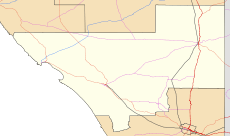
Furner is about 27 kilometers (about 17 miles) north of a larger town called Millicent. It's situated in the southeastern part of South Australia. The exact location can be found using its coordinates: 37.409221° S latitude and 140.338558° E longitude.
A Look at Furner's History
The town of Furner was officially established a long time ago, on 11 November 1886. Later, on 23 February 1995, the surrounding area was also officially recognized as the locality of Furner. This means the name Furner refers to both the small town and the wider rural area around it.
What is Furner Like?
Furner is primarily a farming community. This means that many people living there work in agriculture. They might grow different types of crops or raise livestock like sheep or cattle. The climate in Furner has average maximum temperatures around 20.5°C (68.9°F) and minimum temperatures around 8.1°C (46.6°F). It receives about 568.7 millimeters (22.4 inches) of rain each year. These conditions help support the farming activities in the area.
How Furner is Governed
Even small towns like Furner are part of a larger system of government. This helps manage services and represent the people who live there.
Local Government
Furner is part of the Wattle Range Council. This is the local government body that looks after things like local roads, parks, waste collection, and community services in the Furner area and other nearby towns. It's like the local team that makes sure the community runs smoothly.
State and Federal Representation
For state-level decisions, Furner is in the state electoral district of MacKillop. This means that when people vote for their representatives in the South Australian Parliament, they vote for someone to represent the MacKillop area.
For national-level decisions, Furner is part of the federal division of Barker. This is the area that elects a representative to the Australian Parliament in Canberra. So, people in Furner have a voice at both the state and national levels of government.
 | William M. Jackson |
 | Juan E. Gilbert |
 | Neil deGrasse Tyson |


