Heiteren facts for kids
Quick facts for kids
Heiteren
Haitre
|
||
|---|---|---|
|
||
| Country | France | |
| Region | Grand Est | |
| Department | Haut-Rhin | |
| Arrondissement | Colmar-Ribeauvillé | |
| Canton | Ensisheim | |
| Area
1
|
22.4 km2 (8.6 sq mi) | |
| Population
(2006)
|
890 | |
| • Density | 39.73/km2 (102.9/sq mi) | |
| Time zone | UTC+01:00 (CET) | |
| • Summer (DST) | UTC+02:00 (CEST) | |
| INSEE/Postal code |
68130 /68600
|
|
| Elevation | 196–209 m (643–686 ft) (avg. 200 m or 660 ft) |
|
| 1 French Land Register data, which excludes lakes, ponds, glaciers > 1 km2 (0.386 sq mi or 247 acres) and river estuaries. | ||
Heiteren is a small town, also known as a commune, located in eastern France. It is part of the Haut-Rhin department, which is in the Alsace region.
About Heiteren
Heiteren is a quiet place with a population of about 890 people, based on a count from 2006. It covers an area of around 22.4 square kilometers. This makes it a small but charming community in the French countryside.
Location and Geography
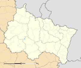
Heiteren is situated in the eastern part of France. Its exact location is marked by coordinates, which help people find it on a map. The town sits at an elevation of about 200 meters (around 656 feet) above sea level. The lowest point in Heiteren is 196 meters, and the highest point is 209 meters. This means the land is mostly flat or gently rolling.
People and Government
Like all communes in France, Heiteren has its own local government. The main leader of the commune is called the mayor. From 2008 to 2014, the mayor of Heiteren was Dominique Schmitt. The mayor and the local council work together to manage the town's services and make decisions for the community. These decisions include things like maintaining roads, managing local schools, and organizing community events.
See also

- In Spanish: Heiteren para niños
 | James Van Der Zee |
 | Alma Thomas |
 | Ellis Wilson |
 | Margaret Taylor-Burroughs |


