Hill City, Idaho facts for kids
Quick facts for kids
Hill City
|
|
|---|---|
| Hill City | |
| Country | United States |
| State | Idaho |
| County | Camas |
| Population
(2012)
|
|
| • Total | 26 |
| Time zone | UTC-7 (Mountain (MST)) |
| • Summer (DST) | UTC-6 (MDT) |
| ZIP codes |
83337
|
| Area code(s) | 208 |
| Website | None |
Hill City is a small, unincorporated community in Camas County, Idaho, United States. It's a place that doesn't have its own local government.
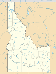
You can find Hill City in the southwestern part of Camas County. It's located where U.S. Route 20 crosses Mink and Swamp Roads. The community is about 14 miles (22.5 km) west-southwest of Fairfield. Fairfield is the main town and county seat for Camas County. Hill City sits at an elevation of 5,090 feet (1,551 meters) above sea level.
History of Hill City
Hill City got its name from the nearby Bennet Mountain Hills. In 1911, it became a very important stop on the Oregon Short Line Railroad. This railroad was a big deal for moving goods and people.
Sheep and Grain Trade
From Hill City and the surrounding Camas Prairie, huge numbers of sheep were sent out. At one point, more sheep were shipped from Hill City than from anywhere else in the world! This shows how important farming and ranching were to the area.
The community also had many grain elevators. These tall buildings were used to store grain harvested from local farms.
Population and Local Spots
In 1960, the population of Hill City was just 30 people. It has always been a very small community.
There was a historic saloon in Hill City. A saloon is like a restaurant and bar. It was reopened in 2013. However, it later closed down. In 2019, Jim and Tina Rice bought it and then removed the building.
Climate in Hill City
Hill City experiences a climate typical of mountain regions. The weather can change quite a bit between seasons. Summers are generally warm, while winters are cold and snowy.
| Climate data for Hill City 1 W, Idaho, 1991–2020 normals, 1915-2020 extremes: 5100ft (1554m) | |||||||||||||
|---|---|---|---|---|---|---|---|---|---|---|---|---|---|
| Month | Jan | Feb | Mar | Apr | May | Jun | Jul | Aug | Sep | Oct | Nov | Dec | Year |
| Record high °F (°C) | 50 (10) |
59 (15) |
70 (21) |
83 (28) |
91 (33) |
98 (37) |
102 (39) |
100 (38) |
98 (37) |
85 (29) |
73 (23) |
59 (15) |
102 (39) |
| Mean maximum °F (°C) | 40.2 (4.6) |
42.9 (6.1) |
54.9 (12.7) |
70.3 (21.3) |
80.1 (26.7) |
87.3 (30.7) |
95.7 (35.4) |
93.5 (34.2) |
87.3 (30.7) |
77.7 (25.4) |
56.7 (13.7) |
42.3 (5.7) |
92.5 (33.6) |
| Mean daily maximum °F (°C) | 29.0 (−1.7) |
31.8 (−0.1) |
42.1 (5.6) |
54.3 (12.4) |
64.9 (18.3) |
74.5 (23.6) |
85.2 (29.6) |
85.1 (29.5) |
75.7 (24.3) |
60.6 (15.9) |
43.1 (6.2) |
30.4 (−0.9) |
56.4 (13.6) |
| Daily mean °F (°C) | 19.1 (−7.2) |
21.8 (−5.7) |
31.4 (−0.3) |
41.5 (5.3) |
50.0 (10.0) |
57.4 (14.1) |
66.0 (18.9) |
64.9 (18.3) |
56.3 (13.5) |
44.4 (6.9) |
31.4 (−0.3) |
20.5 (−6.4) |
42.1 (5.6) |
| Mean daily minimum °F (°C) | 9.2 (−12.7) |
11.7 (−11.3) |
20.8 (−6.2) |
28.8 (−1.8) |
35.1 (1.7) |
40.3 (4.6) |
46.8 (8.2) |
44.8 (7.1) |
36.9 (2.7) |
28.1 (−2.2) |
19.6 (−6.9) |
10.6 (−11.9) |
27.7 (−2.4) |
| Mean minimum °F (°C) | −14.7 (−25.9) |
−13.2 (−25.1) |
−0.1 (−17.8) |
15.9 (−8.9) |
22.7 (−5.2) |
26.1 (−3.3) |
35.6 (2.0) |
31.5 (−0.3) |
23.1 (−4.9) |
10.1 (−12.2) |
−3.2 (−19.6) |
−12.5 (−24.7) |
−20.2 (−29.0) |
| Record low °F (°C) | −44 (−42) |
−40 (−40) |
−26 (−32) |
−8 (−22) |
14 (−10) |
19 (−7) |
21 (−6) |
21 (−6) |
8 (−13) |
−10 (−23) |
−23 (−31) |
−49 (−45) |
−49 (−45) |
| Average precipitation inches (mm) | 2.06 (52) |
1.22 (31) |
1.17 (30) |
1.20 (30) |
1.28 (33) |
0.80 (20) |
0.47 (12) |
0.24 (6.1) |
0.52 (13) |
1.05 (27) |
1.26 (32) |
2.72 (69) |
13.99 (355.1) |
| Average snowfall inches (cm) | 27.6 (70) |
13.4 (34) |
5.3 (13) |
1.8 (4.6) |
0.0 (0.0) |
0.0 (0.0) |
0.0 (0.0) |
0.0 (0.0) |
0.0 (0.0) |
0.5 (1.3) |
8.3 (21) |
27.2 (69) |
84.1 (212.9) |
| Source 1: NOAA | |||||||||||||
| Source 2: XMACIS2 (1991-2006 snowfall, records & monthly max/mins) | |||||||||||||
 | Ernest Everett Just |
 | Mary Jackson |
 | Emmett Chappelle |
 | Marie Maynard Daly |


