
Hingham, Montana facts for kids
Quick facts for kids
Hingham, Montana
|
|
|---|---|
 |
|

Location of Hingham, Montana
|
|
| Country | United States |
| State | Montana |
| County | Hill |
| Area | |
| • Total | 0.17 sq mi (0.44 km2) |
| • Land | 0.17 sq mi (0.44 km2) |
| • Water | 0.00 sq mi (0.00 km2) |
| Elevation | 3,025 ft (922 m) |
| Population
(2020)
|
|
| • Total | 131 |
| • Density | 761.63/sq mi (294.49/km2) |
| Time zone | UTC-7 (Mountain (MST)) |
| • Summer (DST) | UTC-6 (MDT) |
| ZIP code |
59528
|
| Area code(s) | 406 |
| FIPS code | 30-36400 |
| GNIS feature ID | 2412755 |
Hingham is a small town located in Hill County, Montana, in the United States. Most people in Hingham work in farming. In 2020, about 131 people lived there.
Contents
Where is Hingham?
Hingham is found along U.S. Route 2. It's about 35 miles (56 km) from Havre. The town is also close to Fresno Reservoir. The total area of Hingham is very small, about 0.17 square miles (0.44 square kilometers), and it's all land.
Hingham's Story: The Town on the Square
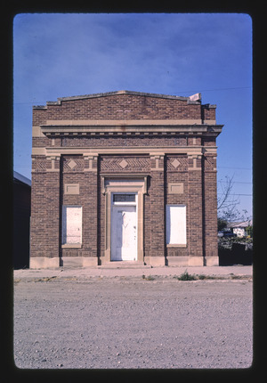
Hingham is a small farming community in northern Montana. Like many towns along the Hi-Line, Hingham grew because it was a good place to store and ship grain. It was located along the Great Northern Railway (now BNSF Railway) and U.S. Route 2.
How Hingham Started
In 1909, settlers bought land to create the town. By early 1910, Hingham was officially established. The town was planned with a large central square. This square became its most important feature. Hingham grew quickly in its early years. It soon had a school, a hospital, several churches, and over forty businesses. In 1917, Hingham became an official town with its own elected mayor and council.
Community Life and Changes
People in the community have worked hard to turn the town square into one of the best parks on the Hi-Line. Much of this work was done by volunteers and through donations. A well-known landmark in Hingham is its water tower, which can be seen from far away.
The Hingham School opened in 1910. Its mascot was the Rangers, and its colors were red, white, and black. The school operated until the early 1980s. At that time, it joined with the nearby Rudyard School to form Blue Sky Schools. Later, in 2005, Blue Sky Schools combined with KG Schools (Kremlin-Gildford) to create North Star Schools.
In recent years, Hingham's population has become smaller. This is because there are fewer job opportunities. In 2010, Hingham celebrated its 100th birthday! Hingham shares its name with other towns in Wisconsin, Massachusetts, and Norfolk, England.
People of Hingham
| Historical population | |||
|---|---|---|---|
| Census | Pop. | %± | |
| 1920 | 154 | — | |
| 1930 | 251 | 63.0% | |
| 1940 | 205 | −18.3% | |
| 1950 | 214 | 4.4% | |
| 1960 | 254 | 18.7% | |
| 1970 | 262 | 3.1% | |
| 1980 | 186 | −29.0% | |
| 1990 | 181 | −2.7% | |
| 2000 | 157 | −13.3% | |
| 2010 | 118 | −24.8% | |
| 2020 | 131 | 11.0% | |
| U.S. Decennial Census | |||
In 2010, the town had 118 people living there. There were 60 households and 33 families. About 91.5% of the people were White. A small number were Native American, Asian, or from two or more races.
The average age in Hingham in 2010 was 52 years old. About 13.6% of residents were under 18. Most people were between 45 and 64 years old (49.2%). About 20.3% of the population was 65 or older.
Hingham's Weather
Hingham has a semi-arid climate. This means it has long, cold, and dry winters. The summers are usually hot.
| Climate data for Hingham | |||||||||||||
|---|---|---|---|---|---|---|---|---|---|---|---|---|---|
| Month | Jan | Feb | Mar | Apr | May | Jun | Jul | Aug | Sep | Oct | Nov | Dec | Year |
| Record high °F (°C) | 68 (20) |
87 (31) |
79 (26) |
95 (35) |
98 (37) |
108 (42) |
108 (42) |
111 (44) |
101 (38) |
91 (33) |
78 (26) |
71 (22) |
111 (44) |
| Mean daily maximum °F (°C) | 25.5 (−3.6) |
33.4 (0.8) |
44.9 (7.2) |
58.5 (14.7) |
68.8 (20.4) |
77.4 (25.2) |
84.6 (29.2) |
83.9 (28.8) |
71.9 (22.2) |
59.4 (15.2) |
40.8 (4.9) |
30.1 (−1.1) |
56.6 (13.7) |
| Daily mean °F (°C) | 14.6 (−9.7) |
21.9 (−5.6) |
32.5 (0.3) |
44.3 (6.8) |
54.5 (12.5) |
62.7 (17.1) |
68.3 (20.2) |
67.6 (19.8) |
56.3 (13.5) |
44.6 (7.0) |
29.1 (−1.6) |
19.0 (−7.2) |
43.0 (6.1) |
| Mean daily minimum °F (°C) | 3.7 (−15.7) |
10.4 (−12.0) |
20.0 (−6.7) |
30.0 (−1.1) |
40.2 (4.6) |
48.0 (8.9) |
52.0 (11.1) |
51.3 (10.7) |
40.7 (4.8) |
29.8 (−1.2) |
17.3 (−8.2) |
7.8 (−13.4) |
29.3 (−1.5) |
| Record low °F (°C) | −57 (−49) |
−55 (−48) |
−41 (−41) |
−14 (−26) |
9 (−13) |
29 (−2) |
31 (−1) |
27 (−3) |
18 (−8) |
−21 (−29) |
−33 (−36) |
−50 (−46) |
−57 (−49) |
| Average precipitation inches (mm) | 0.47 (12) |
0.36 (9.1) |
0.70 (18) |
0.87 (22) |
1.84 (47) |
1.90 (48) |
1.51 (38) |
1.20 (30) |
1.03 (26) |
0.62 (16) |
0.45 (11) |
0.51 (13) |
11.46 (290.1) |
| Source 1: NOAA (normals, 1971–2000) | |||||||||||||
| Source 2: The Weather Channel (Records) | |||||||||||||
Getting Around Hingham
The Amtrak train called the Empire Builder goes through Hingham. This train travels between Seattle/Portland and Chicago. It uses the BNSF tracks. However, the train does not stop in Hingham. The closest train station is in Havre, which is about 35 miles (56 km) to the east.
See also
 In Spanish: Hingham (Montana) para niños
