
Hill County, Montana facts for kids
Quick facts for kids
Hill County
|
|
|---|---|

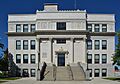
Hill County Courthouse in Havre
|
|

Location within the U.S. state of Montana
|
|
 Montana's location within the U.S. |
|
| Country | |
| State | |
| Founded | 1912 |
| Named for | James J. Hill |
| Seat | Havre |
| Largest city | Havre |
| Area | |
| • Total | 2,916 sq mi (7,550 km2) |
| • Land | 2,899 sq mi (7,510 km2) |
| • Water | 17 sq mi (40 km2) 0.6% |
| Population
(2020)
|
|
| • Total | 16,309 |
| • Estimate
(2022)
|
16,068 |
| • Density | 5.5929/sq mi (2.1594/km2) |
| Time zone | UTC−7 (Mountain) |
| • Summer (DST) | UTC−6 (MDT) |
| Congressional district | 2nd |
|
|
Hill County is a county in Montana, a state in the United States. In 2020, about 16,309 people lived there. The main town and county seat is Havre. Hill County is right next to the border with Canada, touching the Canadian provinces of Alberta and Saskatchewan. A part of the county is home to the Rocky Boy Indian Reservation, which belongs to the Chippewa-Cree Tribe.
Contents
History of Hill County
The first settlement by European-Americans in this area was Fort Assinniboine. The United States Army set up this fort in 1879. Today, 15 of the original 104 buildings from the fort are still standing.
A part of the fort's land was later given to create the Rocky Boy Indian Reservation. This reservation was officially started in 1916.
Hill County is named after James J. Hill. He was the president of the Great Northern Railway Company. This company built train tracks across Montana. These tracks were part of the Transcontinental Railroad, which connected the country to the Pacific coast.
Geography of Hill County
Hill County covers a total area of about 2,916 square miles. Most of this area, about 2,899 square miles, is land. The remaining 17 square miles (0.6%) is water.
The county is located in north-central Montana. This area is often called the "Hi-Line". Hill County shares borders with Blaine County to the east and Liberty County to the west. To the north, it borders Canada.
Hill County is home to Beaver Creek Park. This park is special because it is the largest county park in the entire United States.
Neighboring Areas
Hill County shares its borders with several other counties and areas:
- Liberty County - to the west
- Chouteau County - to the south
- Blaine County - to the east
- County of Forty Mile No. 8, Alberta, Canada - to the northwest
- Cypress County, Alberta, Canada - to the north
- Rural Municipality of Reno No. 51, Saskatchewan, Canada - to the northeast
Main Roads
Two major highways run through Hill County:
 U.S. Route 2
 U.S. Route 87
Protected Natural Areas
Hill County also has special places set aside to protect wildlife:
- Creedman Coulee National Wildlife Refuge
- Lake Thibadeau National Wildlife Refuge
People of Hill County
| Historical population | |||
|---|---|---|---|
| Census | Pop. | %± | |
| 1920 | 13,958 | — | |
| 1930 | 13,775 | −1.3% | |
| 1940 | 13,304 | −3.4% | |
| 1950 | 14,285 | 7.4% | |
| 1960 | 18,653 | 30.6% | |
| 1970 | 17,358 | −6.9% | |
| 1980 | 17,985 | 3.6% | |
| 1990 | 17,654 | −1.8% | |
| 2000 | 16,673 | −5.6% | |
| 2010 | 16,096 | −3.5% | |
| 2020 | 16,309 | 1.3% | |
| 2022 (est.) | 16,068 | −0.2% | |
| U.S. Decennial Census 1790–1960, 1900–1990, 1990–2000, 2010–2020 |
|||
In 2020, the population of Hill County was 16,309 people.
According to the 2010 census, there were 16,096 people living in the county. About 73.9% of the people were white. About 21.7% were American Indian. Other groups made up smaller parts of the population. People of Hispanic or Latino origin made up 2.3% of the population.
Towns and Communities
City
- Havre (This is the county seat, where the main government offices are.)
Town
Other Communities
These are smaller communities in Hill County:
- Azure
- Beaver Creek
- Box Elder
- East End Colony
- Gildford
- Gildford Colony
- Havre North
- Herron
- Hilldale Colony
- Inverness
- Kremlin
- Laredo
- Parker School
- Rocky Boy West
- Rocky Boy's Agency
- Rudyard
- Saddle Butte
- St. Pierre
- Sangrey
- West Havre
Unincorporated Communities
These are small places that are not officially organized as cities or towns:
- Agency
- Goldstone
- Simpson
Images for kids
-
Hill County Courthouse in Havre
See also
 In Spanish: Condado de Hill (Montana) para niños
